TopoQuest Logo
Do you find TopoQuest useful?
Help keep TopoQuest running and adding new maps/features by donating!
Bitcoin:  19c7KJd3qBynnjoSw5npx9KScwjBe4ifkT
Litecoin:  LXs6TkuXGGXo1vDsWCkWVdjQX94eUKd6ui
Home View Maps Find Maps Find Places Resources & Links


Luthersburg, Pennsylvania Topographic Map

USGS Map Title: Luthersburg, PA
USGS Map MRC: 41078A6
DRG (GeoTIFF) Download: o41078a6.tif


Neighboring USGS Topographic Map Quads:


  Falls Creek, PA  
41078B7
 

  Sabula, PA  
41078B6
 

  Penfield, PA  
41078B5
 

  Du Bois, PA  
41078A7
 

  Luthersburg, PA  
41078A6
 

  Elliott Park, PA  
41078A5
 

  McGees Mills, PA  
40078H7
 

  Mahaffey, PA  
40078H6
 

  Curwensville, PA  
40078H5


Map MRC Location:

N42°
W79°
N42°
W78°
H8 H7 H6 H5 H4 H3 H2 H1
G8 G7 G6 G5 G4 G3 G2 G1
F8 F7 F6 F5 F4 F3 F2 F1
E8 E7 E6 E5 E4 E3 E2 E1
D8 D7 D6 D5 D4 D3 D2 D1
C8 C7 C6 C5 C4 C3 C2 C1
B8 B7 B6 B5 B4 B3 B2 B1
A8 A7 A6 A5 A4 A3 A2 A1
N41°
W79°
N41°
W78°

Luthersburg, PA USGS 1:24K Topographic Map Preview:
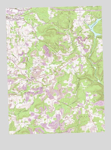
Luthersburg, PA USGS Topographic Map
Click on map above to begin viewing in our Map Viewer.

This topographic map contains these locations and features:
Feature Name Type Latitude Longitude GNIS ID View Map
AndersonPopulated PlaceN41.0584°W78.6606°1202974View Map
Brady Township Fire Company Station 30BuildingN41.0525°W78.7221°2645356View Map
Brooks SchoolSchoolN41.0978°W78.7336°1206460View Map
Chestnut GrovePopulated PlaceN41.0251°W78.6600°1171708View Map
Chestnut RunStreamN41.1009°W78.6700°1171752View Map
Coal HillSummitN41.0484°W78.6945°1192280View Map
Coal Hill School (historical)SchoolN41.0426°W78.7011°1206457View Map
Dressler CemeteryCemeteryN41.1233°W78.6560°1173471View Map
Dressler RunStreamN41.1081°W78.6459°1173472View Map
Du Bois Post OfficePost OfficeN41.1230°W78.7451°2772674View Map
Du Bois ReservoirReservoirN41.0964°W78.6332°1173560View Map
Faudie GrangeBuildingN41.0092°W78.7286°1214743View Map
Faudie SchoolSchoolN41.0101°W78.7253°1206455View Map
GelnettPopulated PlaceN41.1092°W78.6956°1212741View Map
Gelnett SchoolSchoolN41.1078°W78.7006°1206461View Map
Gravel Lick RunStreamN41.1245°W78.7156°1192042View Map
Home CampPopulated PlaceN41.1109°W78.6453°1198229View Map
LabordePopulated PlaceN41.0253°W78.6520°1212742View Map
Laborde BranchStreamN41.1181°W78.7281°1178739View Map
Laborde SchoolSchoolN41.0301°W78.6484°1206453View Map
Laurel RidgeRidgeN41.0812°W78.6753°1192745View Map
Lines School (historical)SchoolN41.0873°W78.7234°1206459View Map
Little Anderson CreekStreamN41.0495°W78.6300°1179456View Map
LuthersburgPopulated PlaceN41.0534°W78.7192°1192863View Map
Luthersburg BranchStreamN41.0909°W78.7086°1180087View Map
Luthersburg Elementary SchoolSchoolN41.0526°W78.7209°1211695View Map
Luthersburg Post OfficePost OfficeN41.0534°W78.7234°2772806View Map
Luthersburg StationLocaleN41.0645°W78.7164°1180088View Map
Memorial ChurchChurchN41.1092°W78.6970°1180902View Map
OklahomaPopulated PlaceN41.1140°W78.7334°1182893View Map
Oklahoma Census Designated PlaceCensusN41.1100°W78.7356°2634250View Map
Oklahoma Civil Defense Fire Company Station 37BuildingN41.1132°W78.7347°2645706View Map
Oklahoma Elementary SchoolSchoolN41.1134°W78.7395°1211696View Map
Oswald School (historical)SchoolN41.0292°W78.7400°1206456View Map
Panther RunStreamN41.0495°W78.6286°1193084View Map
Rock RunStreamN41.0520°W78.6575°1185281View Map
RocktonPopulated PlaceN41.0756°W78.6531°1193209View Map
Rockton Post OfficePost OfficeN41.0760°W78.6547°2772950View Map
Rockton StationLocaleN41.0701°W78.6672°1185324View Map
Saint Johns ChurchChurchN41.0753°W78.6545°1186158View Map
Saint Peters ChurchChurchN41.0540°W78.7234°1186679View Map
SalemPopulated PlaceN41.0720°W78.7417°1186805View Map
ShafferPopulated PlaceN41.1242°W78.7342°1205081View Map
Sheeser SchoolSchoolN41.0676°W78.6720°1206458View Map
Smith MillsPopulated PlaceN41.1020°W78.6734°1212740View Map
Stony RunStreamN41.0892°W78.6647°1188795View Map
Sugarcamp RunStreamN41.0995°W78.7086°1188988View Map
Township of BloomCivilN41.0194°W78.6315°1216225View Map
Township of BradyCivilN41.0396°W78.7393°1216228View Map
Township of UnionCivilN41.0916°W78.6338°1216247View Map
Union Township Volunteer Fire Company Station 40BuildingN41.0761°W78.6551°2645701View Map
Wingart School (historical)SchoolN41.0153°W78.6995°1206454View Map
WOWQ-FM (Du Bois)TowerN41.0442°W78.7031°1200277View Map

Note: Coordinates in the location and feature list above are referenced to NAD83 datum.


Copyright (C) 2008-2025 Ryan Niemi / Sunset Dynamics ... All Rights Reserved