TopoQuest Logo
Do you find TopoQuest useful?
Help keep TopoQuest running and adding new maps/features by donating!
Bitcoin:  19c7KJd3qBynnjoSw5npx9KScwjBe4ifkT
Litecoin:  LXs6TkuXGGXo1vDsWCkWVdjQX94eUKd6ui
Home View Maps Find Maps Find Places Resources & Links


Salem, Kentucky Topographic Map

USGS Map Title: Salem, KY
USGS Map MRC: 37088C2
DRG (GeoTIFF) Download: o37088c2.tif


Neighboring USGS Topographic Map Quads:


  Rosiclare, IL  
37088D3
 

  Cave-in-Rock, IL  
37088D2
 

  Repton, KY  
37088D1
 

  Lola, KY  
37088C3
 

  Salem, KY  
37088C2
 

  Marion, KY  
37088C1
 

  Burna, KY  
37088B3
 

  Dycusburg, KY  
37088B2
 

  Fredonia, KY  
37088B1


Map MRC Location:

N38°
W89°
N38°
W88°
H8 H7 H6 H5 H4 H3 H2 H1
G8 G7 G6 G5 G4 G3 G2 G1
F8 F7 F6 F5 F4 F3 F2 F1
E8 E7 E6 E5 E4 E3 E2 E1
D8 D7 D6 D5 D4 D3 D2 D1
C8 C7 C6 C5 C4 C3 C2 C1
B8 B7 B6 B5 B4 B3 B2 B1
A8 A7 A6 A5 A4 A3 A2 A1
N37°
W89°
N37°
W88°

Salem, KY USGS 1:24K Topographic Map Preview:
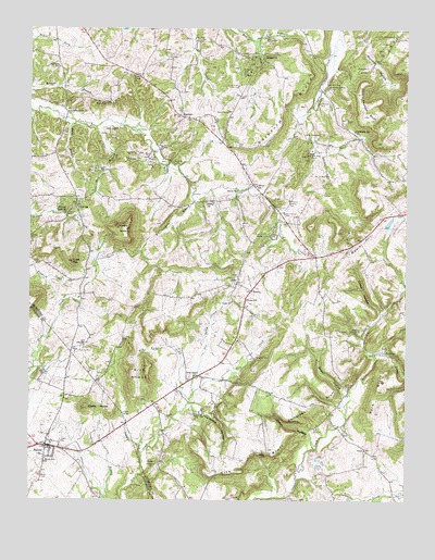
Salem, KY USGS Topographic Map
Click on map above to begin viewing in our Map Viewer.

This topographic map contains these locations and features:
Feature Name Type Latitude Longitude GNIS ID View Map
Ada Florence MineMineN37.3262°W88.1650°485747View Map
Atlas MineMineN37.3417°W88.2170°486124View Map
Babb MineMineN37.2837°W88.2456°486170View Map
Bebout MineMineN37.3528°W88.1842°486638View Map
Big Four MineMineN37.3384°W88.2053°487177View Map
Brown HollowValleyN37.2778°W88.1448°488006View Map
Buck BranchStreamN37.3503°W88.2350°488188View Map
Butler MinesMineN37.3481°W88.2228°488517View Map
Cave HillSummitN37.3134°W88.2356°489121View Map
Childress BluffCliffN37.2753°W88.1536°489473View Map
City of SalemCivilN37.2652°W88.2410°2405405View Map
Clement CreekStreamN37.2559°W88.1600°489653View Map
Clement MineMineN37.3606°W88.1509°489654View Map
Clifty HollowValleyN37.2665°W88.1565°489688View Map
Columbia MineMineN37.3470°W88.1575°489886View Map
Commodore MineMineN37.3720°W88.1711°489909View Map
Corn BranchStreamN37.3489°W88.2281°490113View Map
Corn MineMineN37.3262°W88.2384°490118View Map
Crittenden SpringSpringN37.3599°W88.1513°490357View Map
Crittenden Spring SchoolSchoolN37.3484°W88.1422°490358View Map
Crodson CreekStreamN37.2653°W88.2128°490360View Map
Crodson SpringSpringN37.2730°W88.2188°490361View Map
Crystal MinesMineN37.3406°W88.2100°490438View Map
Davenport MineMineN37.2726°W88.1922°490618View Map
Deer Creek ChurchChurchN37.3620°W88.2161°490772View Map
Dell-High MineMineN37.2895°W88.2342°490798View Map
Dry Fork CreekStreamN37.2767°W88.1967°491215View Map
Eagle-Babb MineMineN37.2914°W88.2309°491413View Map
Eberle KnobsSummitN37.2751°W88.2311°491543View Map
Franklin MinesMineN37.3289°W88.1631°492455View Map
Glendale (historical)Populated PlaceN37.3678°W88.1732°2743689View Map
Glendale ChurchChurchN37.3678°W88.1723°492894View Map
Glendale MinesMineN37.3639°W88.1764°492896View Map
Gorn SchoolSchoolN37.3273°W88.2339°493036View Map
Gray MineMineN37.3551°W88.2278°493204View Map
Griffith BluffCliffN37.3551°W88.1639°493385View Map
Hardin KnobSummitN37.3220°W88.2184°493722View Map
Hickory Cane MineMineN37.3678°W88.1750°494119View Map
Hilltop ChurchChurchN37.3284°W88.1911°494280View Map
Holly MineMineN37.3406°W88.2164°494413View Map
Horse Lot MineMineN37.3439°W88.2059°494581View Map
Hurricane HollowValleyN37.2732°W88.1932°494837View Map
Jim Belt MineMineN37.3187°W88.2495°495261View Map
John Thomas BluffCliffN37.3551°W88.1384°495336View Map
K K MinesMineN37.3598°W88.1806°495561View Map
Keystone Mine and Fluorite Floatation MillMineN37.3206°W88.1700°485688View Map
Kirk BluffCliffN37.2601°W88.1714°495792View Map
Kirk KnobsSummitN37.2853°W88.2103°495796View Map
Kit Love BranchStreamN37.3312°W88.1956°495817View Map
La Rue MineMineN37.3398°W88.2031°495885View Map
LeviasPopulated PlaceN37.3078°W88.1809°496310View Map
Liberty Grove (historical)Populated PlaceN37.3527°W88.2380°2743693View Map
Liberty Grove ChurchChurchN37.3531°W88.2373°496383View Map
Little Hurricane CreekStreamN37.3717°W88.1750°496762View Map
Livingston Hospital and Healthcare ServicesHospitalN37.2630°W88.2285°2660322View Map
Love CemeteryCemeteryN37.3442°W88.1811°497214View Map
Mary Belle MinesMineN37.3420°W88.1575°497637View Map
Memphis Prospect AreaAreaN37.3714°W88.1325°513902View Map
MidwayPopulated PlaceN37.3056°W88.1759°508602View Map
Miller MinesMineN37.3373°W88.2270°498350View Map
Mills CemeteryCemeteryN37.2564°W88.2453°498376View Map
Moore HillSummitN37.3189°W88.1397°498554View Map
Mount Zion CemeteryCemeteryN37.2989°W88.2181°498915View Map
Mount Zion ChurchChurchN37.2601°W88.2448°498928View Map
New SalemPopulated PlaceN37.2834°W88.1942°508695View Map
New Salem CreekStreamN37.2787°W88.1953°499398View Map
Nine Acre MineMineN37.3553°W88.1539°499486View Map
Old Jim MineMineN37.3362°W88.1514°499846View Map
Panther HollowBasinN37.3653°W88.1350°500163View Map
Pleasant Grove (historical)Populated PlaceN37.3261°W88.2377°2743699View Map
Pleasant Grove ChurchChurchN37.3270°W88.2378°500821View Map
Preacher CreekStreamN37.2887°W88.1356°501289View Map
SalemPopulated PlaceN37.2645°W88.2442°502766View Map
Salem CemeteryCemeteryN37.2659°W88.2395°502771View Map
Salem Community Volunteer Fire DepartmentBuildingN37.2635°W88.2435°2636671View Map
SheridanPopulated PlaceN37.3517°W88.1989°509048View Map
Sheridan Volunteer Fire DepartmentBuildingN37.3512°W88.1961°2636944View Map
Siloem (historical)Populated PlaceN37.3334°W88.1753°2743703View Map
Siloem ChurchChurchN37.3320°W88.1806°503505View Map
Siloem SchoolSchoolN37.3334°W88.1748°503506View Map
Sisco ChapelChurchN37.2951°W88.1406°503578View Map
Sisco Chapel (historical)Populated PlaceN37.2954°W88.1402°2743704View Map
South Crittenden DivisionCivilN37.2501°W88.1705°1936959View Map
Steep HollowValleyN37.2996°W88.1337°504320View Map
Sullinger SchoolSchoolN37.3653°W88.2406°504719View Map
Sumner MineMineN37.2881°W88.1742°504780View Map
Tyner ChapelChurchN37.2592°W88.2078°505742View Map
Union (historical)Populated PlaceN37.3016°W88.1789°2743706View Map
Union ChurchChurchN37.3026°W88.1822°505780View Map
Union SchoolSchoolN37.3031°W88.1778°505818View Map
ViewPopulated PlaceN37.2634°W88.1386°509289View Map
Walldell CemeteryCemeteryN37.2625°W88.1709°506147View Map
York BluffCliffN37.2787°W88.1350°507232View Map

Note: Coordinates in the location and feature list above are referenced to NAD83 datum.


Copyright (C) 2008-2024 Ryan Niemi / Sunset Dynamics ... All Rights Reserved