TopoQuest Logo
Do you find TopoQuest useful?
Help keep TopoQuest running and adding new maps/features by donating!
Bitcoin:  19c7KJd3qBynnjoSw5npx9KScwjBe4ifkT
Litecoin:  LXs6TkuXGGXo1vDsWCkWVdjQX94eUKd6ui
Home View Maps Find Maps Find Places Resources & Links


Worthington, Pennsylvania Topographic Map

USGS Map Title: Worthington, PA
USGS Map MRC: 40079G6
DRG (GeoTIFF) Download: o40079g6.tif


Neighboring USGS Topographic Map Quads:


  East Butler, PA  
40079H7
 

  Chicora, PA  
40079H6
 

  East Brady, PA  
40079H5
 

  Saxonburg, PA  
40079G7
 

  Worthington, PA  
40079G6
 

  Kittanning, PA  
40079G5
 

  Curtisville, PA  
40079F7
 

  Freeport, PA  
40079F6
 

  Leechburg, PA  
40079F5


Map MRC Location:

N41°
W80°
N41°
W79°
H8 H7 H6 H5 H4 H3 H2 H1
G8 G7 G6 G5 G4 G3 G2 G1
F8 F7 F6 F5 F4 F3 F2 F1
E8 E7 E6 E5 E4 E3 E2 E1
D8 D7 D6 D5 D4 D3 D2 D1
C8 C7 C6 C5 C4 C3 C2 C1
B8 B7 B6 B5 B4 B3 B2 B1
A8 A7 A6 A5 A4 A3 A2 A1
N40°
W80°
N40°
W79°

Worthington, PA USGS 1:24K Topographic Map Preview:
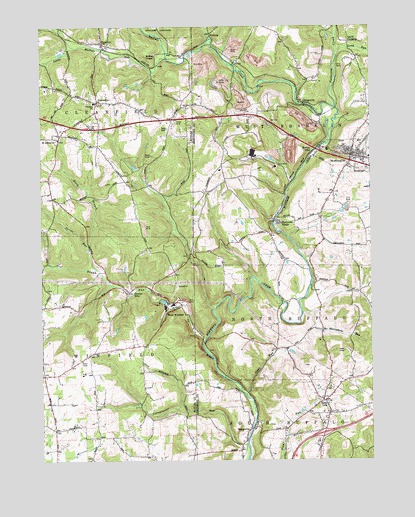
Worthington, PA USGS Topographic Map
Click on map above to begin viewing in our Map Viewer.

This topographic map contains these locations and features:
Feature Name Type Latitude Longitude GNIS ID View Map
Blue Slate CemeteryCemeteryN40.7605°W79.6629°2775875View Map
BoggsvillePopulated PlaceN40.7590°W79.6709°1169941View Map
Borough of WorthingtonCivilN40.8380°W79.6350°1214860View Map
Buffalo MillsPopulated PlaceN40.8401°W79.6434°1192216View Map
Buffalo United Presbyterian Church CemeteryCemeteryN40.7707°W79.6407°2775886View Map
Clearfield SchoolSchoolN40.8531°W79.7292°1213473View Map
Cornplanter RunStreamN40.7545°W79.6725°1172469View Map
CoylevillePopulated PlaceN40.8534°W79.7284°1172573View Map
CraigsvillePopulated PlaceN40.8523°W79.6495°1172609View Map
Craigville Brach Junction StationLocaleN40.8490°W79.6428°1212450View Map
Dennys MillsPopulated PlaceN40.7806°W79.7314°1173163View Map
FeneltonPopulated PlaceN40.8703°W79.7262°1174680View Map
Fenelton Post OfficePost OfficeN40.8702°W79.7265°2773136View Map
J T Willie AirportAirportN40.8087°W79.6698°2442925View Map
Kittanning 6 Emergency Medical Services Station 130 - 2BuildingN40.8367°W79.6304°2719485View Map
Laird CrossingPopulated PlaceN40.8703°W79.6328°1178767View Map
Laird StationLocaleN40.8676°W79.6323°1212449View Map
Little Buffalo RunStreamN40.8653°W79.7017°1179490View Map
Long RunStreamN40.8676°W79.6375°1179899View Map
Marrowbone RunStreamN40.7937°W79.6517°1192896View Map
McKee ChapelChurchN40.8667°W79.7062°1180736View Map
NicholaPopulated PlaceN40.8728°W79.6850°1205070View Map
North Branch Rough RunStreamN40.8051°W79.7289°1182549View Map
Patterson CreekStreamN40.8517°W79.6381°1183369View Map
Reformed Presbyterian ChurchChurchN40.7712°W79.6406°1213472View Map
Rough RunStreamN40.7848°W79.6878°1185513View Map
Saint Johns ChurchChurchN40.8426°W79.7431°1186144View Map
Sarver RunStreamN40.8112°W79.7320°1201557View Map
Shadyside VillagePopulated PlaceN40.8190°W79.6609°1214051View Map
Sipes RunStreamN40.7692°W79.6728°1187727View Map
Slate LickPopulated PlaceN40.7670°W79.6428°1187783View Map
Slate Lick CemeteryCemeteryN40.7680°W79.6424°2775887View Map
Slate Lick United Presbyterian CemeteryCemeteryN40.7636°W79.6389°2775978View Map
Township of ClearfieldCivilN40.8498°W79.7374°1216048View Map
Township of West FranklinCivilN40.8496°W79.6503°1215865View Map
Township of WinfieldCivilN40.7778°W79.7380°1216070View Map
West WinfieldPopulated PlaceN40.7942°W79.6970°1191136View Map
WorthingtonPopulated PlaceN40.8376°W79.6320°1191795View Map
Worthington - West Franklin Volunteer Fire Department Station 250BuildingN40.8368°W79.6305°2645911View Map
Worthington Borough Police DepartmentBuildingN40.8393°W79.6337°2781090View Map
Worthington Evangelical Lutheran CemeteryCemeteryN40.8392°W79.6356°2775991View Map
Worthington Post OfficePost OfficeN40.8368°W79.6274°2773052View Map
Worthington Presbyterian CemeteryCemeteryN40.8422°W79.6301°2775992View Map
Worthington United Presbyterian CemeteryCemeteryN40.8396°W79.6289°2775993View Map

Note: Coordinates in the location and feature list above are referenced to NAD83 datum.


Copyright (C) 2008-2025 Ryan Niemi / Sunset Dynamics ... All Rights Reserved