TopoQuest Logo
Do you find TopoQuest useful?
Help keep TopoQuest running and adding new maps/features by donating!
Bitcoin:  19c7KJd3qBynnjoSw5npx9KScwjBe4ifkT
Litecoin:  LXs6TkuXGGXo1vDsWCkWVdjQX94eUKd6ui
Home View Maps Find Maps Find Places Resources & Links


Alum Bank, Pennsylvania Topographic Map

USGS Map Title: Alum Bank, PA
USGS Map MRC: 40078B5
DRG (GeoTIFF) Download: o40078b5.tif


Neighboring USGS Topographic Map Quads:


  Beaverdale, PA  
40078C6
 

  Blue Knob, PA  
40078C5
 

  Roaring Spring, PA  
40078C4
 

  Ogletown, PA  
40078B6
 

  Alum Bank, PA  
40078B5
 

  New Enterprise, PA  
40078B4
 

  Schellsburg, PA  
40078A6
 

  Bedford, PA  
40078A5
 

  Everett West, PA  
40078A4


Map MRC Location:

N41°
W79°
N41°
W78°
H8 H7 H6 H5 H4 H3 H2 H1
G8 G7 G6 G5 G4 G3 G2 G1
F8 F7 F6 F5 F4 F3 F2 F1
E8 E7 E6 E5 E4 E3 E2 E1
D8 D7 D6 D5 D4 D3 D2 D1
C8 C7 C6 C5 C4 C3 C2 C1
B8 B7 B6 B5 B4 B3 B2 B1
A8 A7 A6 A5 A4 A3 A2 A1
N40°
W79°
N40°
W78°

Alum Bank, PA USGS 1:24K Topographic Map Preview:
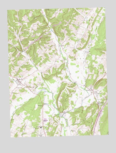
Alum Bank, PA USGS Topographic Map
Click on map above to begin viewing in our Map Viewer.

This topographic map contains these locations and features:
Feature Name Type Latitude Longitude GNIS ID View Map
Acker SchoolSchoolN40.1565°W78.5336°1206833View Map
Alum BankPopulated PlaceN40.1806°W78.6136°1168237View Map
Alum Bank Community Fire Company - Station 38BuildingN40.1790°W78.6091°2645110View Map
Alum Bank Post OfficePost OfficeN40.1760°W78.6070°2768331View Map
Alumbank Post Office (historical)Post OfficeN40.1806°W78.6136°1214323View Map
Barefoot RunStreamN40.1676°W78.5897°1168704View Map
Bethel Park CampgroundsLocaleN40.1301°W78.5467°1169408View Map
Black Oak RidgeRidgeN40.1387°W78.5161°1169722View Map
Bobs CreekStreamN40.1442°W78.5570°1200063View Map
Borough of PleasantvilleCivilN40.1797°W78.6133°1214902View Map
Borough of Saint ClairsvilleCivilN40.1559°W78.5108°1214904View Map
Bowser Covered BridgeBridgeN40.1767°W78.5411°1954959View Map
Chestnut Ridge Ambulance Association - Unit 18BuildingN40.1756°W78.6060°2719506View Map
Chestnut Ridge High SchoolSchoolN40.1345°W78.5856°1171749View Map
Chestnut Ridge SchoolSchoolN40.1406°W78.5814°1171751View Map
ChurchvillePopulated PlaceN40.1648°W78.5122°1171875View Map
Dr Knisely Covered BridgeBridgeN40.1601°W78.6020°1954957View Map
Eight Square SchoolSchoolN40.1356°W78.5839°1206834View Map
Fishertown Lutheran CemeteryCemeteryN40.1254°W78.5863°2776079View Map
Fishertown Post OfficePost OfficeN40.1324°W78.5822°2777464View Map
Friends CemeteryCemeteryN40.1545°W78.5825°1175252View Map
Georges CreekStreamN40.1687°W78.5722°1175534View Map
Harmony RidgeRidgeN40.1623°W78.5520°1176559View Map
Hoover CemeteryCemeteryN40.1854°W78.5921°2776090View Map
Horn United Methodist Church CemeteryCemeteryN40.1766°W78.5838°2776091View Map
Horne ChurchChurchN40.1767°W78.5831°1177424View Map
Ickes AirportAirportN40.1843°W78.5583°2443648View Map
ImlerPopulated PlaceN40.2067°W78.5228°1177691View Map
Imler Area Volunteer Fire Company - Station 42BuildingN40.2065°W78.5249°2645530View Map
Imler Post OfficePost OfficeN40.2031°W78.5249°2768346View Map
Imler Saint Paul Brethren CemeteryCemeteryN40.2060°W78.5238°2776094View Map
Imler Valley CemeteryCemeteryN40.2105°W78.5225°2776095View Map
LovelyPopulated PlaceN40.2095°W78.6050°1179994View Map
Lutheran Cemetery at OsterburgCemeteryN40.1667°W78.5145°2776103View Map
Mauk Cemetery on Paul Mauk FarmCemeteryN40.2087°W78.5438°2776107View Map
McDonald Farm CemeteryCemeteryN40.2151°W78.5674°2776108View Map
Mount Union CemeteryCemeteryN40.2248°W78.6118°2776120View Map
Mount Union ChurchChurchN40.2242°W78.6117°1181869View Map
Mud RunStreamN40.2059°W78.5272°1182025View Map
Old Union CemeteryCemeteryN40.1677°W78.5183°2776130View Map
OsterburgPopulated PlaceN40.1695°W78.5203°1183074View Map
Osterburg Community CemeteryCemeteryN40.1668°W78.5156°2776132View Map
Osterburg Post OfficePost OfficeN40.1699°W78.5189°2768355View Map
Pleasantville CemeteryCemeteryN40.1841°W78.6126°2776142View Map
ReynoldsdalePopulated PlaceN40.1476°W78.5575°1184972View Map
Ryot Covered BridgeBridgeN40.1420°W78.6242°1954956View Map
Saint ClairsvillePopulated PlaceN40.1567°W78.5100°1185885View Map
Saint Peters ChurchChurchN40.1665°W78.5128°1186655View Map
Scrubgrass CreekStreamN40.1701°W78.5281°1187185View Map
Snook's Covered BridgeBridgeN40.1692°W78.5795°1954958View Map
Spring MeadowPopulated PlaceN40.1562°W78.5822°1188243View Map
Spring Meadow Post Office (historical)Post OfficeN40.1562°W78.5822°1214503View Map
Spring Meadow SpringSpringN40.1567°W78.5814°1201451View Map
Stone Church CemeteryCemeteryN40.1336°W78.5937°2776167View Map
Stone CreekStreamN40.1451°W78.5617°1188714View Map
Stone Creek ChurchChurchN40.1334°W78.5934°1188716View Map
Township of East Saint ClairCivilN40.1300°W78.5546°1215893View Map
Township of KingCivilN40.1959°W78.5186°1215898View Map
Township of LincolnCivilN40.2316°W78.6055°1215900View Map
Trinity United Church of Christ CemeteryCemeteryN40.1671°W78.5167°2776131View Map
Union SchoolSchoolN40.1762°W78.5384°1206832View Map
West Branch Georges CreekStreamN40.2084°W78.6042°1190908View Map
WeyantPopulated PlaceN40.2134°W78.5561°1191199View Map
Weyant Post Office (historical)Post OfficeN40.2134°W78.5561°1214322View Map

Note: Coordinates in the location and feature list above are referenced to NAD83 datum.


Copyright (C) 2008-2024 Ryan Niemi / Sunset Dynamics ... All Rights Reserved