TopoQuest Logo
Do you find TopoQuest useful?
Help keep TopoQuest running and adding new maps/features by donating!
Bitcoin:  19c7KJd3qBynnjoSw5npx9KScwjBe4ifkT
Litecoin:  LXs6TkuXGGXo1vDsWCkWVdjQX94eUKd6ui
Home View Maps Find Maps Find Places Resources & Links


Howardsville, Virginia Topographic Map

USGS Map Title: Howardsville, VA
USGS Map MRC: 37078F6
DRG (GeoTIFF) Download: o37078f6.tif


Neighboring USGS Topographic Map Quads:


  Lovingston, VA  
37078G7
 

  Schuyler, VA  
37078G6
 

  Esmont, VA  
37078G5
 

  Shipman, VA  
37078F7
 

  Howardsville, VA  
37078F6
 

  Glenmore, VA  
37078F5
 

  Gladstone, VA  
37078E7
 

  Saint Joy, VA  
37078E6
 

  Buckingham, VA  
37078E5


Map MRC Location:

N38°
W79°
N38°
W78°
H8 H7 H6 H5 H4 H3 H2 H1
G8 G7 G6 G5 G4 G3 G2 G1
F8 F7 F6 F5 F4 F3 F2 F1
E8 E7 E6 E5 E4 E3 E2 E1
D8 D7 D6 D5 D4 D3 D2 D1
C8 C7 C6 C5 C4 C3 C2 C1
B8 B7 B6 B5 B4 B3 B2 B1
A8 A7 A6 A5 A4 A3 A2 A1
N37°
W79°
N37°
W78°

Howardsville, VA USGS 1:24K Topographic Map Preview:
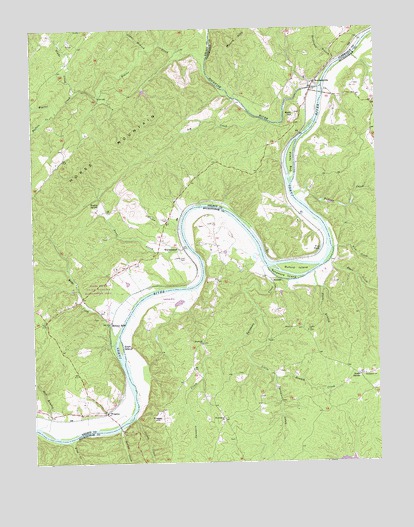
Howardsville, VA USGS Topographic Map
Click on map above to begin viewing in our Map Viewer.

This topographic map contains these locations and features:
Feature Name Type Latitude Longitude GNIS ID View Map
Ariel Church (historical)ChurchN37.7310°W78.7259°1500919View Map
Avon HillSummitN37.7254°W78.6539°1495212View Map
Ballowe CreekStreamN37.7007°W78.6533°1462747View Map
Beaver CreekStreamN37.7415°W78.6853°1462932View Map
Bishop CreekStreamN37.6349°W78.7189°1463463View Map
Branch CreekStreamN37.6490°W78.6633°1463753View Map
Buffalo CreekStreamN37.7260°W78.7406°1464040View Map
Buford IslandIslandN37.6804°W78.6545°1464054View Map
Bugley SpringSpringN37.6996°W78.7258°1464056View Map
Cedar BranchStreamN37.7440°W78.7067°1464587View Map
Creasy CreekStreamN37.6376°W78.7142°2573954View Map
Creasy HillSummitN37.6385°W78.7064°1495436View Map
Dog IslandIslandN37.7107°W78.6556°1465867View Map
Fish PondLakeN37.6857°W78.6457°1466600View Map
Glade CreekStreamN37.7318°W78.7336°1467118View Map
Grace ChurchChurchN37.6629°W78.6508°1467313View Map
Grays CornerPopulated PlaceN37.6501°W78.6320°1477369View Map
Greasy CreekStreamN37.6376°W78.7142°1467418View Map
Haw BranchStreamN37.6354°W78.7486°1467838View Map
Horse MountainSummitN37.7110°W78.7267°1468266View Map
HowardsvillePopulated PlaceN37.7346°W78.6472°1495724View Map
Howardsville Methodist ChurchChurchN37.7354°W78.6503°1675065View Map
Howardsville Post OfficePost OfficeN37.7354°W78.6464°1675066View Map
Ivy CreekStreamN37.7238°W78.6656°1468550View Map
James River State Wildlife Management AreaParkN37.6738°W78.7264°1468631View Map
Jerusalem ChurchChurchN37.6499°W78.6297°1468705View Map
Kidd CreekStreamN37.6315°W78.7375°1468990View Map
Liberty Hall CemeteryCemeteryN37.6837°W78.6946°1469373View Map
Lick CreekStreamN37.6865°W78.6406°1469396View Map
Little Sycamore CreekStreamN37.6682°W78.6675°1469664View Map
Lotus International AirportAirportN37.6730°W78.7040°1498606View Map
ManteoPopulated PlaceN37.6768°W78.6633°1495897View Map
Mayo CreekStreamN37.6624°W78.7197°1470219View Map
Midway MillsPopulated PlaceN37.6660°W78.7222°1495944View Map
MonticolaLocaleN37.7426°W78.6495°1675086View Map
Ramsay Knox DamDamN37.7318°W78.7097°1490434View Map
Ramsay Knox PondReservoirN37.7320°W78.7086°1490435View Map
Rockfish RiverStreamN37.7329°W78.6453°1486713View Map
Rockhouse BranchStreamN37.7404°W78.6389°1473410View Map
Ryan CreekStreamN37.6832°W78.6420°1473666View Map
Slater BranchStreamN37.6924°W78.6964°1474679View Map
Stock BranchStreamN37.6796°W78.6475°1475166View Map
Swan CreekStreamN37.6868°W78.6936°1475367View Map
Swift IslandIslandN37.6582°W78.7186°1475387View Map
Sycamore CreekStreamN37.6815°W78.6656°1475405View Map
Sycamore IslandIslandN37.6782°W78.6586°1475407View Map
WarminsterPopulated PlaceN37.6874°W78.6978°1496374View Map
Warminster ChurchChurchN37.6376°W78.6808°1476340View Map
WinginaPopulated PlaceN37.6399°W78.7239°1477888View Map
Wingina Post OfficePost OfficeN37.6395°W78.7245°2766324View Map
Wood Farm Airport (historical)AirportN37.6365°W78.7300°1498856View Map
Woodland ChurchChurchN37.6590°W78.6886°1476946View Map
YogavillePopulated PlaceN37.6511°W78.6937°2574171View Map
Yogaville Census Designated PlaceCensusN37.6655°W78.6946°2584940View Map

Note: Coordinates in the location and feature list above are referenced to NAD83 datum.


Copyright (C) 2008-2025 Ryan Niemi / Sunset Dynamics ... All Rights Reserved