TopoQuest Logo
Do you find TopoQuest useful?
Help keep TopoQuest running and adding new maps/features by donating!
Bitcoin:  19c7KJd3qBynnjoSw5npx9KScwjBe4ifkT
Litecoin:  LXs6TkuXGGXo1vDsWCkWVdjQX94eUKd6ui
Home View Maps Find Maps Find Places Resources & Links


Glenmore, Virginia Topographic Map

USGS Map Title: Glenmore, VA
USGS Map MRC: 37078F5
DRG (GeoTIFF) Download: o37078f5.tif


Neighboring USGS Topographic Map Quads:


  Schuyler, VA  
37078G6
 

  Esmont, VA  
37078G5
 

  Scottsville, VA  
37078G4
 

  Howardsville, VA  
37078F6
 

  Glenmore, VA  
37078F5
 

  Diana Mills, VA  
37078F4
 

  Saint Joy, VA  
37078E6
 

  Buckingham, VA  
37078E5
 

  Dillwyn, VA  
37078E4


Map MRC Location:

N38°
W79°
N38°
W78°
H8 H7 H6 H5 H4 H3 H2 H1
G8 G7 G6 G5 G4 G3 G2 G1
F8 F7 F6 F5 F4 F3 F2 F1
E8 E7 E6 E5 E4 E3 E2 E1
D8 D7 D6 D5 D4 D3 D2 D1
C8 C7 C6 C5 C4 C3 C2 C1
B8 B7 B6 B5 B4 B3 B2 B1
A8 A7 A6 A5 A4 A3 A2 A1
N37°
W79°
N37°
W78°

Glenmore, VA USGS 1:24K Topographic Map Preview:
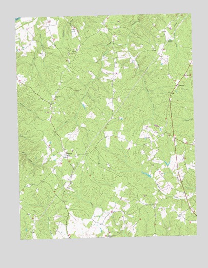
Glenmore, VA USGS Topographic Map
Click on map above to begin viewing in our Map Viewer.

This topographic map contains these locations and features:
Feature Name Type Latitude Longitude GNIS ID View Map
Alexandria ChurchChurchN37.6560°W78.6133°1462394View Map
AxtellPopulated PlaceN37.7013°W78.6014°1477087View Map
Brill DamDamN37.7001°W78.5781°1489299View Map
Buckingham County Volunteer Rescue Squad Station 18BuildingN37.6809°W78.5654°2721136View Map
CammPopulated PlaceN37.6460°W78.5931°1477170View Map
CentenaryPopulated PlaceN37.7093°W78.5114°1464663View Map
Ebenezer ChurchChurchN37.6426°W78.5308°1466164View Map
Emmanuel ChurchChurchN37.6713°W78.5903°1466297View Map
Fitzgerald DamDamN37.6885°W78.5281°1489300View Map
GlenmorePopulated PlaceN37.6715°W78.5900°1477355View Map
Glenmore Post Office (historical)Post OfficeN37.6718°W78.5908°1501534View Map
Glenmore Volunteer Fire DepartmentBuildingN37.6726°W78.5957°2086356View Map
Goshen ChurchChurchN37.7304°W78.5811°1467278View Map
Little Rock Island CreekStreamN37.7335°W78.5456°1469638View Map
Maxeys CreekStreamN37.6518°W78.5003°1470205View Map
Muddy Creek Number One DamDamN37.6568°W78.5331°1489279View Map
Muddy Creek Number Two DamDamN37.6651°W78.5197°1489280View Map
Paynes MillpondReservoirN37.7355°W78.5154°1472135View Map
RansonsPopulated PlaceN37.6368°W78.5114°1477661View Map
Ridgeway School (historical)SchoolN37.7140°W78.5145°1501586View Map
Saint Andrews ChurchChurchN37.6254°W78.5614°1473701View Map
Salem ChurchChurchN37.7051°W78.5978°1473967View Map
Smith StorePopulated PlaceN37.6829°W78.5211°1501601View Map

Note: Coordinates in the location and feature list above are referenced to NAD83 datum.


Copyright (C) 2008-2024 Ryan Niemi / Sunset Dynamics ... All Rights Reserved