TopoQuest Logo
Do you find TopoQuest useful?
Help keep TopoQuest running and adding new maps/features by donating!
Bitcoin:  19c7KJd3qBynnjoSw5npx9KScwjBe4ifkT
Litecoin:  LXs6TkuXGGXo1vDsWCkWVdjQX94eUKd6ui
Home View Maps Find Maps Find Places Resources & Links


Shade Gap, Pennsylvania Topographic Map

USGS Map Title: Shade Gap, PA
USGS Map MRC: 40077B7
DRG (GeoTIFF) Download: o40077b7.tif


Neighboring USGS Topographic Map Quads:


  Butler Knob, PA  
40077C8
 

  Aughwick, PA  
40077C7
 

  Blairs Mills, PA  
40077C6
 

  Orbisonia, PA  
40077B8
 

  Shade Gap, PA  
40077B7
 

  Doylesburg, PA  
40077B6
 

  Burnt Cabins, PA  
40077A8
 

  Fannettsburg, PA  
40077A7
 

  Roxbury, PA  
40077A6


Map MRC Location:

N41°
W78°
N41°
W77°
H8 H7 H6 H5 H4 H3 H2 H1
G8 G7 G6 G5 G4 G3 G2 G1
F8 F7 F6 F5 F4 F3 F2 F1
E8 E7 E6 E5 E4 E3 E2 E1
D8 D7 D6 D5 D4 D3 D2 D1
C8 C7 C6 C5 C4 C3 C2 C1
B8 B7 B6 B5 B4 B3 B2 B1
A8 A7 A6 A5 A4 A3 A2 A1
N40°
W78°
N40°
W77°

Shade Gap, PA USGS 1:24K Topographic Map Preview:
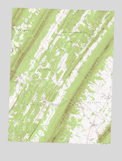
Shade Gap, PA USGS Topographic Map
Click on map above to begin viewing in our Map Viewer.

This topographic map contains these locations and features:
Feature Name Type Latitude Longitude GNIS ID View Map
Beech LickStreamN40.2256°W77.7719°1169107View Map
Blacklog ValleyValleyN40.2307°W77.8661°1192156View Map
Blair CemeteryCemeteryN40.1699°W77.8655°1847179View Map
Bolinger Family CemeteryCemeteryN40.2370°W77.8486°2026376View Map
Borough of Shade GapCivilN40.1803°W77.8662°1215279View Map
Crow CemeteryCemeteryN40.2296°W77.8156°2061744View Map
Dry RunPopulated PlaceN40.1676°W77.7539°1173525View Map
Dry RunStreamN40.1290°W77.7708°1173543View Map
Dry Run Post OfficePost OfficeN40.1687°W77.7526°2772673View Map
Dry Run QuarryMineN40.1681°W77.7614°2724974View Map
Fannett - Metal Fire and Ambulance Department - Company 12BuildingN40.1685°W77.7551°2645056View Map
Felix RunStreamN40.1879°W77.8550°1174663View Map
Fleming CemeteryCemeteryN40.1333°W77.8374°1988419View Map
Gilliland CemeteryCemeteryN40.2320°W77.8609°1175618View Map
Harpers Memorial ParkParkN40.1795°W77.8594°1176567View Map
Hunting RidgeRidgeN40.1868°W77.8055°1192649View Map
Jerrys RidgeRidgeN40.1554°W77.8606°1192689View Map
Jones / Chapman / Parson CemeteryCemeteryN40.2356°W77.7555°2061742View Map
McMullen CemeteryCemeteryN40.2104°W77.8305°2061745View Map
McNeil SchoolSchoolN40.2362°W77.8211°1196989View Map
Mills Brothers AirportAirportN40.1440°W77.8616°2443652View Map
Narrows School (historical)SchoolN40.2323°W77.8742°1196990View Map
NeelytonPopulated PlaceN40.1609°W77.8225°1182212View Map
Neelyton Post OfficePost OfficeN40.1608°W77.8234°2772859View Map
NossvillePopulated PlaceN40.2337°W77.7655°1182694View Map
Nossville CemeteryCemeteryN40.2343°W77.7649°1847176View Map
Orbisonia QuarryMineN40.2253°W77.8658°2724973View Map
Parsons RunStreamN40.2123°W77.7844°1183347View Map
Path Valley CemeteryCemeteryN40.1546°W77.7656°1183363View Map
Pine Grove ChurchChurchN40.1606°W77.8172°1183809View Map
Pine Grove Presbyterian Church CemeteryCemeteryN40.1606°W77.8169°1847178View Map
Pine RidgeRidgeN40.2234°W77.8208°1183869View Map
Pleasant Hill CemeteryCemeteryN40.1428°W77.8657°1847177View Map
Pleasant Hill ChurchChurchN40.1426°W77.8664°1196986View Map
Possumtown CemeteryCemeteryN40.1861°W77.8504°1847181View Map
Salem CemeteryCemeteryN40.2070°W77.8097°1847182View Map
Salem ChurchChurchN40.2068°W77.8105°1186820View Map
Salem SchoolSchoolN40.2068°W77.8105°1196987View Map
Shade CreekStreamN40.2298°W77.8664°1187289View Map
Shade GapPopulated PlaceN40.1809°W77.8658°1187291View Map
Shade Gap Area Fire Company Station 14BuildingN40.1823°W77.8584°2645458View Map
Shade Gap Elementary SchoolSchoolN40.1842°W77.8597°1211483View Map
Shade Gap Post OfficePost OfficeN40.1742°W77.8668°2772973View Map
Shade Gap Presbyterian Church CemeteryCemeteryN40.1827°W77.8622°1847180View Map
Shade Gap StationBuildingN40.1884°W77.8544°1196985View Map
Spring RunPopulated PlaceN40.1420°W77.7736°1188253View Map
Spring Run Post OfficePost OfficeN40.1424°W77.7720°2772988View Map
State Game Lands Number 251ParkN40.2276°W77.8030°1193448View Map
Stony PointPopulated PlaceN40.1281°W77.8044°1188783View Map
Township of DublinCivilN40.1375°W77.8573°1216507View Map
Union SchoolSchoolN40.2479°W77.7603°1196988View Map
Upper Path Valley ChurchChurchN40.1440°W77.7714°1190244View Map

Note: Coordinates in the location and feature list above are referenced to NAD83 datum.


Copyright (C) 2008-2025 Ryan Niemi / Sunset Dynamics ... All Rights Reserved