TopoQuest Logo
Do you find TopoQuest useful?
Help keep TopoQuest running and adding new maps/features by donating!
Bitcoin:  19c7KJd3qBynnjoSw5npx9KScwjBe4ifkT
Litecoin:  LXs6TkuXGGXo1vDsWCkWVdjQX94eUKd6ui
Home View Maps Find Maps Find Places Resources & Links


Blairs Mills, Pennsylvania Topographic Map

USGS Map Title: Blairs Mills, PA
USGS Map MRC: 40077C6
DRG (GeoTIFF) Download: o40077c6.tif


Neighboring USGS Topographic Map Quads:


  Newton Hamilton, PA  
40077D7
 

  McVeytown, PA  
40077D6
 

  McCoysville, PA  
40077D5
 

  Aughwick, PA  
40077C7
 

  Blairs Mills, PA  
40077C6
 

  Blain, PA  
40077C5
 

  Shade Gap, PA  
40077B7
 

  Doylesburg, PA  
40077B6
 

  Newburg, PA  
40077B5


Map MRC Location:

N41°
W78°
N41°
W77°
H8 H7 H6 H5 H4 H3 H2 H1
G8 G7 G6 G5 G4 G3 G2 G1
F8 F7 F6 F5 F4 F3 F2 F1
E8 E7 E6 E5 E4 E3 E2 E1
D8 D7 D6 D5 D4 D3 D2 D1
C8 C7 C6 C5 C4 C3 C2 C1
B8 B7 B6 B5 B4 B3 B2 B1
A8 A7 A6 A5 A4 A3 A2 A1
N40°
W78°
N40°
W77°

Blairs Mills, PA USGS 1:24K Topographic Map Preview:
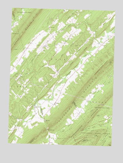
Blairs Mills, PA USGS Topographic Map
Click on map above to begin viewing in our Map Viewer.

This topographic map contains these locations and features:
Feature Name Type Latitude Longitude GNIS ID View Map
Barton HollowValleyN40.3551°W77.6480°1168782View Map
Beers TrailTrailN40.3079°W77.6275°1206555View Map
Big Round TopSummitN40.2587°W77.6450°1169560View Map
Big Roundtop TrailTrailN40.2590°W77.6447°1206552View Map
Big SpringSpringN40.2645°W77.6586°1169589View Map
Big Spring RunStreamN40.2709°W77.6303°1169598View Map
Big Spring State ParkParkN40.2645°W77.6508°1196517View Map
Blair HollowValleyN40.3150°W77.6925°1169792View Map
Blairs MillsPopulated PlaceN40.2837°W77.7183°1169798View Map
Blairs Mills Post OfficePost OfficeN40.2838°W77.7184°2773077View Map
Burns Valley OverlookLocaleN40.2568°W77.6572°1205151View Map
Campbell HollowValleyN40.3579°W77.6711°1171124View Map
Cherry HollowValleyN40.3249°W77.7238°1171642View Map
Colter SchoolSchoolN40.3112°W77.7386°1197171View Map
ConcordPopulated PlaceN40.2518°W77.7003°1172280View Map
Concord NarrowsGapN40.2637°W77.7028°1172290View Map
Creek RidgeRidgeN40.3276°W77.6733°1172669View Map
Cross KeysPopulated PlaceN40.3579°W77.7036°1172742View Map
Cross Keys PathTrailN40.3534°W77.7447°1206505View Map
Elf CemeteryCemeteryN40.2688°W77.7401°2061741View Map
George CreekStreamN40.3112°W77.6850°1175523View Map
Grey RidgeRidgeN40.3351°W77.6858°1176218View Map
Harts RunStreamN40.2573°W77.6325°1176620View Map
Hemlock RunStreamN40.2709°W77.6303°1176813View Map
Hog HollowValleyN40.3502°W77.7003°1177168View Map
Iron Horse TrailTrailN40.2684°W77.6447°1206511View Map
Jeffries CemeteryCemeteryN40.2583°W77.7493°2061743View Map
Lick RunStreamN40.3451°W77.6425°1192774View Map
McCabe ChapelChurchN40.3176°W77.6933°1180604View Map
McCabe SchoolSchoolN40.3179°W77.6905°1197170View Map
McCaskey GravesCemeteryN40.2576°W77.6469°1206556View Map
McWilliams CemeteryCemeteryN40.3515°W77.6275°1180809View Map
Mount Zion Church CemeteryCemeteryN40.2934°W77.7369°1847174View Map
Narrows Branch Tuscarora CreekStreamN40.2856°W77.7192°1182167View Map
O'Donel TrailTrailN40.2606°W77.6497°1182727View Map
Old State Road TrailTrailN40.2559°W77.6789°1199927View Map
Patterson RunStreamN40.2573°W77.6319°1183378View Map
PerulackPopulated PlaceN40.3429°W77.6403°1204384View Map
Polk CemeteryCemeteryN40.3369°W77.7106°1184206View Map
Rhines HollowValleyN40.3473°W77.6503°1184979View Map
SeyocPopulated PlaceN40.2987°W77.6494°1204618View Map
Shade ValleyBasinN40.3281°W77.7322°1187292View Map
Shearer BottomBendN40.3134°W77.7375°1187418View Map
Spears GrovePopulated PlaceN40.2723°W77.7061°1204698View Map
Township of LackCivilN40.3621°W77.6778°1216583View Map
Trough Spring BranchStreamN40.2720°W77.7328°1189827View Map
WaterlooPopulated PlaceN40.2884°W77.6944°1190678View Map
WistieLocaleN40.3667°W77.7378°1212878View Map
Zion ChurchChurchN40.2937°W77.7372°1191984View Map

Note: Coordinates in the location and feature list above are referenced to NAD83 datum.


Copyright (C) 2008-2024 Ryan Niemi / Sunset Dynamics ... All Rights Reserved