TopoQuest Logo
Do you find TopoQuest useful?
Help keep TopoQuest running and adding new maps/features by donating!
Bitcoin:  19c7KJd3qBynnjoSw5npx9KScwjBe4ifkT
Litecoin:  LXs6TkuXGGXo1vDsWCkWVdjQX94eUKd6ui
Home View Maps Find Maps Find Places Resources & Links


Sidney, Arkansas Topographic Map

USGS Map Title: Sidney, AR
USGS Map MRC: 36091A6
DRG (GeoTIFF) Download: o36091a6.tif


Neighboring USGS Topographic Map Quads:


  Franklin, AR  
36091B7
 

  Myron, AR  
36091B6
 

  Ash Flat, AR  
36091B5
 

  Zion, AR  
36091A7
 

  Sidney, AR  
36091A6
 

  Evening Shade, AR  
36091A5
 

  Mount Pleasant, AR  
35091H7
 

  Sandtown, AR  
35091H6
 

  Cave City, AR  
35091H5


Map MRC Location:

N37°
W92°
N37°
W91°
H8 H7 H6 H5 H4 H3 H2 H1
G8 G7 G6 G5 G4 G3 G2 G1
F8 F7 F6 F5 F4 F3 F2 F1
E8 E7 E6 E5 E4 E3 E2 E1
D8 D7 D6 D5 D4 D3 D2 D1
C8 C7 C6 C5 C4 C3 C2 C1
B8 B7 B6 B5 B4 B3 B2 B1
A8 A7 A6 A5 A4 A3 A2 A1
N36°
W92°
N36°
W91°

Sidney, AR USGS 1:24K Topographic Map Preview:
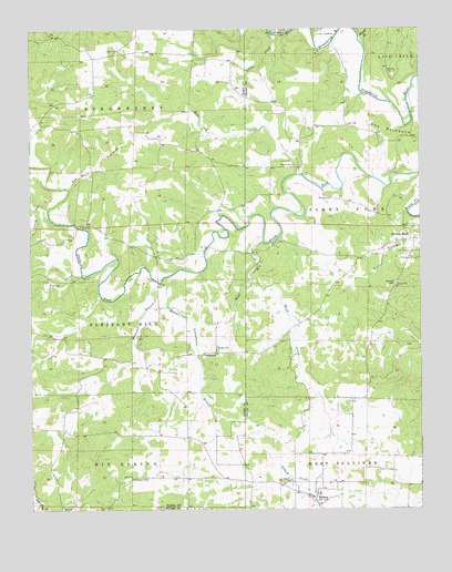
Sidney, AR USGS Topographic Map
Click on map above to begin viewing in our Map Viewer.

This topographic map contains these locations and features:
Feature Name Type Latitude Longitude GNIS ID View Map
Antioch ChurchChurchN36.0745°W91.7332°45901View Map
Bear CreekStreamN36.0873°W91.6646°46208View Map
Bear Creek United Methodist ChurchChurchN36.0898°W91.6654°76268View Map
Bird CreekStreamN36.0603°W91.6796°46630View Map
Caney CreekStreamN36.0787°W91.7443°47433View Map
Catfish LakeReservoirN36.1217°W91.6718°80966View Map
Catfish Lake DamDamN36.1217°W91.6718°80965View Map
Draytons ChapelChurchN36.0081°W91.7179°48602View Map
Finley CreekStreamN36.0609°W91.7338°49055View Map
Gravel HillSummitN36.0590°W91.6329°57841View Map
Hamms Schoolhouse BranchStreamN36.0584°W91.7093°49807View Map
Little CreekStreamN36.1240°W91.6718°51237View Map
Mays BranchStreamN36.0701°W91.6757°51767View Map
Mudtown BranchStreamN36.0595°W91.7088°52531View Map
NeedmorePopulated PlaceN36.0409°W91.6913°57135View Map
Schales CemeteryCemeteryN36.1140°W91.6329°54616View Map
SidneyPopulated PlaceN36.0031°W91.6599°54838View Map
Sidney Fire DepartmentBuildingN36.0043°W91.6631°2117124View Map
Sidney Post OfficePost OfficeN36.0034°W91.6601°84690View Map
Tom Moore BranchStreamN36.0837°W91.7376°55597View Map
Town of SidneyCivilN36.0048°W91.6584°2407333View Map
Township of Big SpringCivilN36.0107°W91.7370°66695View Map
Township of Piney ForkCivilN36.0703°W91.6298°69150View Map
Township of StrawberryCivilN36.1082°W91.7189°66713View Map
Wildcat BranchStreamN36.1228°W91.6443°56359View Map
Williams CemeteryCemeteryN36.0817°W91.6535°56390View Map
Yeager CemeteryCemeteryN36.0423°W91.6907°56587View Map

Note: Coordinates in the location and feature list above are referenced to NAD83 datum.


Copyright (C) 2008-2024 Ryan Niemi / Sunset Dynamics ... All Rights Reserved