TopoQuest Logo
Do you find TopoQuest useful?
Help keep TopoQuest running and adding new maps/features by donating!
Bitcoin:  19c7KJd3qBynnjoSw5npx9KScwjBe4ifkT
Litecoin:  LXs6TkuXGGXo1vDsWCkWVdjQX94eUKd6ui
Home View Maps Find Maps Find Places Resources & Links


Silver Hill, North Carolina Topographic Map

USGS Map Title: Silver Hill, NC
USGS Map MRC: 34079H4
DRG (GeoTIFF) Download: o34079h4.tif


Neighboring USGS Topographic Map Quads:


  Hoffman, NC  
35079A5
 

  Pinebluff, NC  
35079A4
 

  McCain, NC  
35079A3
 

  Marston, NC  
34079H5
 

  Silver Hill, NC  
34079H4
 

  Wagram, NC  
34079H3
 

  Gibson, NC  
34079G5
 

  Laurinburg, NC  
34079G4
 

  Wakulla, NC  
34079G3


Map MRC Location:

N35°
W80°
N35°
W79°
H8 H7 H6 H5 H4 H3 H2 H1
G8 G7 G6 G5 G4 G3 G2 G1
F8 F7 F6 F5 F4 F3 F2 F1
E8 E7 E6 E5 E4 E3 E2 E1
D8 D7 D6 D5 D4 D3 D2 D1
C8 C7 C6 C5 C4 C3 C2 C1
B8 B7 B6 B5 B4 B3 B2 B1
A8 A7 A6 A5 A4 A3 A2 A1
N34°
W80°
N34°
W79°

Silver Hill, NC USGS 1:24K Topographic Map Preview:
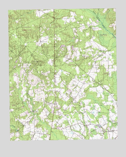
Silver Hill, NC USGS Topographic Map
Click on map above to begin viewing in our Map Viewer.

This topographic map contains these locations and features:
Feature Name Type Latitude Longitude GNIS ID View Map
Beaver Dam CreekStreamN34.9007°W79.4725°980808View Map
Cooley's NurseryBuildingN34.8844°W79.3831°2647153View Map
Davis CemeteryCemeteryN34.8788°W79.4164°983991View Map
Deercroft Census Designated PlaceCensusN34.9593°W79.4352°2629367View Map
Dixie PondReservoirN34.9632°W79.4253°998238View Map
Dixie Pond DamDamN34.9635°W79.4248°998239View Map
Dogwood FarmsLocaleN34.9994°W79.3881°2647169View Map
East Prong Juniper CreekStreamN34.9479°W79.4989°984524View Map
Hills CreekStreamN34.9854°W79.3914°986822View Map
Little CreekStreamN34.9860°W79.3903°988614View Map
McNeill CemeteryCemeteryN34.8804°W79.4731°989635View Map
McNeill CemeteryCemeteryN34.9257°W79.3986°989636View Map
Monroe Mill PondReservoirN34.8851°W79.4916°990145View Map
Mountain CreekStreamN34.9902°W79.3950°990689View Map
Naomi ChurchChurchN34.9888°W79.4187°990861View Map
Nashville ChurchChurchN34.9027°W79.4717°1007540View Map
Nashville SchoolSchoolN34.9032°W79.4717°990870View Map
Newtons PondReservoirN34.8874°W79.4431°998181View Map
Newtons Pond DamDamN34.8868°W79.4431°998182View Map
Oak HillPopulated PlaceN34.9554°W79.3937°1021693View Map
Saint Peters ChurchChurchN34.9107°W79.4209°995388View Map
Saint Peters ChurchChurchN34.8988°W79.4359°994110View Map
Shaw High SchoolSchoolN34.8943°W79.4181°1024857View Map
Silver HillPopulated PlaceN34.8896°W79.4837°994813View Map
Slates Memorial ChurchChurchN34.9693°W79.4623°994905View Map
Smith PondReservoirN34.8880°W79.3952°994990View Map
Spring Branch ChurchChurchN34.8824°W79.3800°995329View Map
Spring HillPopulated PlaceN34.8829°W79.3825°1022748View Map
Spring Hill - Friendship Fire DepartmentBuildingN34.9227°W79.4474°2639004View Map
Spring Hill CemeteryCemeteryN34.8827°W79.3895°995342View Map
Township of Spring HillCivilN34.9288°W79.4227°1027188View Map
West Prong Juniper CreekStreamN34.9479°W79.4989°997037View Map
Wilkes BranchStreamN34.9443°W79.4945°997332View Map
Wrights CemeteryCemeteryN34.9102°W79.4545°997664View Map

Note: Coordinates in the location and feature list above are referenced to NAD83 datum.


Copyright (C) 2008-2025 Ryan Niemi / Sunset Dynamics ... All Rights Reserved