TopoQuest Logo
Do you find TopoQuest useful?
Help keep TopoQuest running and adding new maps/features by donating!
Bitcoin:  19c7KJd3qBynnjoSw5npx9KScwjBe4ifkT
Litecoin:  LXs6TkuXGGXo1vDsWCkWVdjQX94eUKd6ui
Home View Maps Find Maps Find Places Resources & Links


Sliderock Mountain, Montana Topographic Map

USGS Map Title: Sliderock Mountain, MT
USGS Map MRC: 45109E8
DRG (GeoTIFF) Download: o45109e8.tif


Neighboring USGS Topographic Map Quads:


  McLeod, MT  
45110F1
 

  Ross Canyon, MT  
45109F8
 

  Packsaddle Butte, MT  
45109F7
 

  Enos Mountain, MT  
45110E1
 

  Sliderock Mountain, MT  
45109E8
 

  Wildcat Draw, MT  
45109E7
 

  Picket Pin Mountain, MT  
45110D1
 

  Meyer Mountain, MT  
45109D8
 

  Nye, MT  
45109D7


Map MRC Location:

N46°
W110°
N46°
W109°
H8 H7 H6 H5 H4 H3 H2 H1
G8 G7 G6 G5 G4 G3 G2 G1
F8 F7 F6 F5 F4 F3 F2 F1
E8 E7 E6 E5 E4 E3 E2 E1
D8 D7 D6 D5 D4 D3 D2 D1
C8 C7 C6 C5 C4 C3 C2 C1
B8 B7 B6 B5 B4 B3 B2 B1
A8 A7 A6 A5 A4 A3 A2 A1
N45°
W110°
N45°
W109°

Sliderock Mountain, MT USGS 1:24K Topographic Map Preview:
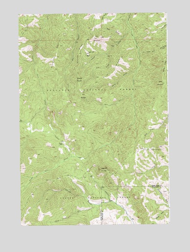
Sliderock Mountain, MT USGS Topographic Map
Click on map above to begin viewing in our Map Viewer.

This topographic map contains these locations and features:
Feature Name Type Latitude Longitude GNIS ID View Map
Arch RockSummitN45.5455°W109.8963°794875View Map
Bear GulchValleyN45.6108°W109.9127°779523View Map
Crow MineMineN45.6083°W109.9519°781931View Map
Davis GulchValleyN45.5908°W109.9016°782114View Map
Dead Indian CreekStreamN45.5135°W109.9246°782143View Map
Dead Indian SpringSpringN45.5019°W109.9743°794874View Map
Derby MountainSummitN45.5833°W109.8802°782307View Map
East Fork Upper Deer CreekStreamN45.5613°W109.9910°782919View Map
Ellis MountainSummitN45.5788°W109.9477°783155View Map
Evergreen MountainSummitN45.5997°W109.9682°783258View Map
Fire GulchValleyN45.6010°W109.9260°783405View Map
Fire RidgeRidgeN45.5935°W109.9177°783409View Map
Gold HillSummitN45.6016°W109.9410°784057View Map
Gold Hill MineMineN45.5999°W109.9430°784062View Map
Gold Hill MineMineN45.5985°W109.9396°805387View Map
Grouse RidgeRidgeN45.6019°W109.9499°784392View Map
Hicks MountainSummitN45.5455°W109.8824°784816View Map
Iron MountainSummitN45.6105°W109.9343°785335View Map
Knapp MineMineN45.6099°W109.9302°805384View Map
Knapp MineMineN45.6108°W109.9307°785798View Map
Lodgepole TrailTrailN45.5502°W109.9660°786441View Map
Placer GulchValleyN45.6152°W109.9052°788977View Map
Placer Gulch MineMineN45.6038°W109.9216°805386View Map
Ross MineMineN45.6083°W109.9166°789791View Map
Ross MineMineN45.6077°W109.9168°805385View Map
Silver King MineMineN45.5997°W109.9252°790520View Map
Sliderock MountainSummitN45.5860°W109.9496°790665View Map
South of the Yellowstone DivisionCivilN45.5648°W109.9889°1940713View Map
Sugarloaf MountainSummitN45.5327°W109.9321°791630View Map
Surprise MineMineN45.6058°W109.9199°791741View Map
Tie Cutter GulchValleyN45.6008°W109.8982°792163View Map
Travois GulchValleyN45.5119°W109.9343°791381View Map
Wepler CabinLocaleN45.5483°W109.9643°792942View Map
West Fork Lower Deer CreekStreamN45.5769°W109.9057°793043View Map

Note: Coordinates in the location and feature list above are referenced to NAD83 datum.


Copyright (C) 2008-2025 Ryan Niemi / Sunset Dynamics ... All Rights Reserved