TopoQuest Logo
Do you find TopoQuest useful?
Help keep TopoQuest running and adding new maps/features by donating!
Bitcoin:  19c7KJd3qBynnjoSw5npx9KScwjBe4ifkT
Litecoin:  LXs6TkuXGGXo1vDsWCkWVdjQX94eUKd6ui
Home View Maps Find Maps Find Places Resources & Links


Percilla, Texas Topographic Map

USGS Map Title: Percilla, TX
USGS Map MRC: 31095E4
DRG (GeoTIFF) Download: o31095e4.tif


Neighboring USGS Topographic Map Quads:


  Southeast Palestine, TX  
31095F5
 

  Slocum, TX  
31095F4
 

  Denson Springs, TX  
31095F3
 

  Elkhart Creek, TX  
31095E5
 

  Percilla, TX  
31095E4
 

  Augusta, TX  
31095E3
 

  Hays Spring, TX  
31095D5
 

  Grapeland, TX  
31095D4
 

  Crockett NE, TX  
31095D3


Map MRC Location:

N32°
W96°
N32°
W95°
H8 H7 H6 H5 H4 H3 H2 H1
G8 G7 G6 G5 G4 G3 G2 G1
F8 F7 F6 F5 F4 F3 F2 F1
E8 E7 E6 E5 E4 E3 E2 E1
D8 D7 D6 D5 D4 D3 D2 D1
C8 C7 C6 C5 C4 C3 C2 C1
B8 B7 B6 B5 B4 B3 B2 B1
A8 A7 A6 A5 A4 A3 A2 A1
N31°
W96°
N31°
W95°

Percilla, TX USGS 1:24K Topographic Map Preview:
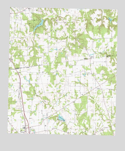
Percilla, TX USGS Topographic Map
Click on map above to begin viewing in our Map Viewer.

This topographic map contains these locations and features:
Feature Name Type Latitude Longitude GNIS ID View Map
Brown CemeteryCemeteryN31.5421°W95.4677°1377428View Map
Dunham-Harmon CemeteryCemeteryN31.5155°W95.4483°1377435View Map
Eleck Turk GraveCemeteryN31.5249°W95.4422°1377427View Map
Enon CemeteryCemeteryN31.5016°W95.4316°1357039View Map
Enon School (historical)SchoolN31.5024°W95.4341°1377440View Map
Evergreen ChurchChurchN31.5607°W95.4094°1357130View Map
Fielder ChapelChurchN31.5046°W95.3919°1357311View Map
Fort Brown (historical)MilitaryN31.5025°W95.4017°1384153View Map
Grapeland LakeReservoirN31.5162°W95.4381°1358289View Map
Grapeland Lake DamDamN31.5135°W95.4336°1860727View Map
Green SpringsSpringN31.5107°W95.4533°1377436View Map
Guiceland School (historical)SchoolN31.5657°W95.4802°1377442View Map
Gulceville CemeteryCemeteryN31.5657°W95.4802°1358499View Map
Houston MoundSummitN31.5752°W95.4094°1359724View Map
Houston Mound Historical MarkerParkN31.5768°W95.4102°1377459View Map
Ioni LakeReservoirN31.6168°W95.4569°1854502View Map
Ioni Lake DamDamN31.6168°W95.4569°1854501View Map
Ioni MarshSwampN31.6205°W95.4324°1360019View Map
Johnston CemeteryCemeteryN31.5177°W95.4636°1377426View Map
Livelyville ChurchChurchN31.5413°W95.4391°1361562View Map
Mill BranchSwampN31.5168°W95.4466°1377433View Map
Mill Branch Water Wheel (historical)BuildingN31.5182°W95.4444°1377434View Map
Mound CityPopulated PlaceN31.5768°W95.4058°1380216View Map
Mound CityPopulated PlaceN31.5768°W95.4063°2034775View Map
Murphy DamDamN31.5785°W95.4336°1854503View Map
Murphy LakeReservoirN31.5785°W95.4336°1854504View Map
Old Enon ChurchChurchN31.5171°W95.4449°1377438View Map
Old Enon SchoolSchoolN31.5171°W95.4449°1377439View Map
PercillaPopulated PlaceN31.5471°W95.3991°1365059View Map
RefugePopulated PlaceN31.5013°W95.4011°1366321View Map
Refuge CemeteryCemeteryN31.5041°W95.3999°1377432View Map
Saddler CreekStreamN31.6216°W95.4286°1367107View Map
SalmonPopulated PlaceN31.5730°W95.4983°1367369View Map
Sand Flat ChurchChurchN31.5902°W95.4163°1367598View Map
Shiloh ChurchChurchN31.5035°W95.4336°1368167View Map
Story SpringsStreamN31.5138°W95.4394°1377441View Map
Strong Memorial ParkParkN31.6246°W95.4802°1369290View Map
Sunset ChurchChurchN31.5066°W95.4469°1369415View Map
Union CrossingCrossingN31.5427°W95.4850°1377430View Map
Union SchoolSchoolN31.5427°W95.4850°1377429View Map
Walling Brick FactoryBuildingN31.5449°W95.4886°1377431View Map
Wilkins DamDamN31.5585°W95.4119°1860729View Map
Wilkins LakeReservoirN31.5592°W95.4128°1860730View Map
Yarborough SpringsSpringN31.5119°W95.4614°1377437View Map

Note: Coordinates in the location and feature list above are referenced to NAD83 datum.


Copyright (C) 2008-2025 Ryan Niemi / Sunset Dynamics ... All Rights Reserved