TopoQuest Logo
Do you find TopoQuest useful?
Help keep TopoQuest running and adding new maps/features by donating!
Bitcoin:  19c7KJd3qBynnjoSw5npx9KScwjBe4ifkT
Litecoin:  LXs6TkuXGGXo1vDsWCkWVdjQX94eUKd6ui
Home View Maps Find Maps Find Places Resources & Links


Snelling, South Carolina Topographic Map

USGS Map Title: Snelling, SC
USGS Map MRC: 33081B4
DRG (GeoTIFF) Download: o33081b4.tif


Neighboring USGS Topographic Map Quads:


  New Ellenton SE, SC  
33081C5
 

  Long Branch, SC  
33081C4
 

  Blackville, SC  
33081C3
 

  Girard NE, SC  
33081B5
 

  Snelling, SC  
33081B4
 

  Barnwell, SC  
33081B3
 

  Millett, SC  
33081A5
 

  Martin, SC  
33081A4
 

  Allendale, SC  
33081A3


Map MRC Location:

N34°
W82°
N34°
W81°
H8 H7 H6 H5 H4 H3 H2 H1
G8 G7 G6 G5 G4 G3 G2 G1
F8 F7 F6 F5 F4 F3 F2 F1
E8 E7 E6 E5 E4 E3 E2 E1
D8 D7 D6 D5 D4 D3 D2 D1
C8 C7 C6 C5 C4 C3 C2 C1
B8 B7 B6 B5 B4 B3 B2 B1
A8 A7 A6 A5 A4 A3 A2 A1
N33°
W82°
N33°
W81°

Snelling, SC USGS 1:24K Topographic Map Preview:
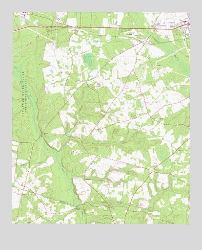
Snelling, SC USGS Topographic Map
Click on map above to begin viewing in our Map Viewer.

This topographic map contains these locations and features:
Feature Name Type Latitude Longitude GNIS ID View Map
Big BranchStreamN33.1674°W81.4698°1246872View Map
Bodiford Mill CreekStreamN33.1546°W81.4612°1220848View Map
Boiling SpringSpringN33.1376°W81.4334°1235432View Map
Boiling Spring School (historical)SchoolN33.1340°W81.4296°1235433View Map
Boiling SpringsPopulated PlaceN33.1352°W81.4312°1246933View Map
Boiling Springs Presbyterian ChurchChurchN33.1343°W81.4296°1235434View Map
Diamond School (historical)SchoolN33.1760°W81.3957°1235454View Map
Ellis Store (historical)LocaleN33.1477°W81.4448°1235465View Map
Gantts Mill CreekStreamN33.1665°W81.4682°1222637View Map
Gideon BranchStreamN33.1963°W81.4865°1235481View Map
Handberry Pond Dam D-3066DamN33.1602°W81.4982°1239733View Map
Hayes Mill PondReservoirN33.1789°W81.4591°1239744View Map
Holmes CemeteryCemeteryN33.2188°W81.4107°1223248View Map
Jordan Baptist ChurchChurchN33.1804°W81.4390°1246205View Map
Jordan School (historical)SchoolN33.1815°W81.4426°1235497View Map
New Home Baptist ChurchChurchN33.1879°W81.4146°1249810View Map
Owens CrossroadPopulated PlaceN33.1568°W81.4009°1227956View Map
Owens Pond D-3067 DamDamN33.1768°W81.4598°1239743View Map
Patterson BranchStreamN33.1754°W81.4598°1250035View Map
Patterson MillPopulated PlaceN33.1785°W81.4790°1250038View Map
Patterson Mill School (historical)SchoolN33.1793°W81.4787°1235521View Map
Pattersons BridgeBridgeN33.1760°W81.4809°1235522View Map
Pleasant Mountain ChurchChurchN33.1424°W81.4934°1250186View Map
Red Branch Baptist ChurchChurchN33.2318°W81.4034°1250303View Map
Red Oak Fire DepartmentBuildingN33.1918°W81.4057°2368071View Map
Saint John School (historical)SchoolN33.1379°W81.4237°1235532View Map
Saint Johns Baptist ChurchChurchN33.1379°W81.4237°1250540View Map
Saint Paul Baptist ChurchChurchN33.2460°W81.4621°1235536View Map
Salem School (historical)SchoolN33.1418°W81.4932°1233157View Map
Seven Pines Baptist ChurchChurchN33.2410°W81.4532°1235546View Map
Siloam ChurchChurchN33.1688°W81.3840°1250886View Map
SnellingPopulated PlaceN33.2399°W81.4559°1226722View Map
Snelling Volunteer Fire DepartmentBuildingN33.2395°W81.4548°2578426View Map
Stinson BridgeLocaleN33.1338°W81.4548°1251047View Map
Sweetwater Grove ChurchChurchN33.2363°W81.4093°1251093View Map
Town of SnellingCivilN33.2416°W81.4622°2407361View Map
Tri-County Shopping CenterLocaleN33.2429°W81.3757°1235564View Map
Union ChurchChurchN33.2088°W81.4479°1227291View Map
WEBA-TV (Allendale)TowerN33.1871°W81.3982°1252560View Map

Note: Coordinates in the location and feature list above are referenced to NAD83 datum.


Copyright (C) 2008-2025 Ryan Niemi / Sunset Dynamics ... All Rights Reserved