TopoQuest Logo
Do you find TopoQuest useful?
Help keep TopoQuest running and adding new maps/features by donating!
Bitcoin:  19c7KJd3qBynnjoSw5npx9KScwjBe4ifkT
Litecoin:  LXs6TkuXGGXo1vDsWCkWVdjQX94eUKd6ui
Home View Maps Find Maps Find Places Resources & Links


Blackville, South Carolina Topographic Map

USGS Map Title: Blackville, SC
USGS Map MRC: 33081C3
DRG (GeoTIFF) Download: o33081c3.tif


Neighboring USGS Topographic Map Quads:


  Williston, SC  
33081D4
 

  Springfield, SC  
33081D3
 

  Norway West, SC  
33081D2
 

  Long Branch, SC  
33081C4
 

  Blackville, SC  
33081C3
 

  Denmark, SC  
33081C2
 

  Snelling, SC  
33081B4
 

  Barnwell, SC  
33081B3
 

  Olar, SC  
33081B2


Map MRC Location:

N34°
W82°
N34°
W81°
H8 H7 H6 H5 H4 H3 H2 H1
G8 G7 G6 G5 G4 G3 G2 G1
F8 F7 F6 F5 F4 F3 F2 F1
E8 E7 E6 E5 E4 E3 E2 E1
D8 D7 D6 D5 D4 D3 D2 D1
C8 C7 C6 C5 C4 C3 C2 C1
B8 B7 B6 B5 B4 B3 B2 B1
A8 A7 A6 A5 A4 A3 A2 A1
N33°
W82°
N33°
W81°

Blackville, SC USGS 1:24K Topographic Map Preview:
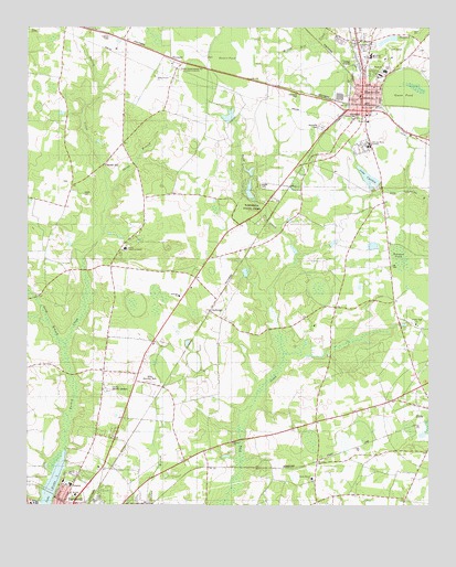
Blackville, SC USGS Topographic Map
Click on map above to begin viewing in our Map Viewer.

This topographic map contains these locations and features:
Feature Name Type Latitude Longitude GNIS ID View Map
AshleighPopulated PlaceN33.3010°W81.3176°1220251View Map
Ashleigh Baptist ChurchChurchN33.3049°W81.3276°1244934View Map
Ashleigh Church (historical)ChurchN33.2988°W81.3187°1235405View Map
Ashleigh Church (historical)ChurchN33.3010°W81.3207°1235406View Map
Ashleigh School (historical)SchoolN33.2996°W81.3159°1235407View Map
Ashleigh School (historical)SchoolN33.3079°W81.3209°1235408View Map
Barnwell County HospitalHospitalN33.2554°W81.3613°1247943View Map
Barnwell State ParkParkN33.3296°W81.3040°1244967View Map
BlackvillePopulated PlaceN33.3579°W81.2707°1246909View Map
Blackville Church (historical)ChurchN33.3493°W81.2598°1235426View Map
Blackville DivisionCivilN33.3690°W81.2760°1938202View Map
Blackville Fire DepartmentBuildingN33.3547°W81.2710°2578400View Map
Blackville High SchoolSchoolN33.3638°W81.2637°1235427View Map
Blackville Middle SchoolSchoolN33.3674°W81.2684°1235428View Map
Blackville Post OfficePost OfficeN33.3553°W81.2696°1252199View Map
Blackville School (historical)SchoolN33.3493°W81.2595°1235429View Map
Blackville United Methodist ChurchChurchN33.3521°W81.2693°1235430View Map
Booker PondSwampN33.3150°W81.2591°1220890View Map
Browns ChurchChurchN33.2665°W81.3107°1247018View Map
Browns School (historical)SchoolN33.2652°W81.2932°1235437View Map
Church of GodChurchN33.3596°W81.2673°1235450View Map
County Memory GardensCemeteryN33.2801°W81.3498°1221775View Map
Double Pond Baptist ChurchChurchN33.2977°W81.2537°1247549View Map
Double Pond School (historical)SchoolN33.2943°W81.2537°1235457View Map
Edgar A Brown LakeReservoirN33.2541°W81.3670°1239738View Map
Edisto Experimental StationLocaleN33.3643°W81.3284°1242385View Map
Edisto Pond Dam D-3061DamN33.3518°W81.3115°1239729View Map
Farrells MillPopulated PlaceN33.3388°W81.3515°1231276View Map
First Baptist ChurchChurchN33.3574°W81.2712°1247746View Map
Friendship Baptist ChurchChurchN33.3618°W81.2715°1235477View Map
Guess PondLakeN33.3563°W81.2562°1222927View Map
Hope Memorial ParkCemeteryN33.2824°W81.3368°1223277View Map
Jefferson Davis AcademySchoolN33.3443°W81.2690°1223525View Map
Jowers CemeteryCemeteryN33.3313°W81.3576°1223669View Map
Jowers CemeteryCemeteryN33.3340°W81.3023°1223670View Map
Lake BrownLakeN33.2541°W81.3670°1247014View Map
Lake CynthiaReservoirN33.3358°W81.2688°1221888View Map
Lake Cynthia Dam D-3068DamN33.3352°W81.2665°1239736View Map
Long BranchStreamN33.2924°W81.3629°1224144View Map
Macedonia Baptist ChurchChurchN33.3538°W81.2737°1235507View Map
Macedonia Middle SchoolSchoolN33.3677°W81.2682°1246509View Map
McLains Pond D-3058 DamDamN33.3718°W81.2582°1239740View Map
Peters PondLakeN33.3679°W81.3107°1225392View Map
Reedy Branch Baptist ChurchChurchN33.2571°W81.2862°1250321View Map
Reedy Branch School (historical)SchoolN33.2615°W81.2843°1235526View Map
ReynoldPopulated PlaceN33.3668°W81.3304°1250355View Map
Sacred Heart ChurchChurchN33.3532°W81.2690°1250490View Map
Saint Albans ChurchChurchN33.3563°W81.2723°1250493View Map
Shiloh Church (historical)ChurchN33.2852°W81.3448°1235548View Map
Shrub BranchStreamN33.3318°W81.3501°1226600View Map
Shrub Branch ChurchChurchN33.3621°W81.3354°1250883View Map
Shrub Branch School (historical)SchoolN33.3627°W81.3359°1235550View Map
Temple Baptist ChurchChurchN33.3504°W81.2690°1251134View Map
Town of BlackvilleCivilN33.3552°W81.2835°2405276View Map
Yale (historical)Populated PlaceN33.2813°W81.3329°1235567View Map

Note: Coordinates in the location and feature list above are referenced to NAD83 datum.


Copyright (C) 2008-2025 Ryan Niemi / Sunset Dynamics ... All Rights Reserved