TopoQuest Logo
Do you find TopoQuest useful?
Help keep TopoQuest running and adding new maps/features by donating!
Bitcoin:  19c7KJd3qBynnjoSw5npx9KScwjBe4ifkT
Litecoin:  LXs6TkuXGGXo1vDsWCkWVdjQX94eUKd6ui
Home View Maps Find Maps Find Places Resources & Links


Snow Shoe, Pennsylvania Topographic Map

USGS Map Title: Snow Shoe, PA
USGS Map MRC: 41077A8
DRG (GeoTIFF) Download: o41077a8.tif


Neighboring USGS Topographic Map Quads:


  Pottersdale, PA  
41078B1
 

  Snow Shoe NW, PA  
41077B8
 

  Snow Shoe NE, PA  
41077B7
 

  Karthaus, PA  
41078A1
 

  Snow Shoe, PA  
41077A8
 

  Snow Shoe SE, PA  
41077A7
 

  Black Moshannon, PA  
40078H1
 

  Bear Knob, PA  
40077H8
 

  Bellefonte, PA  
40077H7


Map MRC Location:

N42°
W78°
N42°
W77°
H8 H7 H6 H5 H4 H3 H2 H1
G8 G7 G6 G5 G4 G3 G2 G1
F8 F7 F6 F5 F4 F3 F2 F1
E8 E7 E6 E5 E4 E3 E2 E1
D8 D7 D6 D5 D4 D3 D2 D1
C8 C7 C6 C5 C4 C3 C2 C1
B8 B7 B6 B5 B4 B3 B2 B1
A8 A7 A6 A5 A4 A3 A2 A1
N41°
W78°
N41°
W77°

Snow Shoe, PA USGS 1:24K Topographic Map Preview:
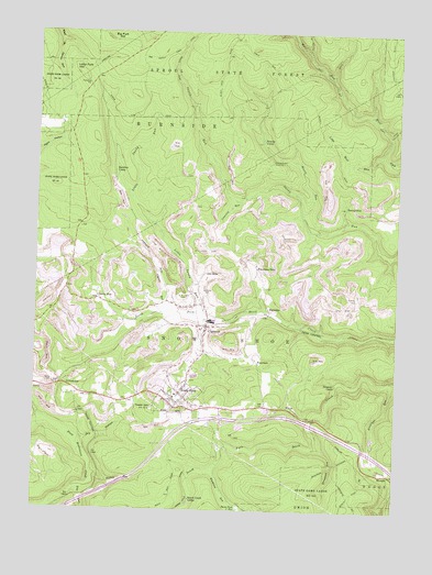
Snow Shoe, PA USGS Topographic Map
Click on map above to begin viewing in our Map Viewer.

This topographic map contains these locations and features:
Feature Name Type Latitude Longitude GNIS ID View Map
Askey CemeteryCemeteryN41.0343°W77.9931°1168468View Map
Beauty CampLocaleN41.0970°W77.9214°1168984View Map
Beauty RunStreamN41.0784°W77.9072°1168985View Map
Beech Creek LodgeLocaleN41.0034°W77.9453°1169099View Map
Big Fork HillSummitN41.1237°W77.9758°1169509View Map
Big Sandy TrailTrailN41.1192°W77.9556°1192140View Map
Borough of Snow ShoeCivilN41.0276°W77.9499°1215061View Map
ButtsPopulated PlaceN41.0273°W77.9111°1203200View Map
Chambers CampLocaleN41.1114°W77.9639°1196972View Map
Cherry RunPopulated PlaceN41.0553°W77.9786°1171654View Map
Cherry Run SchoolSchoolN41.0548°W77.9789°1196973View Map
ClarencePopulated PlaceN41.0481°W77.9403°1171899View Map
Clarence Census Designated PlaceCensusN41.0484°W77.9460°2389321View Map
Clarence Post OfficePost OfficeN41.0479°W77.9405°2772635View Map
Contrary RunStreamN41.0806°W77.9281°1172373View Map
Dead Horse TrailTrailN41.1192°W77.9503°1173025View Map
Dormition of the Mother of God Byzantine CemeteryCemeteryN41.0565°W77.9404°1994544View Map
Dry HollowValleyN41.0183°W77.9823°1173508View Map
Dry RunStreamN41.0059°W77.9911°1168003View Map
FountainPopulated PlaceN41.0395°W77.9231°1203614View Map
GillintownPopulated PlaceN41.0328°W77.9897°1175620View Map
Gillintown Mines StationLocaleN41.0242°W77.9869°1212639View Map
Hartline CampLocaleN41.0876°W77.9714°1176609View Map
Hicklen RunStreamN41.0098°W77.9795°1176942View Map
Horsehead RunStreamN41.0170°W77.9011°1177457View Map
JBM Mines Station (historical)LocaleN41.0428°W77.9564°1212640View Map
Jonathan RunStreamN41.0342°W77.8769°1178143View Map
Little Fork HillSummitN41.1139°W77.9847°1179548View Map
Little Sandy RunStreamN41.0520°W77.9425°1179668View Map
Little Wolf RunStreamN41.0926°W77.8797°1179716View Map
Musellmans CrossingPopulated PlaceN41.0912°W77.9189°1204247View Map
Old SidePopulated PlaceN41.0614°W77.9406°1182939View Map
PancakePopulated PlaceN41.0523°W77.9178°1183235View Map
Pine RunStreamN41.0062°W77.9836°1183898View Map
Poorman SidePopulated PlaceN41.0637°W77.9231°1184247View Map
Poorman Side School (historical)SchoolN41.0659°W77.9253°1196970View Map
RhoadsPopulated PlaceN41.0098°W77.8764°1184982View Map
Rock Run TrailTrailN41.0017°W77.9531°1206394View Map
Saint Michaels CemeteryCemeteryN41.0548°W77.9484°1186480View Map
ShettlestonPopulated PlaceN41.0795°W77.8928°1204634View Map
Snow ShoePopulated PlaceN41.0309°W77.9494°1214015View Map
Snow Shoe Emergency Medical Services Company 29BuildingN41.0304°W77.9635°2719647View Map
Snow Shoe Fire Company 6BuildingN41.0301°W77.9482°2645065View Map
Snow Shoe Fire TowerTowerN41.0267°W77.9592°1206380View Map
Snow Shoe Post OfficePost OfficeN41.0292°W77.9484°2772984View Map
Snow Shoe ReservoirReservoirN41.0003°W77.9274°1193388View Map
Snow Shop StationLocaleN41.0401°W77.9400°1196969View Map
Star SchoolSchoolN41.0303°W77.9817°1196974View Map
Stinktown RunStreamN41.0112°W77.9367°1188688View Map
Sunday Corners (historical)LocaleN41.0839°W77.8850°1196971View Map
Swanset CampLocaleN41.0331°W77.8956°1189139View Map
Tower HillSummitN41.0270°W77.9589°1189679View Map
Township of Snow ShoeCivilN41.0425°W77.9288°1216137View Map
Wolf Run TrailTrailN41.1059°W77.8931°1190964View Map

Note: Coordinates in the location and feature list above are referenced to NAD83 datum.


Copyright (C) 2008-2025 Ryan Niemi / Sunset Dynamics ... All Rights Reserved