TopoQuest Logo
Do you find TopoQuest useful?
Help keep TopoQuest running and adding new maps/features by donating!
Bitcoin:  19c7KJd3qBynnjoSw5npx9KScwjBe4ifkT
Litecoin:  LXs6TkuXGGXo1vDsWCkWVdjQX94eUKd6ui
Home View Maps Find Maps Find Places Resources & Links


Snow Shoe SE, Pennsylvania Topographic Map

USGS Map Title: Snow Shoe SE, PA
USGS Map MRC: 41077A7
DRG (GeoTIFF) Download: o41077a7.tif


Neighboring USGS Topographic Map Quads:


  Snow Shoe NW, PA  
41077B8
 

  Snow Shoe NE, PA  
41077B7
 

  Howard NW, PA  
41077B6
 

  Snow Shoe, PA  
41077A8
 

  Snow Shoe SE, PA  
41077A7
 

  Howard, PA  
41077A6
 

  Bear Knob, PA  
40077H8
 

  Bellefonte, PA  
40077H7
 

  Mingoville, PA  
40077H6


Map MRC Location:

N42°
W78°
N42°
W77°
H8 H7 H6 H5 H4 H3 H2 H1
G8 G7 G6 G5 G4 G3 G2 G1
F8 F7 F6 F5 F4 F3 F2 F1
E8 E7 E6 E5 E4 E3 E2 E1
D8 D7 D6 D5 D4 D3 D2 D1
C8 C7 C6 C5 C4 C3 C2 C1
B8 B7 B6 B5 B4 B3 B2 B1
A8 A7 A6 A5 A4 A3 A2 A1
N41°
W78°
N41°
W77°

Snow Shoe SE, PA USGS 1:24K Topographic Map Preview:
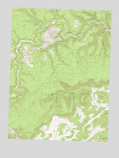
Snow Shoe SE, PA USGS Topographic Map
Click on map above to begin viewing in our Map Viewer.

This topographic map contains these locations and features:
Feature Name Type Latitude Longitude GNIS ID View Map
Council RunStreamN41.0987°W77.8044°1172500View Map
Devils ElbowBendN41.0056°W77.8478°1192352View Map
Eddy Lick RunStreamN41.1134°W77.8108°1173983View Map
Hayes RunStreamN41.1051°W77.7503°1176690View Map
Hogback TunnelTunnelN41.1026°W77.8031°1177179View Map
KatoPopulated PlaceN41.0848°W77.8661°1203913View Map
Laurel RunStreamN41.0467°W77.7972°1178991View Map
Logway RunStreamN41.1017°W77.8119°1179832View Map
Marsh Creek TrailTrailN41.0740°W77.8025°1206383View Map
North Fork Beech CreekStreamN41.0486°W77.8676°1182577View Map
OrvistonPopulated PlaceN41.1065°W77.7522°1183056View Map
Orviston Census Designated PlaceCensusN41.1073°W77.7534°2584495View Map
PantherPopulated PlaceN41.1065°W77.8303°1204355View Map
Panther RunStreamN41.1073°W77.8344°1183266View Map
Pleasant Valley ChurchChurchN41.0195°W77.7739°1184072View Map
Rock Hollow TrailTrailN41.1012°W77.8747°1185265View Map
Rock RunStreamN41.0687°W77.8628°1185282View Map
Sandy RunStreamN41.0739°W77.8689°1186968View Map
South Fork Beech CreekStreamN41.0487°W77.8675°1217372View Map
Summit Hill ChurchChurchN41.0403°W77.7678°1189047View Map
Three Point CampLocaleN41.0459°W77.8000°1189540View Map
Three Rock RunStreamN41.1151°W77.7711°1189542View Map
Township of CurtinCivilN41.0964°W77.7652°1216122View Map
Two Rock RunStreamN41.1134°W77.7747°1190024View Map
Wolf RunStreamN41.0881°W77.8658°1191683View Map

Note: Coordinates in the location and feature list above are referenced to NAD83 datum.


Copyright (C) 2008-2025 Ryan Niemi / Sunset Dynamics ... All Rights Reserved