TopoQuest Logo
Do you find TopoQuest useful?
Help keep TopoQuest running and adding new maps/features by donating!
Bitcoin:  19c7KJd3qBynnjoSw5npx9KScwjBe4ifkT
Litecoin:  LXs6TkuXGGXo1vDsWCkWVdjQX94eUKd6ui
Home View Maps Find Maps Find Places Resources & Links


Oak Park SW, Georgia Topographic Map

USGS Map Title: Oak Park SW, GA
USGS Map MRC: 32082C4
DRG (GeoTIFF) Download: o32082c4.tif


Neighboring USGS Topographic Map Quads:


  Soperton North, GA  
32082D5
 

  Covena, GA  
32082D4
 

  Nunez, GA  
32082D3
 

  Soperton South, GA  
32082C5
 

  Oak Park SW, GA  
32082C4
 

  Oak Park, GA  
32082C3
 

  Mount Vernon, GA  
32082B5
 

  Vidalia, GA  
32082B4
 

  Lyons, GA  
32082B3


Map MRC Location:

N33°
W83°
N33°
W82°
H8 H7 H6 H5 H4 H3 H2 H1
G8 G7 G6 G5 G4 G3 G2 G1
F8 F7 F6 F5 F4 F3 F2 F1
E8 E7 E6 E5 E4 E3 E2 E1
D8 D7 D6 D5 D4 D3 D2 D1
C8 C7 C6 C5 C4 C3 C2 C1
B8 B7 B6 B5 B4 B3 B2 B1
A8 A7 A6 A5 A4 A3 A2 A1
N32°
W83°
N32°
W82°

Oak Park SW, GA USGS 1:24K Topographic Map Preview:
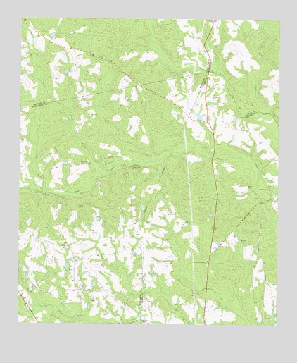
Oak Park SW, GA USGS Topographic Map
Click on map above to begin viewing in our Map Viewer.

This topographic map contains these locations and features:
Feature Name Type Latitude Longitude GNIS ID View Map
Blockers ChapelChurchN32.2524°W82.4385°311527View Map
Camp BranchStreamN32.3138°W82.4585°312195View Map
Eternal Glory CemeteryCemeteryN32.2746°W82.4090°345174View Map
Eternal Glory Gardens ChapelChurchN32.2752°W82.4090°313974View Map
First Advent ChurchChurchN32.2541°W82.4004°345176View Map
Holmes BridgeBridgeN32.3191°W82.4065°345185View Map
Long CreekStreamN32.3530°W82.4035°317350View Map
McDonald CemeteryCemeteryN32.2760°W82.4729°317895View Map
McLeod GraveCemeteryN32.2843°W82.3926°317954View Map
Mill CreekStreamN32.3366°W82.3815°318225View Map
Morris GravesCemeteryN32.3613°W82.3973°318492View Map
Mosley CemeteryCemeteryN32.3063°W82.3893°318517View Map
Mosleytown ChurchChurchN32.3346°W82.4654°318521View Map
Mount Shady ChurchChurchN32.3618°W82.4104°318871View Map
Naked CreekStreamN32.3049°W82.4874°319194View Map
Pidgeon Springs CemeteryCemeteryN32.3141°W82.4462°320485View Map
Price PondReservoirN32.3682°W82.4848°347501View Map
Rice LakeReservoirN32.3357°W82.4136°340363View Map
Rice Lake DamDamN32.3352°W82.4132°340362View Map
Ruth ChapelChurchN32.2821°W82.4771°322018View Map
Sanders CemeteryCemeteryN32.3493°W82.4471°322440View Map
Water ProngStreamN32.2582°W82.4904°324892View Map
Williamson CemeteryCemeteryN32.3157°W82.4704°325377View Map
Williamson CemeteryCemeteryN32.3296°W82.3887°325378View Map
Williamson CemeteryCemeteryN32.3427°W82.4071°325379View Map
Williamson CemeteryCemeteryN32.3743°W82.4071°325380View Map

Note: Coordinates in the location and feature list above are referenced to NAD83 datum.


Copyright (C) 2008-2025 Ryan Niemi / Sunset Dynamics ... All Rights Reserved