TopoQuest Logo
Do you find TopoQuest useful?
Help keep TopoQuest running and adding new maps/features by donating!
Bitcoin:  19c7KJd3qBynnjoSw5npx9KScwjBe4ifkT
Litecoin:  LXs6TkuXGGXo1vDsWCkWVdjQX94eUKd6ui
Home View Maps Find Maps Find Places Resources & Links


Sparta NW, Georgia Topographic Map

USGS Map Title: Sparta NW, GA
USGS Map MRC: 33082D8
DRG (GeoTIFF) Download: o33082d8.tif


Neighboring USGS Topographic Map Quads:


  Union Point, GA  
33083E1
 

  Crawfordville, GA  
33082E8
 

  Sharon, GA  
33082E7
 

  White Plains, GA  
33083D1
 

  Sparta NW, GA  
33082D8
 

  Sparta NE, GA  
33082D7
 

  Shoulderbone, GA  
33083C1
 

  Sparta, GA  
33082C8
 

  Jewell, GA  
33082C7


Map MRC Location:

N34°
W83°
N34°
W82°
H8 H7 H6 H5 H4 H3 H2 H1
G8 G7 G6 G5 G4 G3 G2 G1
F8 F7 F6 F5 F4 F3 F2 F1
E8 E7 E6 E5 E4 E3 E2 E1
D8 D7 D6 D5 D4 D3 D2 D1
C8 C7 C6 C5 C4 C3 C2 C1
B8 B7 B6 B5 B4 B3 B2 B1
A8 A7 A6 A5 A4 A3 A2 A1
N33°
W83°
N33°
W82°

Sparta NW, GA USGS 1:24K Topographic Map Preview:
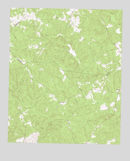
Sparta NW, GA USGS Topographic Map
Click on map above to begin viewing in our Map Viewer.

This topographic map contains these locations and features:
Feature Name Type Latitude Longitude GNIS ID View Map
Antioch Baptist ChurchChurchN33.4679°W82.8835°354354View Map
Antioch CemeteryCemeteryN33.4676°W82.8832°347605View Map
Apostolic Faith CemeteryCemeteryN33.3765°W82.9238°1985767View Map
Battery CemeteryCemeteryN33.4918°W82.9488°347606View Map
Battery ChurchChurchN33.4915°W82.9485°354480View Map
Battle BranchStreamN33.4132°W82.9113°310862View Map
Camilla-Zack County Life Negro Center (historical)BuildingN33.4129°W82.9365°348197View Map
Cooper Family CemeteryCemeteryN33.4182°W82.9446°1985790View Map
Dixon CemeteryCemeteryN33.3949°W82.9332°313501View Map
Hilsman - Lary Family CemeteryCemeteryN33.4188°W82.9609°1985814View Map
Hubert Family CemeteryCemeteryN33.4132°W82.9434°1985817View Map
Hunnon BranchStreamN33.4049°W82.8857°315825View Map
Johnson CreekStreamN33.4737°W82.9551°316163View Map
Johnston Family CemeteryCemeteryN33.4368°W82.9338°1985823View Map
Lacy CreekStreamN33.4737°W82.9551°316527View Map
Mary Olis Wilcox Health Center (historical)HospitalN33.4121°W82.9376°348228View Map
Old Springfield Church CemeteryCemeteryN33.4160°W82.9401°1985856View Map
Powelton CemeteryCemeteryN33.4231°W82.8783°348244View Map
Powelton Community CemeteryCemeteryN33.4267°W82.8764°348245View Map
Powelton Methodist ChurchChurchN33.4235°W82.8782°348246View Map
Pride (historical)Populated PlaceN33.4262°W82.9040°348249View Map
SpringfieldPopulated PlaceN33.4137°W82.9432°333106View Map
Springfield CemeteryCemeteryN33.4140°W82.9432°348267View Map
Springfield Cemetery Number 2CemeteryN33.4144°W82.9403°1985855View Map
Springfield ChurchChurchN33.4135°W82.9426°348268View Map

Note: Coordinates in the location and feature list above are referenced to NAD83 datum.


Copyright (C) 2008-2025 Ryan Niemi / Sunset Dynamics ... All Rights Reserved