TopoQuest Logo
Do you find TopoQuest useful?
Help keep TopoQuest running and adding new maps/features by donating!
Bitcoin:  19c7KJd3qBynnjoSw5npx9KScwjBe4ifkT
Litecoin:  LXs6TkuXGGXo1vDsWCkWVdjQX94eUKd6ui
Home View Maps Find Maps Find Places Resources & Links


Shiloh, Louisiana Topographic Map

USGS Map Title: Shiloh, LA
USGS Map MRC: 32092G5
DRG (GeoTIFF) Download: o32092g5.tif


Neighboring USGS Topographic Map Quads:


  Lillie, LA  
32092H6
 

  Spearsville, LA  
32092H5
 

  Truxno, LA  
32092H4
 

  Bernice, LA  
32092G6
 

  Shiloh, LA  
32092G5
 

  Farmerville, LA  
32092G4
 

  Dubach, LA  
32092F6
 

  Cedarton, LA  
32092F5
 

  Downsville North, LA  
32092F4


Map MRC Location:

N33°
W93°
N33°
W92°
H8 H7 H6 H5 H4 H3 H2 H1
G8 G7 G6 G5 G4 G3 G2 G1
F8 F7 F6 F5 F4 F3 F2 F1
E8 E7 E6 E5 E4 E3 E2 E1
D8 D7 D6 D5 D4 D3 D2 D1
C8 C7 C6 C5 C4 C3 C2 C1
B8 B7 B6 B5 B4 B3 B2 B1
A8 A7 A6 A5 A4 A3 A2 A1
N32°
W93°
N32°
W92°

Shiloh, LA USGS 1:24K Topographic Map Preview:
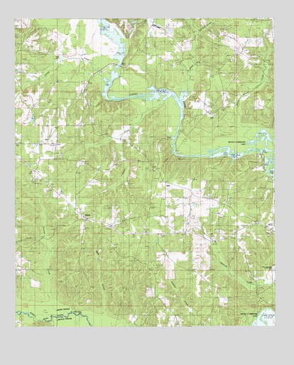
Shiloh, LA USGS Topographic Map
Click on map above to begin viewing in our Map Viewer.

This topographic map contains these locations and features:
Feature Name Type Latitude Longitude GNIS ID View Map
Barrett CemeteryCemeteryN32.8210°W92.6168°544043View Map
Bernice Oil and Gas FieldOilfieldN32.8335°W92.6229°548697View Map
Camp CreekStreamN32.8421°W92.5454°533655View Map
Clayton (historical)Populated PlaceN32.8635°W92.5449°548701View Map
Cypress CreekStreamN32.8696°W92.5379°534364View Map
EvergreenPopulated PlaceN32.7504°W92.5463°548711View Map
Evergreen CemeteryCemeteryN32.7504°W92.5471°534862View Map
Friendship SchoolSchoolN32.7868°W92.5704°535127View Map
Horse Trough CreekStreamN32.8215°W92.5049°535807View Map
Lowrys Ferry (historical)CrossingN32.8196°W92.5335°548718View Map
Mount Patrick CemeteryCemeteryN32.8137°W92.5576°544061View Map
Mount Sterling ChurchChurchN32.8324°W92.5915°537404View Map
Parish Governing Authority District 4CivilN32.7794°W92.5671°1930040View Map
Patrick ChurchChurchN32.8138°W92.5576°538013View Map
Pleasant Hill ChurchChurchN32.8582°W92.5204°538259View Map
Potter CreekStreamN32.8440°W92.5546°538365View Map
ShilohPopulated PlaceN32.7935°W92.5893°541191View Map
Shiloh CemeteryCemeteryN32.7932°W92.5901°544065View Map
Shiloh Gas FieldOilfieldN32.8260°W92.5849°548728View Map
Tenmile CreekStreamN32.7557°W92.5999°556217View Map
Village CreekStreamN32.8482°W92.5796°540171View Map
Ward FourCivilN32.7921°W92.5871°545232View Map
Wynn BranchStreamN32.7518°W92.5799°540555View Map

Note: Coordinates in the location and feature list above are referenced to NAD83 datum.


Copyright (C) 2008-2025 Ryan Niemi / Sunset Dynamics ... All Rights Reserved