TopoQuest Logo
Do you find TopoQuest useful?
Help keep TopoQuest running and adding new maps/features by donating!
Bitcoin:  19c7KJd3qBynnjoSw5npx9KScwjBe4ifkT
Litecoin:  LXs6TkuXGGXo1vDsWCkWVdjQX94eUKd6ui
Home View Maps Find Maps Find Places Resources & Links


Spring Mills, Pennsylvania Topographic Map

USGS Map Title: Spring Mills, PA
USGS Map MRC: 40077G5
DRG (GeoTIFF) Download: o40077g5.tif


Neighboring USGS Topographic Map Quads:


  Mingoville, PA  
40077H6
 

  Madisonburg, PA  
40077H5
 

  Millheim, PA  
40077H4
 

  Centre Hall, PA  
40077G6
 

  Spring Mills, PA  
40077G5
 

  Coburn, PA  
40077G4
 

  Barrville, PA  
40077F6
 

  Burnham, PA  
40077F5
 

  Alfarata, PA  
40077F4


Map MRC Location:

N41°
W78°
N41°
W77°
H8 H7 H6 H5 H4 H3 H2 H1
G8 G7 G6 G5 G4 G3 G2 G1
F8 F7 F6 F5 F4 F3 F2 F1
E8 E7 E6 E5 E4 E3 E2 E1
D8 D7 D6 D5 D4 D3 D2 D1
C8 C7 C6 C5 C4 C3 C2 C1
B8 B7 B6 B5 B4 B3 B2 B1
A8 A7 A6 A5 A4 A3 A2 A1
N40°
W78°
N40°
W77°

Spring Mills, PA USGS 1:24K Topographic Map Preview:
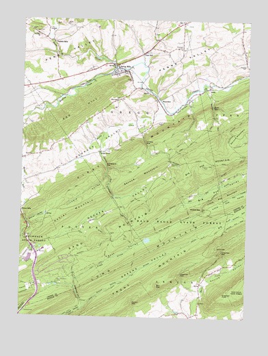
Spring Mills, PA USGS Topographic Map
Click on map above to begin viewing in our Map Viewer.

This topographic map contains these locations and features:
Feature Name Type Latitude Longitude GNIS ID View Map
Barr GapGapN40.7626°W77.5478°1168750View Map
BeaverdamPopulated PlaceN40.8415°W77.5475°1203043View Map
Beaverdam SchoolSchoolN40.8426°W77.5486°1197191View Map
Bethesda ChurchChurchN40.8706°W77.6106°1169423View Map
Big FlatFlatN40.7906°W77.5094°1169506View Map
Big Poe MountainSummitN40.8137°W77.5211°1169547View Map
Britton RunStreamN40.7845°W77.6233°1170278View Map
Carson GapGapN40.7559°W77.5617°1171268View Map
Crissman GapGapN40.7776°W77.5133°1172701View Map
Crissman KnobSummitN40.7601°W77.5122°1172702View Map
Decker PathTrailN40.7853°W77.5769°1173046View Map
Decker SchoolSchoolN40.8226°W77.5828°1197187View Map
Decker ValleyValleyN40.7834°W77.6045°1173048View Map
Devils HoleBendN40.7790°W77.5133°1173205View Map
Egg HillSummitN40.8317°W77.6019°1174040View Map
Egg Hill ChurchChurchN40.8284°W77.6250°1174041View Map
Farmers MillsPopulated PlaceN40.8656°W77.6075°1203554View Map
Faust ValleyValleyN40.7658°W77.5938°1174640View Map
Front MountainSummitN40.7656°W77.5569°1175294View Map
Gentzel SchoolSchoolN40.8481°W77.5208°1197192View Map
Georges ValleyValleyN40.8364°W77.5462°1175538View Map
Greens ValleyValleyN40.7543°W77.5888°1176166View Map
Greens Valley StreamStreamN40.7537°W77.5894°1176168View Map
Greens Valley TrailTrailN40.7701°W77.5578°1176169View Map
Gregg Township Volunteer Fire Company 7BuildingN40.8555°W77.5726°2645794View Map
Ground Oak TrailTrailN40.7790°W77.5758°1176268View Map
Havice ValleyValleyN40.7646°W77.5217°1176664View Map
Heckman CemeteryCemeteryN40.8640°W77.5369°1176747View Map
Holy Cross ChurchChurchN40.8415°W77.5706°1177256View Map
Illinois ValleyValleyN40.8088°W77.5779°1177689View Map
Indian TrailTrailN40.8009°W77.5344°1177795View Map
Kettle RunStreamN40.8481°W77.5228°1178424View Map
Kishacoquillas ValleyValleyN40.7606°W77.5256°1178554View Map
Kohler MountainSummitN40.7978°W77.5842°1178638View Map
Kohler ValleyValleyN40.7898°W77.6210°1178640View Map
Krise ValleyValleyN40.7837°W77.6236°1178688View Map
Laurel RunStreamN40.8273°W77.5789°1178982View Map
Lingle StreamStreamN40.7667°W77.5908°1179428View Map
Lingle TrailTrailN40.7795°W77.5617°1179429View Map
Locust GrovePopulated PlaceN40.8192°W77.5811°1179775View Map
Long MountainRangeN40.7767°W77.5550°1192837View Map
Mountain CemeteryCemeteryN40.8148°W77.5419°1181945View Map
Muddy CreekStreamN40.8373°W77.5450°1182042View Map
Paradise CemeteryCemeteryN40.8565°W77.5015°1183275View Map
Penn HallPopulated PlaceN40.8609°W77.5575°1183475View Map
Penn NurseryLocaleN40.7778°W77.6131°1206551View Map
Penn Nursery DamDamN40.7767°W77.6197°1195031View Map
Penn Spring ReservoirReservoirN40.7743°W77.6199°1195030View Map
Pennfield Farm AirportAirportN40.8514°W77.6144°1194120View Map
Penns Valley Emergency Medical Services Company 28BuildingN40.8502°W77.6037°2719553View Map
Pike SchoolSchoolN40.8515°W77.6053°1197188View Map
Poe Valley Fire TowerTowerN40.8140°W77.5214°1212874View Map
Polk Hill SchoolSchoolN40.8415°W77.5703°1197189View Map
Ripka TrailTrailN40.7965°W77.5528°1185099View Map
Rising SpringSpringN40.8557°W77.5750°1202159View Map
Rising Spring Station (historical)BuildingN40.8528°W77.5742°1197190View Map
Rossman GapGapN40.7678°W77.5353°1185501View Map
Saint Marks ChurchChurchN40.7565°W77.5253°1186331View Map
Salem ChurchChurchN40.8745°W77.5350°1186848View Map
Sand MountainSummitN40.7884°W77.5722°1193283View Map
Seven Mountain CampLocaleN40.7648°W77.6039°1200117View Map
Sinking CreekStreamN40.8551°W77.5722°1198124View Map
Spring MillsPopulated PlaceN40.8534°W77.5675°1188247View Map
Spring Mills Census Designated PlaceCensusN40.8534°W77.5653°2390333View Map
Spring Mills Post OfficePost OfficeN40.8531°W77.5731°2779695View Map
Stillhouse HollowValleyN40.7545°W77.5895°1188672View Map
Summit TrailTrailN40.7848°W77.5467°1189053View Map
Synagogue GapGapN40.8128°W77.5769°1189225View Map
Township of GreggCivilN40.8648°W77.5744°1216124View Map
Triester ValleyValleyN40.7781°W77.6186°1189763View Map
Union CemeteryCemeteryN40.8701°W77.6183°1190111View Map
Vonada GapGapN40.8231°W77.5558°1190453View Map
Wildcat GapGapN40.7959°W77.5239°1191402View Map
Wolf TrailTrailN40.7756°W77.6042°1191691View Map
ZerbyPopulated PlaceN40.8462°W77.5211°1205014View Map
Zerby GapGapN40.8390°W77.5186°1191949View Map

Note: Coordinates in the location and feature list above are referenced to NAD83 datum.


Copyright (C) 2008-2025 Ryan Niemi / Sunset Dynamics ... All Rights Reserved