TopoQuest Logo
Do you find TopoQuest useful?
Help keep TopoQuest running and adding new maps/features by donating!
Bitcoin:  19c7KJd3qBynnjoSw5npx9KScwjBe4ifkT
Litecoin:  LXs6TkuXGGXo1vDsWCkWVdjQX94eUKd6ui
Home View Maps Find Maps Find Places Resources & Links


Leona SW, Texas Topographic Map

USGS Map Title: Leona SW, TX
USGS Map MRC: 31095A8
DRG (GeoTIFF) Download: o31095a8.tif


Neighboring USGS Topographic Map Quads:


  Spring Seat, TX  
31096B1
 

  Leona, TX  
31095B8
 

  Middleton, TX  
31095B7
 

  Normangee, TX  
31096A1
 

  Leona SW, TX  
31095A8
 

  Elwood, TX  
31095A7
 

  North Zulch, TX  
30096H1
 

  Madisonville, TX  
30095H8
 

  Connor, TX  
30095H7


Map MRC Location:

N32°
W96°
N32°
W95°
H8 H7 H6 H5 H4 H3 H2 H1
G8 G7 G6 G5 G4 G3 G2 G1
F8 F7 F6 F5 F4 F3 F2 F1
E8 E7 E6 E5 E4 E3 E2 E1
D8 D7 D6 D5 D4 D3 D2 D1
C8 C7 C6 C5 C4 C3 C2 C1
B8 B7 B6 B5 B4 B3 B2 B1
A8 A7 A6 A5 A4 A3 A2 A1
N31°
W96°
N31°
W95°

Leona SW, TX USGS 1:24K Topographic Map Preview:
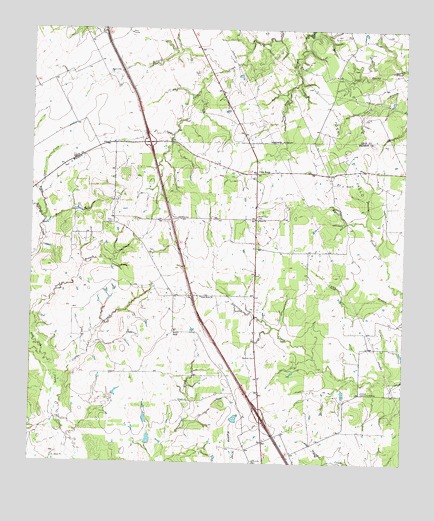
Leona SW, TX USGS Topographic Map
Click on map above to begin viewing in our Map Viewer.

This topographic map contains these locations and features:
Feature Name Type Latitude Longitude GNIS ID View Map
Buck GullyValleyN31.0696°W95.9933°1353132View Map
Concord Community BuildingLocaleN31.0210°W95.8888°1354862View Map
Coplin BranchStreamN31.0077°W95.9866°1354965View Map
Cross RoadsPopulated PlaceN31.0835°W95.9241°1379610View Map
Cross RoadsPopulated PlaceN31.0838°W95.9252°2034824View Map
Fisherman Paradise LakeReservoirN31.0152°W95.9019°1864209View Map
Fisherman Paradise Lake DamDamN31.0152°W95.9036°1864208View Map
Greenbriar CemeteryCemeteryN31.0010°W95.9247°1358389View Map
Greer CemeteryCemeteryN31.0696°W95.9725°1358418View Map
Hensarling AirportAirportN31.0469°W95.9225°1387130View Map
Leon CreekStreamN31.0777°W95.9975°1361087View Map
Middle Branch Riley CreekStreamN31.0705°W95.9963°1362700View Map
Mount Tabor CemeteryCemeteryN31.0713°W95.9238°1363321View Map
OSR Oil FieldOilfieldN31.0921°W95.8811°1364255View Map
Riley CreekStreamN31.0363°W96.0000°1375740View Map
Sand BranchStreamN31.0363°W95.9997°1367558View Map
Seven J RanchLocaleN31.0380°W95.9513°1367974View Map
Spring BranchStreamN31.1132°W95.9350°1368931View Map
Sweet Home ChurchChurchN31.0482°W95.9425°1369467View Map
Tabor ChurchChurchN31.0702°W95.9233°1369548View Map
Walker Lake Number 1ReservoirN31.0070°W95.9602°1860597View Map
Walker Lake Number 1 DamDamN31.0052°W95.9602°1860596View Map
Walker Lake Number 2ReservoirN31.0134°W95.9311°1860599View Map
Walker Lake Number 2 DamDamN31.0119°W95.9319°1860598View Map

Note: Coordinates in the location and feature list above are referenced to NAD83 datum.


Copyright (C) 2008-2025 Ryan Niemi / Sunset Dynamics ... All Rights Reserved