TopoQuest Logo
Do you find TopoQuest useful?
Help keep TopoQuest running and adding new maps/features by donating!
Bitcoin:  19c7KJd3qBynnjoSw5npx9KScwjBe4ifkT
Litecoin:  LXs6TkuXGGXo1vDsWCkWVdjQX94eUKd6ui
Home View Maps Find Maps Find Places Resources & Links


Marion East, Louisiana Topographic Map

USGS Map Title: Marion East, LA
USGS Map MRC: 32092H2
DRG (GeoTIFF) Download: o32092h2.tif


Neighboring USGS Topographic Map Quads:


  Strong, AR  
33092A3
 

  Huttig, AR  
33092A2
 

  Felsenthal Dam, AR  
33092A1
 

  Marion West, LA  
32092H3
 

  Marion East, LA  
32092H2
 

  Fish Lake, LA  
32092H1
 

  De Loutre, LA  
32092G3
 

  Haile, LA  
32092G2
 

  Harrell Lake, LA  
32092G1


Map MRC Location:

N33°
W93°
N33°
W92°
H8 H7 H6 H5 H4 H3 H2 H1
G8 G7 G6 G5 G4 G3 G2 G1
F8 F7 F6 F5 F4 F3 F2 F1
E8 E7 E6 E5 E4 E3 E2 E1
D8 D7 D6 D5 D4 D3 D2 D1
C8 C7 C6 C5 C4 C3 C2 C1
B8 B7 B6 B5 B4 B3 B2 B1
A8 A7 A6 A5 A4 A3 A2 A1
N32°
W93°
N32°
W92°

Marion East, LA USGS 1:24K Topographic Map Preview:
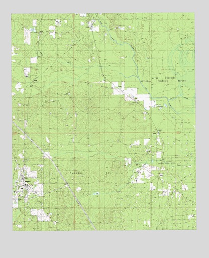
Marion East, LA USGS Topographic Map
Click on map above to begin viewing in our Map Viewer.

This topographic map contains these locations and features:
Feature Name Type Latitude Longitude GNIS ID View Map
BemisPopulated PlaceN32.9571°W92.1785°542981View Map
CecilPopulated PlaceN32.9610°W92.2360°541068View Map
DeanPopulated PlaceN32.9068°W92.1510°543134View Map
Dean CemeteryCemeteryN32.9032°W92.1476°544054View Map
Frank Lapere CreekStreamN32.9629°W92.1638°77340View Map
GravelPopulated PlaceN32.9324°W92.1518°543255View Map
Linville High School (historical)SchoolN32.9053°W92.2433°548717View Map
LitroePopulated PlaceN32.9935°W92.1962°541129View Map
LocoPopulated PlaceN32.9482°W92.1654°555119View Map
MarionPopulated PlaceN32.9015°W92.2421°536898View Map
Marion ChurchChurchN32.9482°W92.2424°536899View Map
Marion Gas FieldOilfieldN32.9501°W92.2324°548720View Map
Marion High SchoolSchoolN32.9049°W92.2429°548721View Map
Marion Police DepartmentBuildingN32.9012°W92.2427°2755266View Map
Marion Post OfficePost OfficeN32.9012°W92.2464°1630776View Map
Marion Volunteer Fire DepartmentBuildingN32.9004°W92.2402°2672964View Map
Parish Governing Authority District 2CivilN32.8897°W92.1665°1929921View Map
Reppond CemeteryCemeteryN32.8990°W92.1340°538565View Map
Reppond CemeteryCemeteryN32.9265°W92.1787°538566View Map
SadiePopulated PlaceN32.9893°W92.2310°538783View Map
Saint Pauls CemeteryCemeteryN32.9540°W92.2118°539037View Map
Saint Pauls ChurchChurchN32.9415°W92.2074°539044View Map
Town of MarionCivilN32.8998°W92.2405°2406100View Map
Ward TwoCivilN32.8915°W92.1965°545230View Map

Note: Coordinates in the location and feature list above are referenced to NAD83 datum.


Copyright (C) 2008-2024 Ryan Niemi / Sunset Dynamics ... All Rights Reserved