TopoQuest Logo
Do you find TopoQuest useful?
Help keep TopoQuest running and adding new maps/features by donating!
Bitcoin:  19c7KJd3qBynnjoSw5npx9KScwjBe4ifkT
Litecoin:  LXs6TkuXGGXo1vDsWCkWVdjQX94eUKd6ui
Home View Maps Find Maps Find Places Resources & Links


Sulphur City, Arkansas Topographic Map

USGS Map Title: Sulphur City, AR
USGS Map MRC: 35094H1
DRG (GeoTIFF) Download: o35094h1.tif


Neighboring USGS Topographic Map Quads:


  Fayetteville, AR  
36094A2
 

  Elkins, AR  
36094A1
 

  Goshen, AR  
36093A8
 

  West Fork, AR  
35094H2
 

  Sulphur City, AR  
35094H1
 

  Durham, AR  
35093H8
 

  Winslow, AR  
35094G2
 

  Brentwood, AR  
35094G1
 

  Delaney, AR  
35093G8


Map MRC Location:

N36°
W95°
N36°
W94°
H8 H7 H6 H5 H4 H3 H2 H1
G8 G7 G6 G5 G4 G3 G2 G1
F8 F7 F6 F5 F4 F3 F2 F1
E8 E7 E6 E5 E4 E3 E2 E1
D8 D7 D6 D5 D4 D3 D2 D1
C8 C7 C6 C5 C4 C3 C2 C1
B8 B7 B6 B5 B4 B3 B2 B1
A8 A7 A6 A5 A4 A3 A2 A1
N35°
W95°
N35°
W94°

Sulphur City, AR USGS 1:24K Topographic Map Preview:
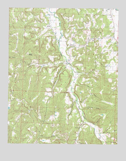
Sulphur City, AR USGS Topographic Map
Click on map above to begin viewing in our Map Viewer.

This topographic map contains these locations and features:
Feature Name Type Latitude Longitude GNIS ID View Map
ArnettPopulated PlaceN35.8951°W94.0396°57281View Map
Arnett Post Office (historical)Post OfficeN35.8923°W94.0321°84298View Map
Black OakPopulated PlaceN35.9834°W94.0796°56931View Map
Black Oak School (historical)SchoolN35.9834°W94.0794°81630View Map
Carter (historical)Populated PlaceN35.9270°W94.0521°65300View Map
Carter Post Office (historical)Post OfficeN35.9270°W94.0521°2026803View Map
George West HollowValleyN35.9140°W94.0505°49377View Map
Greasy CreekStreamN35.8987°W94.0369°71829View Map
Hannah BranchStreamN35.8851°W94.0160°49826View Map
Heflin LakeReservoirN35.9077°W94.1241°79743View Map
Heflin Lake DamDamN35.9084°W94.1235°79742View Map
HicksPopulated PlaceN35.9390°W94.0483°57916View Map
Hicks Post Office (historical)Post OfficeN35.9348°W94.0488°84309View Map
John Turner ForkStreamN35.8898°W94.0260°50663View Map
Kings CemeteryCemeteryN35.9940°W94.0780°50866View Map
Lingebaugh MountainSummitN35.9298°W94.1194°58070View Map
Low Gap ChurchChurchN35.8956°W94.0841°51493View Map
Lutman HollowValleyN35.9304°W94.0471°51519View Map
McCord ChurchChurchN35.9690°W94.0019°51802View Map
Mount Salem Post Office (historical)Post OfficeN35.9723°W94.0277°84890View Map
Mount Zion Church (historical)ChurchN35.9412°W94.0480°65390View Map
Parker BranchStreamN35.9487°W94.0563°53187View Map
Parricks RidgeRidgeN35.9681°W94.1099°65404View Map
Pierce HollowValleyN35.8937°W94.0244°53355View Map
Reese CemeteryCemeteryN35.9492°W94.0560°53975View Map
Richardson CemeteryCemeteryN35.9184°W94.0530°54012View Map
Richardson HollowValleyN35.9092°W94.0099°54017View Map
Rocky Comfort Church (historical)ChurchN35.9692°W94.0499°65428View Map
Salem CemeteryCemeteryN35.9709°W94.0274°54492View Map
Snyder MountainSummitN35.9576°W94.1033°54995View Map
Sulphur CityPopulated PlaceN35.9651°W94.0505°78490View Map
Sulphur City Baptist ChurchChurchN35.9645°W94.0483°65460View Map
Sulphur City Post Office (historical)Post OfficeN35.9648°W94.0502°84319View Map
Tatum SpringSpringN35.8900°W94.0436°55453View Map
Township of White RiverCivilN35.9462°W94.0608°69810View Map
Trace CreekStreamN35.9537°W94.0599°78573View Map
White ChurchChurchN35.8959°W94.0399°65492View Map
Whitehouse Volunteer Fire DepartmentBuildingN35.8954°W94.0398°2117315View Map
WyolaPopulated PlaceN35.8790°W94.0471°57241View Map
Zion CemeteryCemeteryN35.9417°W94.0466°56629View Map

Note: Coordinates in the location and feature list above are referenced to NAD83 datum.


Copyright (C) 2008-2024 Ryan Niemi / Sunset Dynamics ... All Rights Reserved