TopoQuest Logo
Do you find TopoQuest useful?
Help keep TopoQuest running and adding new maps/features by donating!
Bitcoin:  19c7KJd3qBynnjoSw5npx9KScwjBe4ifkT
Litecoin:  LXs6TkuXGGXo1vDsWCkWVdjQX94eUKd6ui
Home View Maps Find Maps Find Places Resources & Links


Blue Eye, Arkansas Topographic Map

USGS Map Title: Blue Eye, AR
USGS Map MRC: 36093D4
DRG (GeoTIFF) Download: o36093d4.tif


Neighboring USGS Topographic Map Quads:


  Viola, MO  
36093E5
 

  Lampe, MO  
36093E4
 

  Table Rock Dam, MO  
36093E3
 

  Grandview, AR  
36093D5
 

  Blue Eye, AR  
36093D4
 

  Denver, AR  
36093D3
 

  Berryville, AR  
36093C5
 

  Green Forest, AR  
36093C4
 

  Alpena, AR  
36093C3


Map MRC Location:

N37°
W94°
N37°
W93°
H8 H7 H6 H5 H4 H3 H2 H1
G8 G7 G6 G5 G4 G3 G2 G1
F8 F7 F6 F5 F4 F3 F2 F1
E8 E7 E6 E5 E4 E3 E2 E1
D8 D7 D6 D5 D4 D3 D2 D1
C8 C7 C6 C5 C4 C3 C2 C1
B8 B7 B6 B5 B4 B3 B2 B1
A8 A7 A6 A5 A4 A3 A2 A1
N36°
W94°
N36°
W93°

Blue Eye, AR USGS 1:24K Topographic Map Preview:
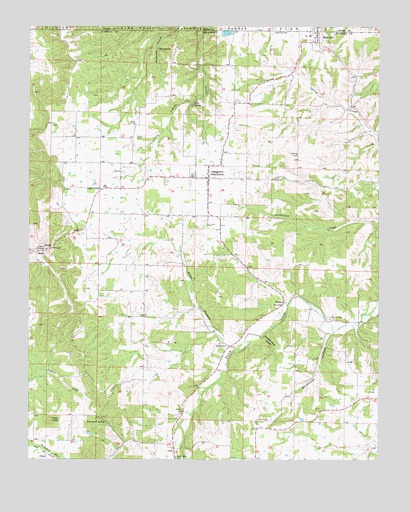
Blue Eye, AR USGS Topographic Map
Click on map above to begin viewing in our Map Viewer.

This topographic map contains these locations and features:
Feature Name Type Latitude Longitude GNIS ID View Map
Allen HollowValleyN36.4123°W93.4346°45835View Map
Armo Baptist Academy (historical)SchoolN36.4978°W93.3966°69188View Map
Blue EyePopulated PlaceN36.4978°W93.3980°76381View Map
Blue EyePopulated PlaceN36.4987°W93.3969°714403View Map
Blue Eye CemeteryCemeteryN36.4992°W93.4132°46746View Map
Blue Eye Post OfficePost OfficeN36.4989°W93.3972°2782817View Map
Blue SpringSpringN36.4940°W93.4549°46762View Map
Boyd CemeteryCemeteryN36.4681°W93.4621°46868View Map
Boyd ChurchChurchN36.4717°W93.4624°46870View Map
Buzzard Roost HollowValleyN36.4103°W93.4160°47252View Map
Church of ChristChurchN36.4531°W93.4749°69202View Map
CiscoPopulated PlaceN36.3759°W93.4941°76614View Map
Fanning ChurchChurchN36.4078°W93.4299°49004View Map
Hale CemeteryCemeteryN36.4578°W93.4666°1959672View Map
Hale ChurchChurchN36.4581°W93.4674°49762View Map
Hale SpringSpringN36.4778°W93.4416°49765View Map
Hammond SpringSpringN36.3856°W93.4727°49804View Map
MaplePopulated PlaceN36.4348°W93.4974°58118View Map
New Home CemeteryCemeteryN36.3753°W93.4474°52644View Map
Oak Grove Post OfficePost OfficeN36.4568°W93.4364°2781941View Map
Oak Grove School (historical)SchoolN36.4542°W93.4360°69234View Map
Oak Grove Volunteer Fire Department Station 1BuildingN36.4560°W93.4364°2116888View Map
Oak Grove Volunteer Fire Department Station 2BuildingN36.4560°W93.4401°2116889View Map
OakgrovePopulated PlaceN36.4562°W93.4366°58291View Map
Parker CemeteryCemeteryN36.3865°W93.4141°53188View Map
Pilot KnobSummitN36.3862°W93.4927°58369View Map
Stillhouse HollowValleyN36.4109°W93.3932°55232View Map
Town of Blue EyeCivilN36.4964°W93.3974°2405282View Map
Town of Oak GroveCivilN36.4638°W93.4303°2407016View Map
Township of North YocumCivilN36.4768°W93.4574°66903View Map
Township of South YocumCivilN36.4415°W93.4318°66910View Map
Township of Yocum (historical)CivilN36.4528°W93.4252°69250View Map
YocumPopulated PlaceN36.4195°W93.4132°78823View Map
Yocum CemeteryCemeteryN36.4164°W93.3924°56601View Map

Note: Coordinates in the location and feature list above are referenced to NAD83 datum.


Copyright (C) 2008-2024 Ryan Niemi / Sunset Dynamics ... All Rights Reserved