TopoQuest Logo
Do you find TopoQuest useful?
Help keep TopoQuest running and adding new maps/features by donating!
Bitcoin:  19c7KJd3qBynnjoSw5npx9KScwjBe4ifkT
Litecoin:  LXs6TkuXGGXo1vDsWCkWVdjQX94eUKd6ui
Home View Maps Find Maps Find Places Resources & Links


Threemile Buttes, Montana Topographic Map

USGS Map Title: Threemile Buttes, MT
USGS Map MRC: 45105D8
DRG (GeoTIFF) Download: o45105d8.tif


Neighboring USGS Topographic Map Quads:


  Coleman Draw, MT  
45106E1
 

  Home Creek Butte, MT  
45105E8
 

  Samuelson Ranch, MT  
45105E7
 

  Yager Butte, MT  
45106D1
 

  Threemile Buttes, MT  
45105D8
 

  Sonnette, MT  
45105D7
 

  Goodspeed Butte, MT  
45106C1
 

  Phillips Butte, MT  
45105C8
 

  Hodsdon Flats, MT  
45105C7


Map MRC Location:

N46°
W106°
N46°
W105°
H8 H7 H6 H5 H4 H3 H2 H1
G8 G7 G6 G5 G4 G3 G2 G1
F8 F7 F6 F5 F4 F3 F2 F1
E8 E7 E6 E5 E4 E3 E2 E1
D8 D7 D6 D5 D4 D3 D2 D1
C8 C7 C6 C5 C4 C3 C2 C1
B8 B7 B6 B5 B4 B3 B2 B1
A8 A7 A6 A5 A4 A3 A2 A1
N45°
W106°
N45°
W105°

Threemile Buttes, MT USGS 1:24K Topographic Map Preview:
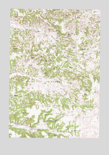
Threemile Buttes, MT USGS Topographic Map
Click on map above to begin viewing in our Map Viewer.

This topographic map contains these locations and features:
Feature Name Type Latitude Longitude GNIS ID View Map
04S47E12CABD01 WellWellN45.4989°W105.8811°809807View Map
05S47E10BCAB01 WellWellN45.4164°W105.9250°809384View Map
05S47E19BCBA01 WellWellN45.3878°W105.9900°809238View Map
Abbott SpringSpringN45.4378°W105.9488°778856View Map
Anchor SpringSpringN45.3777°W105.9380°779027View Map
Blue Bore SpringSpringN45.4526°W105.9707°780137View Map
Bottles School (historical)SchoolN45.3886°W105.9903°780246View Map
Bowers ReservoirReservoirN45.4284°W105.9176°780307View Map
Butte SpringSpringN45.4736°W105.9218°780703View Map
Collinge SpringSpringN45.4171°W105.8935°781511View Map
Dalzells SpringSpringN45.3913°W105.9388°782068View Map
Dead Horse SpringSpringN45.3990°W105.9818°782142View Map
Doonan SpringSpringN45.4778°W105.8946°782485View Map
Joe SpringSpringN45.4357°W105.9469°785503View Map
Joe Yager SpringSpringN45.4437°W105.9176°785504View Map
Knudson SpringSpringN45.4986°W105.9046°785818View Map
Knudson Spring Number TwoSpringN45.4919°W105.9084°785819View Map
Mankameyer SpringSpringN45.3822°W105.9110°786815View Map
McLennon Spring Number OneSpringN45.4623°W105.9463°787099View Map
McLennon Spring Number TwoSpringN45.4644°W105.9361°787100View Map
Middle Creek SpringSpringN45.4149°W105.9943°787235View Map
Montgomery SpringSpringN45.3917°W105.9400°787583View Map
Old Faithful SpringSpringN45.4429°W105.9404°788414View Map
Ole SpringSpringN45.4448°W105.9945°788434View Map
Otter DivisionCivilN45.3952°W105.9841°1940686View Map
Phillips WellWellN45.3875°W105.9900°788821View Map
Potter SpringSpringN45.4184°W105.9725°789147View Map
Quebbeman SpringSpringN45.4217°W105.8908°789286View Map
Ridenour ReservoirReservoirN45.4974°W105.8857°789583View Map
Roundup CreekStreamN45.4358°W105.9814°789816View Map
Sawmill SpringSpringN45.4540°W105.9207°790082View Map
Script SpringSpringN45.4668°W105.8928°790167View Map
Skinner Gulch Spring Number OneSpringN45.4563°W105.8975°790595View Map
Skinner Gulch Spring Number TwoSpringN45.4615°W105.9016°790596View Map
Spring CreekStreamN45.3855°W105.9561°791201View Map
Spring Creek SpringSpringN45.3977°W105.9511°791281View Map
Sterling MineMineN45.3830°W105.9178°791496View Map
Tenmile SpringSpringN45.4170°W105.9246°791963View Map
Tenmile WellWellN45.4167°W105.9253°791964View Map
Threemile ButtesSummitN45.4764°W105.9150°792132View Map
Upper Fifteenmile SpringSpringN45.3920°W105.9376°792631View Map
Watt DrawValleyN45.4822°W105.9967°792886View Map
Watt Draw Spring Number OneSpringN45.4615°W105.9955°792888View Map
Watt SpringSpringN45.4921°W105.9939°792889View Map
Wild Hog SpringSpringN45.4696°W105.9372°793287View Map

Note: Coordinates in the location and feature list above are referenced to NAD83 datum.


Copyright (C) 2008-2025 Ryan Niemi / Sunset Dynamics ... All Rights Reserved