TopoQuest Logo
Do you find TopoQuest useful?
Help keep TopoQuest running and adding new maps/features by donating!
Bitcoin:  19c7KJd3qBynnjoSw5npx9KScwjBe4ifkT
Litecoin:  LXs6TkuXGGXo1vDsWCkWVdjQX94eUKd6ui
Home View Maps Find Maps Find Places Resources & Links


Lucinda, Pennsylvania Topographic Map

USGS Map Title: Lucinda, PA
USGS Map MRC: 41079C3
DRG (GeoTIFF) Download: o41079c3.tif


Neighboring USGS Topographic Map Quads:


  Tionesta, PA  
41079D4
 

  Tylersburg, PA  
41079D3
 

  Marienville West, PA  
41079D2
 

  Fryburg, PA  
41079C4
 

  Lucinda, PA  
41079C3
 

  Cooksburg, PA  
41079C2
 

  Clarion, PA  
41079B4
 

  Strattanville, PA  
41079B3
 

  Corsica, PA  
41079B2


Map MRC Location:

N42°
W80°
N42°
W79°
H8 H7 H6 H5 H4 H3 H2 H1
G8 G7 G6 G5 G4 G3 G2 G1
F8 F7 F6 F5 F4 F3 F2 F1
E8 E7 E6 E5 E4 E3 E2 E1
D8 D7 D6 D5 D4 D3 D2 D1
C8 C7 C6 C5 C4 C3 C2 C1
B8 B7 B6 B5 B4 B3 B2 B1
A8 A7 A6 A5 A4 A3 A2 A1
N41°
W80°
N41°
W79°

Lucinda, PA USGS 1:24K Topographic Map Preview:
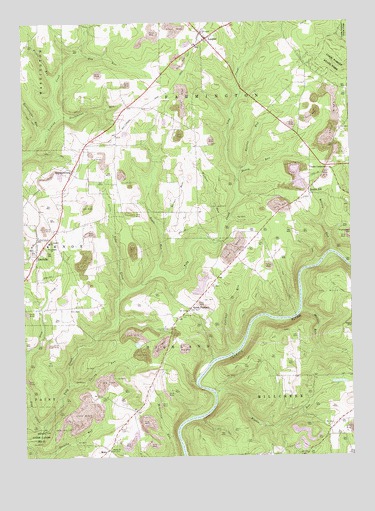
Lucinda, PA USGS Topographic Map
Click on map above to begin viewing in our Map Viewer.

This topographic map contains these locations and features:
Feature Name Type Latitude Longitude GNIS ID View Map
Barlett RunStreamN41.3326°W79.2900°1168721View Map
Blyson RunStreamN41.2687°W79.3025°1169908View Map
Callihan RunStreamN41.2801°W79.2950°1170900View Map
Cherry RunStreamN41.2706°W79.3584°1171661View Map
Cooks CornersLocaleN41.3328°W79.2589°1172389View Map
Engle RunStreamN41.3028°W79.3242°1174259View Map
Farmington Area Ambulance ServiceBuildingN41.3689°W79.3076°2645838View Map
Farmington Township Volunteer Fire Company Station 540BuildingN41.3706°W79.3049°2644883View Map
Foy RunStreamN41.3662°W79.3528°1175122View Map
Frederick AirparkAirportN41.3719°W79.3434°2442787View Map
Frills RunStreamN41.3584°W79.3617°1175274View Map
Gold SchoolSchoolN41.3398°W79.3384°1200598View Map
Gold SchoolSchoolN41.3398°W79.3387°1201229View Map
Grolemund RunStreamN41.3484°W79.3606°1176262View Map
Helen FurnacePopulated PlaceN41.2923°W79.3117°1203776View Map
Henry RunStreamN41.3320°W79.2920°1176843View Map
Henry School (historical)SchoolN41.3462°W79.2500°1200607View Map
Highland Township High School (historical)SchoolN41.2548°W79.3331°1201228View Map
Howe SchoolSchoolN41.3659°W79.2698°1200600View Map
Howe SchoolSchoolN41.3659°W79.2695°1201230View Map
LeeperPopulated PlaceN41.3703°W79.3042°1179125View Map
Leeper Census Designated PlaceCensusN41.3705°W79.3056°2630020View Map
Leeper Post OfficePost OfficeN41.3709°W79.3053°2779744View Map
Little TobyLocaleN41.3567°W79.3164°1200887View Map
Little Toby CreekStreamN41.2984°W79.3362°1179696View Map
LucindaPopulated PlaceN41.3084°W79.3698°1180060View Map
Lucinda Post OfficePost OfficeN41.3129°W79.3677°2779766View Map
Maxwell RunStreamN41.2917°W79.2689°1180568View Map
MiolaPopulated PlaceN41.2520°W79.3434°1204192View Map
Miola CemeteryCemeteryN41.2577°W79.3365°1181352View Map
Rattlesnake RunStreamN41.3428°W79.3659°1184683View Map
Saint Josephs ChurchChurchN41.3112°W79.3656°1186235View Map
Saint Josephs SchoolSchoolN41.3120°W79.3648°1186262View Map
Schmader Airport (historical)AirportN41.2834°W79.3498°1194205View Map
Scotch HillPopulated PlaceN41.3267°W79.2653°1187152View Map
Shiloh ChurchChurchN41.2520°W79.3423°1187520View Map
SnydersburgPopulated PlaceN41.3328°W79.3556°1187966View Map
Step CreekStreamN41.2590°W79.3681°1193468View Map
Township of FarmingtonCivilN41.3734°W79.2815°1216205View Map
Township of HighlandCivilN41.2689°W79.3322°1216206View Map
Township of MillcreekCivilN41.2614°W79.2513°1216211View Map
Tylersburg StationLocaleN41.3703°W79.3067°1212171View Map
Watson RunStreamN41.3090°W79.2573°1190692View Map
Weiser RunStreamN41.3170°W79.3231°1190792View Map
Wolbert RunStreamN41.3173°W79.2978°1191645View Map
Wolfert SchoolSchoolN41.3376°W79.3084°1200599View Map

Note: Coordinates in the location and feature list above are referenced to NAD83 datum.


Copyright (C) 2008-2024 Ryan Niemi / Sunset Dynamics ... All Rights Reserved