TopoQuest Logo
Do you find TopoQuest useful?
Help keep TopoQuest running and adding new maps/features by donating!
Bitcoin:  19c7KJd3qBynnjoSw5npx9KScwjBe4ifkT
Litecoin:  LXs6TkuXGGXo1vDsWCkWVdjQX94eUKd6ui
Home View Maps Find Maps Find Places Resources & Links


Tylersburg, Pennsylvania Topographic Map

USGS Map Title: Tylersburg, PA
USGS Map MRC: 41079D3
DRG (GeoTIFF) Download: o41079d3.tif


Neighboring USGS Topographic Map Quads:


  West Hickory, PA  
41079E4
 

  Kellettville, PA  
41079E3
 

  Mayburg, PA  
41079E2
 

  Tionesta, PA  
41079D4
 

  Tylersburg, PA  
41079D3
 

  Marienville West, PA  
41079D2
 

  Fryburg, PA  
41079C4
 

  Lucinda, PA  
41079C3
 

  Cooksburg, PA  
41079C2


Map MRC Location:

N42°
W80°
N42°
W79°
H8 H7 H6 H5 H4 H3 H2 H1
G8 G7 G6 G5 G4 G3 G2 G1
F8 F7 F6 F5 F4 F3 F2 F1
E8 E7 E6 E5 E4 E3 E2 E1
D8 D7 D6 D5 D4 D3 D2 D1
C8 C7 C6 C5 C4 C3 C2 C1
B8 B7 B6 B5 B4 B3 B2 B1
A8 A7 A6 A5 A4 A3 A2 A1
N41°
W80°
N41°
W79°

Tylersburg, PA USGS 1:24K Topographic Map Preview:
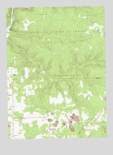
Tylersburg, PA USGS Topographic Map
Click on map above to begin viewing in our Map Viewer.

This topographic map contains these locations and features:
Feature Name Type Latitude Longitude GNIS ID View Map
Armitage Newmansville Airport (historical)AirportN41.4334°W79.3498°1194232View Map
Big Weaver RunStreamN41.4437°W79.2875°1209424View Map
Bull RunStreamN41.4295°W79.3120°1209456View Map
CrownPopulated PlaceN41.3898°W79.2709°1203372View Map
Crown Census Designated PlaceCensusN41.3917°W79.2633°2630003View Map
Crown Post OfficePost OfficeN41.3974°W79.2576°2773108View Map
Crown Pumping StationLocaleN41.3926°W79.2687°1210494View Map
Dans RunStreamN41.4406°W79.3298°1209544View Map
Farmington Township SchoolSchoolN41.3790°W79.3114°1210495View Map
Flynn School (historical)SchoolN41.4434°W79.3606°1200635View Map
Fox RunStreamN41.4692°W79.3289°1209615View Map
Frills CornersPopulated PlaceN41.3956°W79.3681°1209618View Map
GolinzaPopulated PlaceN41.4398°W79.3287°1203696View Map
GuitonvillePopulated PlaceN41.4759°W79.2584°1209652View Map
Haskill StationLocaleN41.3867°W79.2992°1212061View Map
Irish RunStreamN41.4501°W79.3448°1209690View Map
Judy RunStreamN41.4437°W79.2806°1209716View Map
Kerr SchoolSchoolN41.4167°W79.3481°1200595View Map
LickingvillePopulated PlaceN41.3778°W79.3684°1209757View Map
Little Coon CreekStreamN41.4798°W79.3717°1209764View Map
Little Coon RunStreamN41.4298°W79.3175°1209765View Map
Little Weaver RunStreamN41.4473°W79.2714°1209777View Map
Love SchoolSchoolN41.3998°W79.2659°1200597View Map
NewmansvillePopulated PlaceN41.4287°W79.3684°1209853View Map
North Clarion High SchoolSchoolN41.3945°W79.3562°1209862View Map
Saint Marys SchoolSchoolN41.3898°W79.2562°1209953View Map
Shotts SchoolSchoolN41.3992°W79.3025°1200596View Map
State Game Lands Number 24ParkN41.4367°W79.2842°1210214View Map
Township of GreenCivilN41.4705°W79.3293°1216452View Map
TylersburgPopulated PlaceN41.3848°W79.3223°1210068View Map
Tylersburg Census Designated PlaceCensusN41.3837°W79.3202°2630044View Map
Tylersburg Post OfficePost OfficeN41.3854°W79.3214°2779878View Map
Walley RunStreamN41.4320°W79.3028°1210079View Map
Wolf RunStreamN41.4470°W79.2631°1210132View Map
Young Hill School (historical)SchoolN41.4751°W79.3503°1200631View Map
Zipp RunStreamN41.4331°W79.3017°1210145View Map

Note: Coordinates in the location and feature list above are referenced to NAD83 datum.


Copyright (C) 2008-2025 Ryan Niemi / Sunset Dynamics ... All Rights Reserved