TopoQuest Logo
Do you find TopoQuest useful?
Help keep TopoQuest running and adding new maps/features by donating!
Bitcoin:  19c7KJd3qBynnjoSw5npx9KScwjBe4ifkT
Litecoin:  LXs6TkuXGGXo1vDsWCkWVdjQX94eUKd6ui
Home View Maps Find Maps Find Places Resources & Links


West Hickory, Pennsylvania Topographic Map

USGS Map Title: West Hickory, PA
USGS Map MRC: 41079E4
DRG (GeoTIFF) Download: o41079e4.tif


Neighboring USGS Topographic Map Quads:


  Grand Valley, PA  
41079F5
 

  Tidioute, PA  
41079F4
 

  Cobham, PA  
41079F3
 

  Pleasantville, PA  
41079E5
 

  West Hickory, PA  
41079E4
 

  Kellettville, PA  
41079E3
 

  President, PA  
41079D5
 

  Tionesta, PA  
41079D4
 

  Tylersburg, PA  
41079D3


Map MRC Location:

N42°
W80°
N42°
W79°
H8 H7 H6 H5 H4 H3 H2 H1
G8 G7 G6 G5 G4 G3 G2 G1
F8 F7 F6 F5 F4 F3 F2 F1
E8 E7 E6 E5 E4 E3 E2 E1
D8 D7 D6 D5 D4 D3 D2 D1
C8 C7 C6 C5 C4 C3 C2 C1
B8 B7 B6 B5 B4 B3 B2 B1
A8 A7 A6 A5 A4 A3 A2 A1
N41°
W80°
N41°
W79°

West Hickory, PA USGS 1:24K Topographic Map Preview:
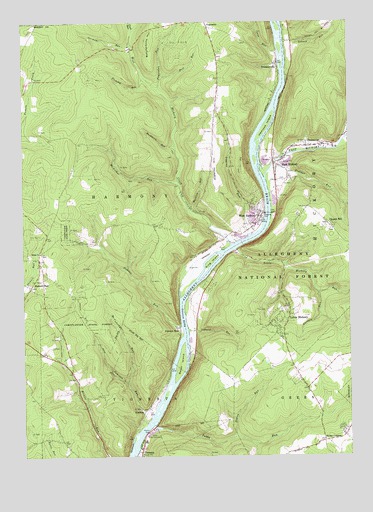
West Hickory, PA USGS Topographic Map
Click on map above to begin viewing in our Map Viewer.

This topographic map contains these locations and features:
Feature Name Type Latitude Longitude GNIS ID View Map
Baker IslandIslandN41.5265°W79.4398°1209391View Map
Ball RunStreamN41.6092°W79.4456°1209394View Map
Beaver RunStreamN41.5917°W79.3753°1210148View Map
Buckhorn RunStreamN41.5895°W79.4406°1209454View Map
Burdick RunStreamN41.5712°W79.4356°1209460View Map
Butcherknife HillSummitN41.6195°W79.4500°1209466View Map
Church HillPopulated PlaceN41.5667°W79.3823°1209501View Map
Church Hill ChurchChurchN41.5653°W79.3803°1210272View Map
Dawson EddyBayN41.5406°W79.4381°1209551View Map
Dawson RunPopulated PlaceN41.5367°W79.4398°1210162View Map
Dawson RunStreamN41.5376°W79.4392°1210163View Map
East HickoryPopulated PlaceN41.5840°W79.4017°1209586View Map
East Hickory CreekStreamN41.5798°W79.4064°1210171View Map
East Hickory Fire HallBuildingN41.5856°W79.4042°2044438View Map
East Hickory Methodist ChurchChurchN41.5865°W79.4023°2044437View Map
East Hickory SubstationBuildingN41.5870°W79.4042°2044436View Map
EndeavorPopulated PlaceN41.5895°W79.3850°1210172View Map
Endeavor Community CenterBuildingN41.5892°W79.3850°2044441View Map
Endeavor Post OfficePost OfficeN41.5896°W79.3901°2044439View Map
Endeavor Presbyterian ChurchChurchN41.5898°W79.3848°2044440View Map
Fagundus RunStreamN41.6053°W79.4473°1210174View Map
Fleming Hill SchoolSchoolN41.5973°W79.4250°1210273View Map
Fleming RunStreamN41.6089°W79.4523°1209603View Map
Funk RunStreamN41.6223°W79.4567°1209622View Map
Furnace RunStreamN41.5473°W79.3864°1209623View Map
German RunStreamN41.6184°W79.4575°1209627View Map
Harmony Township Community CenterBuildingN41.5670°W79.4095°2044432View Map
Hemlock IslandIslandN41.5948°W79.4067°1209667View Map
Hickory CenterLocaleN41.6017°W79.4431°1210388View Map
Hunter Run SchoolSchoolN41.5242°W79.4812°1200593View Map
Hunter Run SchoolSchoolN41.5242°W79.4809°1210350View Map
Hunter Run TrailTrailN41.5359°W79.4703°1210370View Map
JamisonPopulated PlaceN41.5131°W79.4531°1209705View Map
Jamison RunStreamN41.5084°W79.4548°1209706View Map
Jones RunStreamN41.6167°W79.4012°1209714View Map
King IslandIslandN41.5565°W79.4281°1209729View Map
Kiser CornersPopulated PlaceN41.5045°W79.3845°1209735View Map
Kizer School (historical)SchoolN41.5201°W79.3912°1200594View Map
Lashure TrailTrailN41.5473°W79.4812°1210369View Map
Little HickoryPopulated PlaceN41.5409°W79.3975°1209766View Map
Little Hickory RunStreamN41.5598°W79.4175°1209767View Map
McArthur RunStreamN41.5795°W79.4398°1209802View Map
McCaferdy RunStreamN41.5220°W79.4600°1209803View Map
Mount Pleasant Church (historical)ChurchN41.5265°W79.3953°1201267View Map
Mount Zion Lutheran ChurchChurchN41.5078°W79.3753°2044435View Map
Mountain Crest AirportAirportN41.5865°W79.4255°1210251View Map
Otter CreekStreamN41.6031°W79.3764°1209873View Map
Pennsylvania Conservation and Natural Resources District 14 Corn Planter ForestBuildingN41.5391°W79.4889°2645501View Map
Pigeon Hill Church (historical)SchoolN41.5084°W79.4295°1210351View Map
Pigeon Hill School (historical)SchoolN41.5084°W79.4295°1210271View Map
Pigeon RunStreamN41.5056°W79.4192°1209885View Map
Prather RunStreamN41.5820°W79.4050°1209906View Map
Preacher HillSummitN41.5837°W79.4259°1209907View Map
Schwab RunStreamN41.6195°W79.3989°1209961View Map
Sibbald RunStreamN41.5362°W79.4364°1209979View Map
Siggins RunStreamN41.5628°W79.4131°1209981View Map
Stewart RunPopulated PlaceN41.5490°W79.4970°1210014View Map
Tionesta Ambulance ServiceBuildingN41.5025°W79.4545°2719464View Map
Tionesta Emergency Medical StationHospitalN41.5023°W79.4542°2044430View Map
Township of HarmonyCivilN41.5784°W79.4639°1216453View Map
TrunkeyvillePopulated PlaceN41.6131°W79.4020°1210061View Map
Tubbs RunStreamN41.5092°W79.4495°1210062View Map
West Forest Junior Senior High SchoolSchoolN41.5453°W79.4325°2044431View Map
West HickoryPopulated PlaceN41.5687°W79.4081°1210100View Map
West Hickory CreekStreamN41.5606°W79.4200°1210101View Map
West Hickory Methodist ChurchChurchN41.5676°W79.4092°2044433View Map
West Hickory Post OfficePost OfficeN41.5675°W79.4089°2044434View Map
West Hickory Volunteer Fire DepartmentBuildingN41.5850°W79.4045°2645404View Map
White ChurchChurchN41.5587°W79.4931°1210109View Map

Note: Coordinates in the location and feature list above are referenced to NAD83 datum.


Copyright (C) 2008-2025 Ryan Niemi / Sunset Dynamics ... All Rights Reserved