TopoQuest Logo
Do you find TopoQuest useful?
Help keep TopoQuest running and adding new maps/features by donating!
Bitcoin:  19c7KJd3qBynnjoSw5npx9KScwjBe4ifkT
Litecoin:  LXs6TkuXGGXo1vDsWCkWVdjQX94eUKd6ui
Home View Maps Find Maps Find Places Resources & Links


Tipton, Pennsylvania Topographic Map

USGS Map Title: Tipton, PA
USGS Map MRC: 40078F3
DRG (GeoTIFF) Download: o40078f3.tif


Neighboring USGS Topographic Map Quads:


  Ramey, PA  
40078G4
 

  Houtzdale, PA  
40078G3
 

  Sandy Ridge, PA  
40078G2
 

  Blandburg, PA  
40078F4
 

  Tipton, PA  
40078F3
 

  Tyrone, PA  
40078F2
 

  Altoona, PA  
40078E4
 

  Bellwood, PA  
40078E3
 

  Spruce Creek, PA  
40078E2


Map MRC Location:

N41°
W79°
N41°
W78°
H8 H7 H6 H5 H4 H3 H2 H1
G8 G7 G6 G5 G4 G3 G2 G1
F8 F7 F6 F5 F4 F3 F2 F1
E8 E7 E6 E5 E4 E3 E2 E1
D8 D7 D6 D5 D4 D3 D2 D1
C8 C7 C6 C5 C4 C3 C2 C1
B8 B7 B6 B5 B4 B3 B2 B1
A8 A7 A6 A5 A4 A3 A2 A1
N40°
W79°
N40°
W78°

Tipton, PA USGS 1:24K Topographic Map Preview:
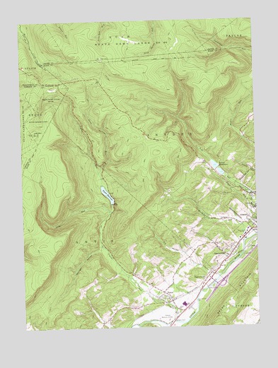
Tipton, PA USGS Topographic Map
Click on map above to begin viewing in our Map Viewer.

This topographic map contains these locations and features:
Feature Name Type Latitude Longitude GNIS ID View Map
CharlottsvillePopulated PlaceN40.6448°W78.2770°1171589View Map
Charlottsville CemeteryCemeteryN40.6359°W78.2831°1171590View Map
Cold SpringSpringN40.6534°W78.2606°1202439View Map
Dysart CemeteryCemeteryN40.6327°W78.2958°2776342View Map
Fry HollowValleyN40.6548°W78.2892°1175309View Map
GrayPopulated PlaceN40.6567°W78.2539°1176020View Map
GraziervillePopulated PlaceN40.6537°W78.2647°1176036View Map
Grazierville CemeteryCemeteryN40.6536°W78.2700°2776350View Map
Grazierville Census Designated PlaceCensusN40.6576°W78.2707°2630012View Map
Hutchinson RunStreamN40.6603°W78.2558°1177659View Map
Jacker Burial GroundCemeteryN40.7266°W78.3379°2776355View Map
Lost MountainSummitN40.7048°W78.3681°1179972View Map
Loup RunStreamN40.6717°W78.3275°1179983View Map
Mountain SchoolSchoolN40.6912°W78.3075°1200870View Map
Mulholland SchoolSchoolN40.6278°W78.3242°1201109View Map
Mulligan HollowValleyN40.6570°W78.3339°1182074View Map
Oak Grove CemeteryCemeteryN40.6764°W78.2508°1182738View Map
Peterson Memorial Field (historical)AirportN40.6301°W78.3039°1194049View Map
State Game Lands Number 60ParkN40.7398°W78.3128°1188519View Map
Three Springs RunStreamN40.6884°W78.3333°1189549View Map
TiptonPopulated PlaceN40.6359°W78.2958°1189596View Map
Tipton - Antis District Volunteer Fire Company Station 21BuildingN40.6349°W78.2957°2645620View Map
Tipton Census Designated PlaceCensusN40.6358°W78.3001°2390393View Map
Tipton DamDamN40.6751°W78.3264°1194968View Map
Tipton Post OfficePost OfficeN40.6380°W78.2975°2777482View Map
Tipton ReservoirReservoirN40.6794°W78.3293°1189597View Map
Tipton RunStreamN40.6276°W78.2950°1189598View Map
Township of SnyderCivilN40.7036°W78.2526°1215967View Map
Tyrone Area Junior Senior High SchoolSchoolN40.6734°W78.2506°1205647View Map
Tyrone Dam Number OneDamN40.6867°W78.2664°1194982View Map
Tyrone HospitalHospitalN40.6747°W78.2523°2718106View Map
Tyrone ReservoirReservoirN40.6895°W78.2697°1190056View Map
Tyrone Reservoir Number OneReservoirN40.6878°W78.2681°1194981View Map
Tyrone Reservoir Number TwoReservoirN40.6908°W78.2715°1194986View Map
Wolfgang SchoolSchoolN40.6531°W78.2872°1200867View Map
WTRN-AM (Tyrone)TowerN40.6603°W78.2556°1200444View Map

Note: Coordinates in the location and feature list above are referenced to NAD83 datum.


Copyright (C) 2008-2024 Ryan Niemi / Sunset Dynamics ... All Rights Reserved