TopoQuest Logo
Do you find TopoQuest useful?
Help keep TopoQuest running and adding new maps/features by donating!
Bitcoin:  19c7KJd3qBynnjoSw5npx9KScwjBe4ifkT
Litecoin:  LXs6TkuXGGXo1vDsWCkWVdjQX94eUKd6ui
Home View Maps Find Maps Find Places Resources & Links


Houtzdale, Pennsylvania Topographic Map

USGS Map Title: Houtzdale, PA
USGS Map MRC: 40078G3
DRG (GeoTIFF) Download: o40078g3.tif


Neighboring USGS Topographic Map Quads:


  Glen Richey, PA  
40078H4
 

  Wallaceton, PA  
40078H3
 

  Philipsburg, PA  
40078H2
 

  Ramey, PA  
40078G4
 

  Houtzdale, PA  
40078G3
 

  Sandy Ridge, PA  
40078G2
 

  Blandburg, PA  
40078F4
 

  Tipton, PA  
40078F3
 

  Tyrone, PA  
40078F2


Map MRC Location:

N41°
W79°
N41°
W78°
H8 H7 H6 H5 H4 H3 H2 H1
G8 G7 G6 G5 G4 G3 G2 G1
F8 F7 F6 F5 F4 F3 F2 F1
E8 E7 E6 E5 E4 E3 E2 E1
D8 D7 D6 D5 D4 D3 D2 D1
C8 C7 C6 C5 C4 C3 C2 C1
B8 B7 B6 B5 B4 B3 B2 B1
A8 A7 A6 A5 A4 A3 A2 A1
N40°
W79°
N40°
W78°

Houtzdale, PA USGS 1:24K Topographic Map Preview:
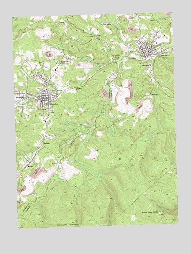
Houtzdale, PA USGS Topographic Map
Click on map above to begin viewing in our Map Viewer.

This topographic map contains these locations and features:
Feature Name Type Latitude Longitude GNIS ID View Map
AshlandPopulated PlaceN40.8714°W78.3331°1168453View Map
Bear RunStreamN40.8167°W78.3070°1168918View Map
Beaver RunStreamN40.8473°W78.2931°1169034View Map
Beaver SchoolSchoolN40.8442°W78.3039°1169049View Map
BeavertonLocaleN40.8470°W78.3003°1201296View Map
BeavertonPopulated PlaceN40.8434°W78.3058°1212660View Map
Big RunStreamN40.8523°W78.2833°1169574View Map
Borough of BrisbinCivilN40.8395°W78.3526°1215093View Map
Borough of HoutzdaleCivilN40.8251°W78.3510°1215102View Map
Borough of Osceola MillsCivilN40.8525°W78.2698°1215108View Map
BrisbinPopulated PlaceN40.8381°W78.3545°1170271View Map
Brisbin Baptist ChurchChurchN40.8376°W78.3525°1213523View Map
Brisbin Post OfficePost OfficeN40.8354°W78.3497°2772616View Map
Christ the King ChurchChurchN40.8306°W78.3506°1213522View Map
Coal RunStreamN40.8478°W78.2906°1172074View Map
Coal Run ChurchChurchN40.8626°W78.3058°1213525View Map
Coal Run JunctionLocaleN40.8495°W78.2920°1214056View Map
Columbia Fire Company Station 22BuildingN40.8514°W78.2671°2645197View Map
Decatur Township Police DepartmentBuildingN40.8651°W78.2663°2781037View Map
DonegalLocaleN40.8662°W78.2500°1201295View Map
EarnestvillePopulated PlaceN40.8492°W78.2831°1173716View Map
EdendalePopulated PlaceN40.8376°W78.2670°1173995View Map
First United Methodist Church Of HoutzdaleChurchN40.8274°W78.3530°2612198View Map
Goss RunStreamN40.8312°W78.3378°1175853View Map
Goss Run JunctionPopulated PlaceN40.8320°W78.3322°1203703View Map
HalePopulated PlaceN40.7887°W78.3445°1203740View Map
Herder SpringSpringN40.7862°W78.2525°1176866View Map
HoutzdalePopulated PlaceN40.8251°W78.3511°1177516View Map
Houtzdale Fire Company 1BuildingN40.8260°W78.3524°2644967View Map
Houtzdale Post OfficePost OfficeN40.8241°W78.3541°2772749View Map
Houtzdale Ramey Emergency Medical Services Station 47BuildingN40.8231°W78.3540°2719455View Map
Independent Order of Odd Fellows CemeteryCemeteryN40.8386°W78.3570°1213528View Map
JimtownLocaleN40.8292°W78.2622°1201294View Map
Leslie MineMineN40.8184°W78.3047°1212915View Map
Little Beaver RunStreamN40.8434°W78.3100°1179473View Map
MorannPopulated PlaceN40.7864°W78.3670°1181528View Map
Morann Post OfficePost OfficeN40.7903°W78.3616°2773212View Map
MoshannonLocaleN40.8326°W78.3234°1201297View Map
Moshannon Valley Christian AcademySchoolN40.8470°W78.3381°1213524View Map
Mountain BranchStreamN40.8064°W78.3209°1181943View Map
Mountain Top Fire Company 13 Ambulance SubstationBuildingN40.8522°W78.2676°2645907View Map
New Fellowship ChapelChurchN40.8520°W78.2645°1213527View Map
New TownPopulated PlaceN40.8492°W78.2614°1182375View Map
Ocean SchoolSchoolN40.8489°W78.3645°1182861View Map
Osceola MillsPopulated PlaceN40.8501°W78.2706°1183066View Map
Osceola Mills Junior High SchoolSchoolN40.8517°W78.2731°1207325View Map
Osceola Mills Post OfficePost OfficeN40.8509°W78.2696°2772896View Map
Osceola ReservoirReservoirN40.8036°W78.2678°1183067View Map
ParsonsvillePopulated PlaceN40.8467°W78.3322°1183348View Map
Penn FivePopulated PlaceN40.8270°W78.2686°1204375View Map
Roup RunStreamN40.7814°W78.3431°1185569View Map
Rush Consolidated Elementary School (historical)SchoolN40.8484°W78.2647°1213600View Map
Saint Joseph CemeteryCemeteryN40.8571°W78.2786°1213526View Map
Sand Spring RunStreamN40.7645°W78.2995°1193285View Map
Sandy Ridge Fire TowerTowerN40.7701°W78.2500°1212916View Map
Sankey AirportAirportN40.8579°W78.2569°2242803View Map
Scotch HollowPopulated PlaceN40.8698°W78.3022°1193306View Map
Spike IslandPopulated PlaceN40.8439°W78.2683°1188174View Map
State Correctional Institution HoutzdaleBuildingN40.8136°W78.3552°2757214View Map
SterlingPopulated PlaceN40.8303°W78.3420°1204730View Map
StumptownPopulated PlaceN40.8617°W78.2631°1204764View Map
Trim Root RunStreamN40.7837°W78.3186°1193549View Map
Trout RunStreamN40.8476°W78.2672°1189853View Map
West MoshannonPopulated PlaceN40.8270°W78.3639°1191075View Map
WhitesidePopulated PlaceN40.8001°W78.3534°1191342View Map
Whiteside RunStreamN40.8056°W78.3270°1191343View Map
Wilson RunStreamN40.7656°W78.3606°1193677View Map

Note: Coordinates in the location and feature list above are referenced to NAD83 datum.


Copyright (C) 2008-2025 Ryan Niemi / Sunset Dynamics ... All Rights Reserved