TopoQuest Logo
Do you find TopoQuest useful?
Help keep TopoQuest running and adding new maps/features by donating!
Bitcoin:  19c7KJd3qBynnjoSw5npx9KScwjBe4ifkT
Litecoin:  LXs6TkuXGGXo1vDsWCkWVdjQX94eUKd6ui
Home View Maps Find Maps Find Places Resources & Links


Ramey, Pennsylvania Topographic Map

USGS Map Title: Ramey, PA
USGS Map MRC: 40078G4
DRG (GeoTIFF) Download: o40078g4.tif


Neighboring USGS Topographic Map Quads:


  Curwensville, PA  
40078H5
 

  Glen Richey, PA  
40078H4
 

  Wallaceton, PA  
40078H3
 

  Irvona, PA  
40078G5
 

  Ramey, PA  
40078G4
 

  Houtzdale, PA  
40078G3
 

  Coalport, PA  
40078F5
 

  Blandburg, PA  
40078F4
 

  Tipton, PA  
40078F3


Map MRC Location:

N41°
W79°
N41°
W78°
H8 H7 H6 H5 H4 H3 H2 H1
G8 G7 G6 G5 G4 G3 G2 G1
F8 F7 F6 F5 F4 F3 F2 F1
E8 E7 E6 E5 E4 E3 E2 E1
D8 D7 D6 D5 D4 D3 D2 D1
C8 C7 C6 C5 C4 C3 C2 C1
B8 B7 B6 B5 B4 B3 B2 B1
A8 A7 A6 A5 A4 A3 A2 A1
N40°
W79°
N40°
W78°

Ramey, PA USGS 1:24K Topographic Map Preview:
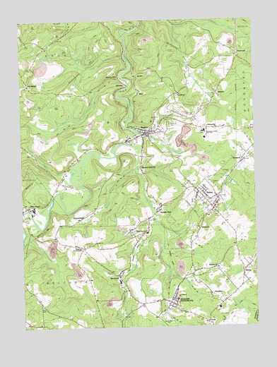
Ramey, PA USGS Topographic Map
Click on map above to begin viewing in our Map Viewer.

This topographic map contains these locations and features:
Feature Name Type Latitude Longitude GNIS ID View Map
Alexander CemeteryCemeteryN40.8330°W78.4200°1213569View Map
Alexander RunStreamN40.8289°W78.4370°1168143View Map
AlmadenPopulated PlaceN40.7628°W78.3997°1168215View Map
AmesvillePopulated PlaceN40.8309°W78.4003°1168262View Map
Amesville Mine StationLocaleN40.8212°W78.3756°1213020View Map
AtlanticPopulated PlaceN40.8448°W78.3950°1168487View Map
Banian JunctionPopulated PlaceN40.8139°W78.4364°1203017View Map
Banian RunStreamN40.8148°W78.4386°1168687View Map
BeccariaPopulated PlaceN40.7701°W78.4481°1169073View Map
BelsenaPopulated PlaceN40.8489°W78.4431°1169211View Map
Belsena MillsLocaleN40.8520°W78.4459°1213565View Map
Belsena Unity ChurchChurchN40.8484°W78.4425°1213567View Map
Benjamin Number 10 Mine Station (historical)LocaleN40.8062°W78.4339°1213597View Map
Bethel United Methodist ChurchChurchN40.7848°W78.4609°1214046View Map
BetzPopulated PlaceN40.8453°W78.4359°1169442View Map
BeulahPopulated PlaceN40.8087°W78.4100°1169445View Map
Beulah CemeteryCemeteryN40.8097°W78.4010°1213561View Map
BlackburnLocaleN40.8451°W78.4161°1213022View Map
Blue RunStreamN40.7976°W78.4984°1169898View Map
BookerPopulated PlaceN40.8526°W78.4375°1203125View Map
Borough of Glen HopeCivilN40.8009°W78.4986°1215100View Map
Borough of RameyCivilN40.8017°W78.3994°1215109View Map
Buck RunStreamN40.8228°W78.4956°1202930View Map
Caldwell Memorial ParkParkN40.7951°W78.4984°1213555View Map
Calvary CemeteryCemeteryN40.8183°W78.4171°1170917View Map
ChesterfieldPopulated PlaceN40.7939°W78.4697°1203262View Map
Cofinan RunStreamN40.7873°W78.4986°1172136View Map
Crossroads CemeteryCemeteryN40.7836°W78.4664°1213557View Map
East Branch Little Muddy RunStreamN40.7734°W78.4217°1173752View Map
FernwoodPopulated PlaceN40.7737°W78.3984°1174707View Map
GinterPopulated PlaceN40.7726°W78.3820°1175635View Map
Glen Hope Fire Company Station 26BuildingN40.7993°W78.4999°2644842View Map
Hegarty CrossroadsPopulated PlaceN40.7826°W78.4678°1203773View Map
HendersonPopulated PlaceN40.8606°W78.3831°1176823View Map
Henderson CemeteryCemeteryN40.8610°W78.3836°1213568View Map
JanesvillePopulated PlaceN40.7601°W78.4214°1177990View Map
Japling RunStreamN40.8284°W78.4311°1177992View Map
KendrickPopulated PlaceN40.8184°W78.3809°1178356View Map
Little Muddy RunStreamN40.7928°W78.4286°1179617View Map
Lost RunStreamN40.8603°W78.4439°1179975View Map
MaderaPopulated PlaceN40.8284°W78.4350°1180175View Map
Madera Post OfficePost OfficeN40.8286°W78.4339°2775102View Map
Madera United Methodist ChurchChurchN40.8300°W78.4315°2612199View Map
Madera Volunteer Ambulance Service Station 25BuildingN40.8282°W78.4341°2719621View Map
Madera Volunteer Fire Company Station 25BuildingN40.8261°W78.4387°2645804View Map
Manor Hill SchoolSchoolN40.8342°W78.4064°1180295View Map
Maplepole RunStreamN40.8212°W78.4645°1180373View Map
Mascot (historical)Populated PlaceN40.8506°W78.4011°1213575View Map
Mid Penn Mine StationLocaleN40.8273°W78.4281°1213021View Map
Moshannon Valley Area SchoolsSchoolN40.8298°W78.4011°1213564View Map
Moshannon Valley Baptist ChurchChurchN40.8031°W78.4003°1213560View Map
Mountz Memorial ParkParkN40.7548°W78.4247°1213554View Map
Muddy RunStreamN40.8226°W78.4378°1182058View Map
New LondonPopulated PlaceN40.7887°W78.4331°1182346View Map
Ninosky Airport (historical)AirportN40.7509°W78.4497°1194091View Map
North Branch Upper Morgan RunStreamN40.8731°W78.4178°1182557View Map
Oak RidgePopulated PlaceN40.8495°W78.4964°1204316View Map
Oak Ridge Union ChurchChurchN40.8489°W78.4947°1213566View Map
Pine RunStreamN40.8517°W78.4456°1183894View Map
Porter RunStreamN40.8148°W78.4722°1184296View Map
RameyPopulated PlaceN40.7981°W78.3972°1184623View Map
Ramey Post OfficePost OfficeN40.7998°W78.3961°2772931View Map
Ramey Volunteer Fire Company Station 24BuildingN40.8001°W78.4029°2645143View Map
Saint Barbara CemeteryCemeteryN40.8122°W78.3884°1213563View Map
Saint Marys CemeteryCemeteryN40.8075°W78.3981°1213562View Map
Saint Marys ChurchChurchN40.8053°W78.4009°1213559View Map
Saint Vladimir ChurchChurchN40.7626°W78.4184°1213556View Map
Smithmill Post OfficePost OfficeN40.7618°W78.4201°1214696View Map
Smoke RunPopulated PlaceN40.7948°W78.4275°1204675View Map
Smoke Run United Methodist ChurchChurchN40.7956°W78.4286°1213558View Map
Smokerun Post OfficePost OfficeN40.7981°W78.4255°2773260View Map
Smokerun Post Office (historical)Post OfficeN40.7939°W78.4322°1214325View Map
Township of BiglerCivilN40.8284°W78.4403°1216224View Map
Township of GulichCivilN40.7616°W78.3998°1216237View Map
Township of WoodwardCivilN40.8500°W78.3768°1216250View Map
Utahville Airport (historical)AirportN40.7501°W78.4664°1194090View Map
Ventland Post Office (historical)Post OfficeN40.7864°W78.4725°1201289View Map
ViolaPopulated PlaceN40.7523°W78.4011°1213019View Map
WaltzvalePopulated PlaceN40.7898°W78.4050°1204899View Map
Weld CemeteryCemeteryN40.7578°W78.4908°1190803View Map
Wolf RunStreamN40.8745°W78.4028°1191681View Map

Note: Coordinates in the location and feature list above are referenced to NAD83 datum.


Copyright (C) 2008-2025 Ryan Niemi / Sunset Dynamics ... All Rights Reserved