TopoQuest Logo
Do you find TopoQuest useful?
Help keep TopoQuest running and adding new maps/features by donating!
Bitcoin:  19c7KJd3qBynnjoSw5npx9KScwjBe4ifkT
Litecoin:  LXs6TkuXGGXo1vDsWCkWVdjQX94eUKd6ui
Home View Maps Find Maps Find Places Resources & Links


Kendall West, Wisconsin Topographic Map

USGS Map Title: Kendall West, WI
USGS Map MRC: 43090G4
DRG (GeoTIFF) Download: o43090g4.tif


Neighboring USGS Topographic Map Quads:


  Tomah, WI  
43090H5
 

  Oakdale, WI  
43090H4
 

  Camp Douglas, WI  
43090H3
 

  Wilton, WI  
43090G5
 

  Kendall West, WI  
43090G4
 

  Kendall East, WI  
43090G3
 

  Ontario, WI  
43090F5
 

  Trippville, WI  
43090F4
 

  Hillsboro, WI  
43090F3


Map MRC Location:

N44°
W91°
N44°
W90°
H8 H7 H6 H5 H4 H3 H2 H1
G8 G7 G6 G5 G4 G3 G2 G1
F8 F7 F6 F5 F4 F3 F2 F1
E8 E7 E6 E5 E4 E3 E2 E1
D8 D7 D6 D5 D4 D3 D2 D1
C8 C7 C6 C5 C4 C3 C2 C1
B8 B7 B6 B5 B4 B3 B2 B1
A8 A7 A6 A5 A4 A3 A2 A1
N43°
W91°
N43°
W90°

Kendall West, WI USGS 1:24K Topographic Map Preview:
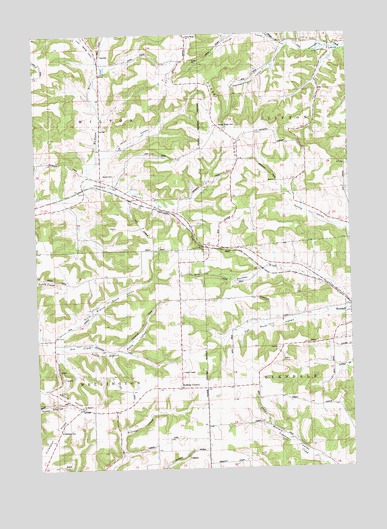
Kendall West, WI USGS Topographic Map
Click on map above to begin viewing in our Map Viewer.

This topographic map contains these locations and features:
Feature Name Type Latitude Longitude GNIS ID View Map
Black Valley SchoolSchoolN43.7941°W90.4782°1561890View Map
Cold Spring SchoolSchoolN43.8664°W90.4640°1563240View Map
Cold Spring ValleyValleyN43.8675°W90.4748°1563241View Map
Dorset CemeteryCemeteryN43.8344°W90.4693°1564070View Map
Dorset RidgeRidgeN43.8422°W90.4196°1564071View Map
Dorset Ridge CemeteryCemeteryN43.8480°W90.4257°1846200View Map
Dorset Ridge ChurchChurchN43.8489°W90.4276°1564072View Map
Dorset Ridge SchoolSchoolN43.8741°W90.4387°1846201View Map
Dorset Valley SchoolSchoolN43.8308°W90.4701°1564074View Map
Finucan ValleyValleyN43.8709°W90.4015°1564954View Map
Gammerdinger ValleyValleyN43.8706°W90.3997°1565389View Map
Graf SchoolSchoolN43.8722°W90.3935°1565703View Map
Hoffman CornersPopulated PlaceN43.7725°W90.4443°1566512View Map
Hoye ValleyValleyN43.8400°W90.4718°1566779View Map
North Branch Black ValleyValleyN43.7875°W90.4940°1570365View Map
Number One TunnelTunnelN43.8130°W90.4315°1575716View Map
Poe CreekStreamN43.7866°W90.4968°1571713View Map
Porpus QuarryMineN43.7519°W90.4883°2634033View Map
Saint Matthew CemeteryCemeteryN43.7616°W90.4910°1573354View Map
Saint Matthew ChurchChurchN43.7677°W90.4829°1846281View Map
South Branch Black ValleyValleyN43.7854°W90.4925°1574400View Map
South Ridge SchoolSchoolN43.7677°W90.4835°1574487View Map
Spring ValleyValleyN43.8186°W90.3760°1574702View Map
Sunnyvalley Parochial SchoolSchoolN43.8638°W90.4109°2715770View Map
Town of WellingtonCivilN43.7688°W90.4923°1584394View Map
Town of WiltonCivilN43.8566°W90.4924°1584450View Map
WVCX-FM (Tomah)TowerN43.8536°W90.4579°1582472View Map

Note: Coordinates in the location and feature list above are referenced to NAD83 datum.


Copyright (C) 2008-2025 Ryan Niemi / Sunset Dynamics ... All Rights Reserved