TopoQuest Logo
Do you find TopoQuest useful?
Help keep TopoQuest running and adding new maps/features by donating!
Bitcoin:  19c7KJd3qBynnjoSw5npx9KScwjBe4ifkT
Litecoin:  LXs6TkuXGGXo1vDsWCkWVdjQX94eUKd6ui
Home View Maps Find Maps Find Places Resources & Links


Hull Creek, California Topographic Map

USGS Map Title: Hull Creek, CA
USGS Map MRC: 38120A1
DRG (GeoTIFF) Download: o38120a1.tif


Neighboring USGS Topographic Map Quads:


  Crandall Peak, CA  
38120B2
 

  Strawberry, CA  
38120B1
 

  Pinecrest, CA  
38119B8
 

  Twain Harte, CA  
38120A2
 

  Hull Creek, CA  
38120A1
 

  Cherry Lake North, CA  
38119A8
 

  Tuolumne, CA  
37120H2
 

  Duckwall Mountain, CA  
37120H1
 

  Cherry Lake South, CA  
37119H8


Map MRC Location:

N39°
W121°
N39°
W120°
H8 H7 H6 H5 H4 H3 H2 H1
G8 G7 G6 G5 G4 G3 G2 G1
F8 F7 F6 F5 F4 F3 F2 F1
E8 E7 E6 E5 E4 E3 E2 E1
D8 D7 D6 D5 D4 D3 D2 D1
C8 C7 C6 C5 C4 C3 C2 C1
B8 B7 B6 B5 B4 B3 B2 B1
A8 A7 A6 A5 A4 A3 A2 A1
N38°
W121°
N38°
W120°

Hull Creek, CA USGS 1:24K Topographic Map Preview:
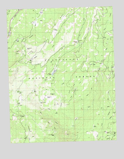
Hull Creek, CA USGS Topographic Map
Click on map above to begin viewing in our Map Viewer.

This topographic map contains these locations and features:
Feature Name Type Latitude Longitude GNIS ID View Map
Bone FlatFlatN38.0349°W120.0699°257336View Map
Bourland CreekStreamN38.0199°W120.0130°257392View Map
Box SpringSpringN38.0269°W120.0697°257414View Map
Brownes MeadowFlatN38.1210°W120.0871°257512View Map
Brushy CreekStreamN38.0405°W120.0632°257540View Map
Camp ClaveyLocaleN38.0716°W120.0263°257861View Map
Camp Ida SpringSpringN38.1040°W120.0670°257883View Map
Camp NiagaraLocaleN38.0071°W120.0046°257886View Map
Camp Twentyfive CreekStreamN38.0366°W120.0660°257904View Map
Camp TwentyfourLocaleN38.0371°W120.0888°257905View Map
Camp Twentyone SpringSpringN38.0067°W120.0745°257906View Map
DeadwoodPopulated PlaceN38.0041°W120.1082°259144View Map
Deadwood SpringSpringN38.0249°W120.1122°259162View Map
Fahey CabinLocaleN38.0774°W120.0996°260019View Map
Fahey MeadowFlatN38.0385°W120.1155°260020View Map
Faust CabinLocaleN38.0477°W120.1138°260061View Map
Funks MeadowFlatN38.0477°W120.0977°260449View Map
Hull CreekStreamN38.0013°W120.0613°266832View Map
Hull Creek CampgroundLocaleN38.0938°W120.0421°274799View Map
Hull Creek SpringSpringN38.0928°W120.0436°261603View Map
Hulls MeadowsFlatN38.0663°W120.0721°261606View Map
Lee Price CampLocaleN38.0635°W120.0763°262397View Map
Looney CreekStreamN38.0313°W120.0046°262916View Map
Merrill SpringSpringN38.0956°W120.1157°263466View Map
Milk Ranch SpringSpringN38.0445°W120.0724°263580View Map
Reynolds CreekStreamN38.0199°W120.0130°265385View Map
Rock CreekStreamN38.0963°W120.0057°265483View Map
Rosasco MeadowFlatN38.0060°W120.0110°265188View Map
Rush CreekStreamN38.0899°W120.0430°265678View Map
Sam Williams SpringSpringN38.0879°W120.1032°1682551View Map
Trout CreekStreamN38.0819°W120.0105°268431View Map
Twomile CreekStreamN38.0146°W120.0507°268560View Map
Wet Meadows SpringsSpringN38.0414°W120.0820°268949View Map
Wolfin MeadowFlatN38.0133°W120.0280°269273View Map

Note: Coordinates in the location and feature list above are referenced to NAD83 datum.


Copyright (C) 2008-2024 Ryan Niemi / Sunset Dynamics ... All Rights Reserved