TopoQuest Logo
Do you find TopoQuest useful?
Help keep TopoQuest running and adding new maps/features by donating!
Bitcoin:  19c7KJd3qBynnjoSw5npx9KScwjBe4ifkT
Litecoin:  LXs6TkuXGGXo1vDsWCkWVdjQX94eUKd6ui
Home View Maps Find Maps Find Places Resources & Links


Gilbertsville, New York Topographic Map

USGS Map Title: Gilbertsville, NY
USGS Map MRC: 42075D3
DRG (GeoTIFF) Download: o42075d3.tif


Neighboring USGS Topographic Map Quads:


  Holmesville, NY  
42075E4
 

  New Berlin South, NY  
42075E3
 

  Morris, NY  
42075E2
 

  Guilford, NY  
42075D4
 

  Gilbertsville, NY  
42075D3
 

  Otego, NY  
42075D2
 

  Sidney, NY  
42075C4
 

  Unadilla, NY  
42075C3
 

  Franklin, NY  
42075C2


Map MRC Location:

N43°
W76°
N43°
W75°
H8 H7 H6 H5 H4 H3 H2 H1
G8 G7 G6 G5 G4 G3 G2 G1
F8 F7 F6 F5 F4 F3 F2 F1
E8 E7 E6 E5 E4 E3 E2 E1
D8 D7 D6 D5 D4 D3 D2 D1
C8 C7 C6 C5 C4 C3 C2 C1
B8 B7 B6 B5 B4 B3 B2 B1
A8 A7 A6 A5 A4 A3 A2 A1
N42°
W76°
N42°
W75°

Gilbertsville, NY USGS 1:24K Topographic Map Preview:
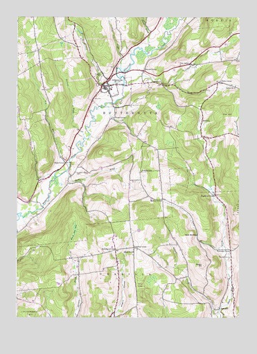
Gilbertsville, NY USGS Topographic Map
Click on map above to begin viewing in our Map Viewer.

This topographic map contains these locations and features:
Feature Name Type Latitude Longitude GNIS ID View Map
Black Ash BogSwampN42.4117°W75.3418°944063View Map
Blanchard CemeteryCemeteryN42.4003°W75.2559°944220View Map
Brookside CemeteryCemeteryN42.4746°W75.3286°944868View Map
Buckley CornersLocaleN42.4031°W75.3193°945077View Map
Butternut CreekStreamN42.4154°W75.3743°969945View Map
Butternut Valley CemeteryCemeteryN42.4353°W75.3418°945388View Map
Cahoon CreekStreamN42.4720°W75.3152°945434View Map
Copes CornerPopulated PlaceN42.4392°W75.3477°972343View Map
Coye BrookStreamN42.4787°W75.3177°947616View Map
Dry BrookStreamN42.4387°W75.3452°948676View Map
Dunderberg CreekStreamN42.4720°W75.3155°948786View Map
Filer HillSummitN42.4612°W75.2568°950049View Map
Freer CornerPopulated PlaceN42.4731°W75.2607°972511View Map
Frone CornerPopulated PlaceN42.4584°W75.3202°972519View Map
GilbertsvillePopulated PlaceN42.4715°W75.3257°951099View Map
Gilbertsville - Mount Upton Elementray SchoolSchoolN42.4444°W75.3476°2597885View Map
Gilbertsville - Mount Upton Junior and Senior High SchoolSchoolN42.4449°W75.3470°2597889View Map
Gilbertsville Free LibraryBuildingN42.4716°W75.3262°2598961View Map
Gilbertsville Volunteer Fire DepartmentBuildingN42.4720°W75.3267°2735150View Map
Halbert BrookStreamN42.4498°W75.3368°952005View Map
Heslops CornerPopulated PlaceN42.4779°W75.3041°972612View Map
Hollis CemeteryCemeteryN42.4662°W75.3318°953000View Map
Hughston CornersLocaleN42.4262°W75.2635°953412View Map
Indian CreekStreamN42.3765°W75.2618°953641View Map
Kinnie Ridge FarmLocaleN42.4922°W75.2983°2557736View Map
Mallory CornerPopulated PlaceN42.4242°W75.2932°972750View Map
Milfer FarmLocaleN42.4081°W75.3217°2557737View Map
Old Churchyard CemeteryCemeteryN42.4747°W75.3244°2558768View Map
Prentiss CemeteryCemeteryN42.4731°W75.2993°961117View Map
RootvillePopulated PlaceN42.4570°W75.2710°973022View Map
Sand HillPopulated PlaceN42.3787°W75.2621°973040View Map
School Number 11 (historical)SchoolN42.4715°W75.2524°974969View Map
School Number 4 (historical)SchoolN42.4023°W75.3093°975318View Map
Shaw BrookStreamN42.4359°W75.3471°964968View Map
Sisson HillSummitN42.3973°W75.2699°965309View Map
Sisson Hill School (historical)SchoolN42.4092°W75.2738°965310View Map
Southwind FarmsLocaleN42.4733°W75.2631°2557738View Map
Thorp BrookStreamN42.4884°W75.3016°967440View Map
Toll CornerPopulated PlaceN42.4804°W75.2788°973161View Map
Town of ButternutsCivilN42.4678°W75.3222°978770View Map
Townline School (historical)SchoolN42.4359°W75.3049°967718View Map
Unadilla CenterPopulated PlaceN42.4042°W75.3088°973174View Map
Unadilla Center CemeteryCemeteryN42.4034°W75.3071°2558775View Map
Upton Park CemeteryCemeteryN42.4331°W75.3568°2558767View Map
Village of GilbertsvilleCivilN42.4693°W75.3226°2390859View Map
Youmans CornerPopulated PlaceN42.4034°W75.2549°973305View Map

Note: Coordinates in the location and feature list above are referenced to NAD83 datum.


Copyright (C) 2008-2025 Ryan Niemi / Sunset Dynamics ... All Rights Reserved