TopoQuest Logo
Do you find TopoQuest useful?
Help keep TopoQuest running and adding new maps/features by donating!
Bitcoin:  19c7KJd3qBynnjoSw5npx9KScwjBe4ifkT
Litecoin:  LXs6TkuXGGXo1vDsWCkWVdjQX94eUKd6ui
Home View Maps Find Maps Find Places Resources & Links


Varna, Illinois Topographic Map

USGS Map Title: Varna, IL
USGS Map MRC: 41089A2
DRG (GeoTIFF) Download: o41089a2.tif


Neighboring USGS Topographic Map Quads:


  Florid, IL  
41089B3
 

  McNabb, IL  
41089B2
 

  Tonica, IL  
41089B1
 

  Henry, IL  
41089A3
 

  Varna, IL  
41089A2
 

  Wenona, IL  
41089A1
 

  Washburn, IL  
40089H3
 

  La Rose, IL  
40089H2
 

  Minonk, IL  
40089H1


Map MRC Location:

N42°
W90°
N42°
W89°
H8 H7 H6 H5 H4 H3 H2 H1
G8 G7 G6 G5 G4 G3 G2 G1
F8 F7 F6 F5 F4 F3 F2 F1
E8 E7 E6 E5 E4 E3 E2 E1
D8 D7 D6 D5 D4 D3 D2 D1
C8 C7 C6 C5 C4 C3 C2 C1
B8 B7 B6 B5 B4 B3 B2 B1
A8 A7 A6 A5 A4 A3 A2 A1
N41°
W90°
N41°
W89°

Varna, IL USGS 1:24K Topographic Map Preview:
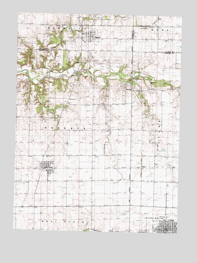
Varna, IL USGS Topographic Map
Click on map above to begin viewing in our Map Viewer.

This topographic map contains these locations and features:
Feature Name Type Latitude Longitude GNIS ID View Map
Antioch CemeteryCemeteryN41.0003°W89.1498°1719806View Map
Antioch Christian ChurchChurchN41.0092°W89.1348°1719807View Map
Arnold School (historical)SchoolN41.1120°W89.1437°403632View Map
Beckwith School (historical)SchoolN41.0300°W89.1426°404083View Map
Brushy College School (historical)SchoolN41.0892°W89.1440°405051View Map
City of TolucaCivilN41.0044°W89.1339°2397034View Map
Cumberland CemeteryCemeteryN41.0853°W89.1473°1719805View Map
CusterPopulated PlaceN41.0373°W89.1537°422598View Map
Fairview School (historical)SchoolN41.0298°W89.1909°408227View Map
Fieldcrest Elementary School-WestSchoolN41.0036°W89.1384°1808657View Map
Fieldcrest Middle School-WestSchoolN41.0045°W89.1265°1808659View Map
First Evangelical Lutheran ChurchChurchN41.0384°W89.2251°1967953View Map
Gaylords BranchStreamN41.0873°W89.1818°1808660View Map
Judd CreekStreamN41.0903°W89.1854°411270View Map
Judd School (historical)SchoolN41.0584°W89.1440°411271View Map
Junker Landing Strip (historical)AirportN41.0478°W89.1818°1720205View Map
Little Sandy CreekStreamN41.0914°W89.2254°412411View Map
Lloyd School (historical)SchoolN41.0731°W89.1912°412458View Map
MagnoliaPopulated PlaceN41.1136°W89.1945°412847View Map
Magnolia CemeteryCemeteryN41.1136°W89.1995°1953545View Map
Magnolia CemeteryCemeteryN41.1134°W89.1998°1967959View Map
Magnolia Fire DepartmentBuildingN41.1125°W89.1942°2640651View Map
Magnolia Post OfficePost OfficeN41.1125°W89.1948°2788697View Map
Myers CreekStreamN41.0861°W89.2337°1808665View Map
PorterfieldPopulated PlaceN41.0842°W89.1620°423081View Map
Roberts BranchStreamN41.0695°W89.2212°1808666View Map
Roberts CemeteryCemeteryN41.0759°W89.2095°1719808View Map
Saint Anns ChurchChurchN41.0023°W89.1370°1962600View Map
Salem CemeteryCemeteryN41.0659°W89.2167°1719810View Map
Salem CemeteryCemeteryN41.0428°W89.2220°1719811View Map
Statler CemeteryCemeteryN41.0672°W89.2217°1719809View Map
Statler School (historical)SchoolN41.0667°W89.2165°419074View Map
TolucaPopulated PlaceN41.0023°W89.1334°419768View Map
Toluca City HallBuildingN41.0019°W89.1339°2680818View Map
Toluca City Police DepartmentBuildingN41.0021°W89.1337°2757045View Map
Toluca Post OfficePost OfficeN41.0017°W89.1350°2788218View Map
Township of RobertsCivilN41.0590°W89.2204°429650View Map
Union School (historical)SchoolN41.1098°W89.2493°420130View Map
VarnaPopulated PlaceN41.0364°W89.2262°420237View Map
Varna Elementary SchoolSchoolN41.0345°W89.2256°1808669View Map
Varna Fire Protection DistrictBuildingN41.0336°W89.2244°2640902View Map
Varna Post OfficePost OfficeN41.0366°W89.2267°1967954View Map
Village of MagnoliaCivilN41.1140°W89.1958°2399225View Map
Village of VarnaCivilN41.0352°W89.2243°2400049View Map

Note: Coordinates in the location and feature list above are referenced to NAD83 datum.


Copyright (C) 2008-2025 Ryan Niemi / Sunset Dynamics ... All Rights Reserved