TopoQuest Logo
Do you find TopoQuest useful?
Help keep TopoQuest running and adding new maps/features by donating!
Bitcoin:  19c7KJd3qBynnjoSw5npx9KScwjBe4ifkT
Litecoin:  LXs6TkuXGGXo1vDsWCkWVdjQX94eUKd6ui
Home View Maps Find Maps Find Places Resources & Links


Tomah, Wisconsin Topographic Map

USGS Map Title: Tomah, WI
USGS Map MRC: 43090H5
DRG (GeoTIFF) Download: o43090h5.tif


Neighboring USGS Topographic Map Quads:


  Alderwood Lake, WI  
44090A6
 

  Tunnel City, WI  
44090A5
 

  Wyeville, WI  
44090A4
 

  City Rock, WI  
43090H6
 

  Tomah, WI  
43090H5
 

  Oakdale, WI  
43090H4
 

  Saint Marys, WI  
43090G6
 

  Wilton, WI  
43090G5
 

  Kendall West, WI  
43090G4


Map MRC Location:

N44°
W91°
N44°
W90°
H8 H7 H6 H5 H4 H3 H2 H1
G8 G7 G6 G5 G4 G3 G2 G1
F8 F7 F6 F5 F4 F3 F2 F1
E8 E7 E6 E5 E4 E3 E2 E1
D8 D7 D6 D5 D4 D3 D2 D1
C8 C7 C6 C5 C4 C3 C2 C1
B8 B7 B6 B5 B4 B3 B2 B1
A8 A7 A6 A5 A4 A3 A2 A1
N43°
W91°
N43°
W90°

Tomah, WI USGS 1:24K Topographic Map Preview:
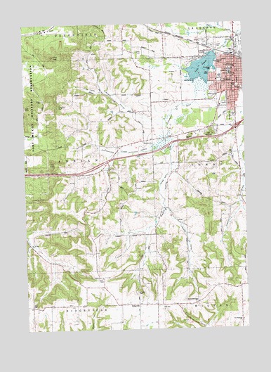
Tomah, WI USGS Topographic Map
Click on map above to begin viewing in our Map Viewer.

This topographic map contains these locations and features:
Feature Name Type Latitude Longitude GNIS ID View Map
Anderson SchoolSchoolN43.9680°W90.5518°1560862View Map
Aney CemeteryCemeteryN43.8847°W90.6212°1846178View Map
Assembly of God ChurchChurchN43.9664°W90.5304°1846179View Map
Buckley ParkParkN43.9733°W90.5007°1846188View Map
Butts ParkParkN43.9922°W90.5040°1846189View Map
Cedar PointCapeN43.9430°W90.6057°1562866View Map
Chub CreekStreamN43.9547°W90.5440°1563071View Map
Church of ChristChurchN43.9666°W90.5082°1846196View Map
Church of God (historical)ChurchN43.9750°W90.5065°1846197View Map
Congar SchoolSchoolN43.8847°W90.6165°1563318View Map
Eckleberg SchoolSchoolN43.8927°W90.5035°1564434View Map
Engine RockPillarN43.9391°W90.6126°1564653View Map
First Church of Christ ScientistChurchN43.9780°W90.5071°1846210View Map
First Congregational ChurchChurchN43.9789°W90.5051°1846211View Map
First United Methodist ChurchChurchN43.9769°W90.5154°1846212View Map
Gillett PArkParkN43.9744°W90.5037°1846214View Map
Gloria Dei Lutheran ChurchChurchN43.9683°W90.5087°1846216View Map
Gundersen-Mubarak ClinicHospitalN43.9780°W90.5051°1846217View Map
Hiawatha ParkParkN43.9861°W90.5065°1846220View Map
Hillcrest SchoolSchoolN43.8852°W90.5326°1566439View Map
Hopeville SchoolSchoolN43.9864°W90.5454°1566685View Map
Immanuel Evangelical United Brethren Church (historical)ChurchN43.9827°W90.5060°1846223View Map
JacksonvillePopulated PlaceN43.9519°W90.5576°1846224View Map
Jacksonville PassGapN43.9389°W90.6057°1569150View Map
Jacksonville SchoolSchoolN43.9525°W90.5576°1567082View Map
Jacksonville ValleyValleyN43.9573°W90.5433°1567083View Map
Jodi Circle ParkParkN43.9730°W90.5171°1846226View Map
Lake ParkParkN43.9880°W90.5187°1846231View Map
Lake TomahReservoirN43.9816°W90.5231°1575495View Map
Lake Tomah 26ReservoirN43.9866°W90.5168°1791969View Map
Lake Tomah ClinicHospitalN43.9827°W90.5151°1846232View Map
Limekiln HillSummitN43.9283°W90.6229°1568060View Map
Linnehan ValleyValleyN43.9228°W90.5436°1568151View Map
Miller Elementary SchoolSchoolN43.9792°W90.5076°1846247View Map
Monroe CountyCivilN43.9457°W90.6178°1581101View Map
Mount Vernon CemeteryCemeteryN43.9533°W90.5337°1569857View Map
Noth CemeteryCemeteryN43.8838°W90.5485°1846254View Map
Oak Grove CemeteryCemeteryN43.9622°W90.5084°1570614View Map
Our Saviors Mission Chapel (historical)ChurchN43.9844°W90.5015°1846257View Map
Perry ValleyValleyN43.9723°W90.5807°1846259View Map
Perry Valley SchoolSchoolN43.9714°W90.5837°1571236View Map
Pikes PeakSummitN43.9861°W90.6099°1571396View Map
Queen of the Apostles SchoolSchoolN43.9799°W90.5079°1846280View Map
Randall SchoolSchoolN43.9475°W90.5068°1572064View Map
RaymorePopulated PlaceN43.9975°W90.6193°1577785View Map
Recreation ParkParkN43.9705°W90.5182°1846266View Map
Reels ValleyValleyN43.9495°W90.5433°1572178View Map
Reels Valley SchoolSchoolN43.9244°W90.5479°1572179View Map
Ridgeville SchoolSchoolN43.8858°W90.5676°1572304View Map
Saint Johns CemeteryCemeteryN43.8900°W90.5629°1572994View Map
Saint Johns SchoolSchoolN43.8852°W90.5568°1573134View Map
Saint Mary's Catholic CemeteryCemeteryN43.9622°W90.5062°1846277View Map
Saint Marys Catholic ChurchChurchN43.9800°W90.5076°1846276View Map
Saint Marys Episcopal ChurchChurchN43.9775°W90.5065°1846278View Map
Saint Paul Lutheran SchoolSchoolN43.9823°W90.5053°1846286View Map
Saint Pauls Evangelical Lutheran ChurchChurchN43.9816°W90.5051°1846285View Map
Seventh Day Adventist ChurchChurchN43.9827°W90.5060°1846289View Map
Stevens ValleyValleyN43.9610°W90.5529°1574884View Map
TomahPopulated PlaceN43.9786°W90.5040°1575494View Map
Tomah Area Ambulance ServiceBuildingN43.9923°W90.5002°2698328View Map
Tomah Baptist AcademySchoolN43.9710°W90.5101°2715735View Map
Tomah Baptist ChurchChurchN43.9747°W90.5082°1846304View Map
Tomah Care CenterHospitalN43.9727°W90.5154°1846305View Map
Tomah City HallBuildingN43.9789°W90.5051°1846306View Map
Tomah High SchoolSchoolN43.9783°W90.5135°1846311View Map
Tomah Lake 2 WP 258 DamDamN43.9866°W90.5168°1791968View Map
Tomah Memorial HospitalHospitalN43.9840°W90.5155°1846244View Map
Tomah Memorial Hospital HeliportAirportN43.9847°W90.5154°1582241View Map
Tomah Middle SchoolSchoolN43.9807°W90.5083°1846308View Map
Tomah Police DepartmentBuildingN43.9793°W90.5051°2759814View Map
Tomah Post OfficePost OfficeN43.9786°W90.5051°1846309View Map
Tomah Public LibraryBuildingN43.9797°W90.5037°1846310View Map
Tomah Volunteer Fire Department Station 1BuildingN43.9789°W90.5052°2697643View Map
Tomah Volunteer Fire Department Station 2 North SideBuildingN43.9920°W90.5003°1846252View Map
Tomah Wastewater Treatment PlantLocaleN43.9942°W90.5006°2709819View Map
Town of AdrianCivilN43.9425°W90.6112°1582659View Map
Windrow BluffCliffN43.9641°W90.6065°1576857View Map
Winnebago ParkParkN43.9802°W90.5176°1846324View Map
Wisconsin State Patrol - Tomah PostBuildingN43.9523°W90.5163°2759937View Map
Wisconsin State Patrol District 5 HeliportAirportN43.9519°W90.5190°1581051View Map
Woodside SchoolSchoolN43.9386°W90.5979°1577032View Map
Worden-Burroughs CemeteryCemeteryN43.8858°W90.5290°1846326View Map
WTMB-AM (Tomah)TowerN43.9686°W90.5140°1582358View Map
WZFR-FM (Tomah)TowerN43.8969°W90.5826°1582471View Map

Note: Coordinates in the location and feature list above are referenced to NAD83 datum.


Copyright (C) 2008-2024 Ryan Niemi / Sunset Dynamics ... All Rights Reserved