TopoQuest Logo
Do you find TopoQuest useful?
Help keep TopoQuest running and adding new maps/features by donating!
Bitcoin:  19c7KJd3qBynnjoSw5npx9KScwjBe4ifkT
Litecoin:  LXs6TkuXGGXo1vDsWCkWVdjQX94eUKd6ui
Home View Maps Find Maps Find Places Resources & Links


West Greene, Alabama Topographic Map

USGS Map Title: West Greene, AL
USGS Map MRC: 32088H1
DRG (GeoTIFF) Download: o32088h1.tif


Neighboring USGS Topographic Map Quads:


  Aliceville South, AL  
33088A2
 

  Pleasant Ridge, AL  
33088A1
 

  Mantua, AL  
33087A8
 

  Warsaw, AL  
32088H2
 

  West Greene, AL  
32088H1
 

  Union, AL  
32087H8
 

  Gainesville, AL  
32088G2
 

  Boligee, AL  
32088G1
 

  Eutaw, AL  
32087G8


Map MRC Location:

N33°
W89°
N33°
W88°
H8 H7 H6 H5 H4 H3 H2 H1
G8 G7 G6 G5 G4 G3 G2 G1
F8 F7 F6 F5 F4 F3 F2 F1
E8 E7 E6 E5 E4 E3 E2 E1
D8 D7 D6 D5 D4 D3 D2 D1
C8 C7 C6 C5 C4 C3 C2 C1
B8 B7 B6 B5 B4 B3 B2 B1
A8 A7 A6 A5 A4 A3 A2 A1
N32°
W89°
N32°
W88°

West Greene, AL USGS 1:24K Topographic Map Preview:
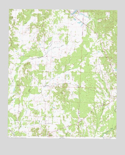
West Greene, AL USGS Topographic Map
Click on map above to begin viewing in our Map Viewer.

This topographic map contains these locations and features:
Feature Name Type Latitude Longitude GNIS ID View Map
Alexander CemeteryCemeteryN32.9215°W88.0050°158400View Map
Bangdoodle BranchStreamN32.9473°W88.1089°113438View Map
Beaver CreekStreamN32.9910°W88.0325°132447View Map
Brickyard CemeteryCemeteryN32.9585°W88.0156°114887View Map
Carpenters LakeReservoirN32.9968°W88.0484°115641View Map
Church BranchStreamN32.9573°W88.0820°116149View Map
Demount CemeteryCemeteryN32.8904°W88.1136°158630View Map
Eatman CemeteryCemeteryN32.9768°W88.0064°117806View Map
Fairview School (historical)SchoolN32.9723°W88.1236°132545View Map
Horton CemeteryCemeteryN32.9962°W88.0547°158406View Map
Horton CemeteryCemeteryN32.9968°W88.0611°120439View Map
Little Vine Baptist ChurchChurchN32.9882°W88.1189°158005View Map
Mantua-West Greene DivisionCivilN32.9756°W88.0288°161614View Map
Mount Mariah Methodist ChurchChurchN32.8901°W88.1136°158020View Map
New Light Baptist ChurchChurchN32.9232°W88.0428°158044View Map
New Light CemeteryCemeteryN32.9240°W88.0422°158648View Map
New Light School (historical)SchoolN32.9235°W88.0422°132660View Map
Oak Grove CemeteryCemeteryN32.9071°W88.0111°158649View Map
Oak Grove Methodist ChurchChurchN32.9065°W88.0125°158046View Map
Oak Grove SchoolSchoolN32.9071°W88.0117°132664View Map
Oak Hill School (historical)SchoolN32.9460°W88.0072°132666View Map
Oakhill ChurchChurchN32.9460°W88.0067°132667View Map
Pleasant Grove Methodist ChurchChurchN32.9898°W88.1203°158058View Map
Reeves BranchStreamN32.9093°W88.1009°125541View Map
Saint Johns CemeteryCemeteryN32.8907°W88.0375°158653View Map
Saint Johns ChurchChurchN32.8912°W88.0395°126126View Map
Saint Johns School (historical)SchoolN32.8910°W88.0395°132693View Map
Sardis CemeteryCemeteryN32.9235°W88.1134°158416View Map
Sardis ChurchChurchN32.9240°W88.1128°153337View Map
Spencer CemeteryCemeteryN32.9040°W88.1222°158419View Map
West GreenePopulated PlaceN32.9237°W88.0853°157238View Map
West Greene ChurchChurchN32.9262°W88.0872°132742View Map
West Greene Post OfficePost OfficeN32.9237°W88.0851°169026View Map
West Greene Volunteer Fire DepartmentBuildingN32.9237°W88.0852°2691180View Map
White CemeteryCemeteryN32.9890°W88.1209°158955View Map
Williams CemeteryCemeteryN32.9173°W88.0620°129007View Map
Zion Hill Baptist ChurchChurchN32.9976°W88.1225°158109View Map

Note: Coordinates in the location and feature list above are referenced to NAD83 datum.


Copyright (C) 2008-2024 Ryan Niemi / Sunset Dynamics ... All Rights Reserved