TopoQuest Logo
Do you find TopoQuest useful?
Help keep TopoQuest running and adding new maps/features by donating!
Bitcoin:  19c7KJd3qBynnjoSw5npx9KScwjBe4ifkT
Litecoin:  LXs6TkuXGGXo1vDsWCkWVdjQX94eUKd6ui
Home View Maps Find Maps Find Places Resources & Links


Bridgeboro, Georgia Topographic Map

USGS Map Title: Bridgeboro, GA
USGS Map MRC: 31083D8
DRG (GeoTIFF) Download: o31083d8.tif


Neighboring USGS Topographic Map Quads:


  Albany East, GA  
31084E1
 

  Acree, GA  
31083E8
 

  Sylvester, GA  
31083E7
 

  Putney, GA  
31084D1
 

  Bridgeboro, GA  
31083D8
 

  Tempy, GA  
31083D7
 

  Sale City, GA  
31084C1
 

  Doerun, GA  
31083C8
 

  Sigsbee, GA  
31083C7


Map MRC Location:

N32°
W84°
N32°
W83°
H8 H7 H6 H5 H4 H3 H2 H1
G8 G7 G6 G5 G4 G3 G2 G1
F8 F7 F6 F5 F4 F3 F2 F1
E8 E7 E6 E5 E4 E3 E2 E1
D8 D7 D6 D5 D4 D3 D2 D1
C8 C7 C6 C5 C4 C3 C2 C1
B8 B7 B6 B5 B4 B3 B2 B1
A8 A7 A6 A5 A4 A3 A2 A1
N31°
W84°
N31°
W83°

Bridgeboro, GA USGS 1:24K Topographic Map Preview:
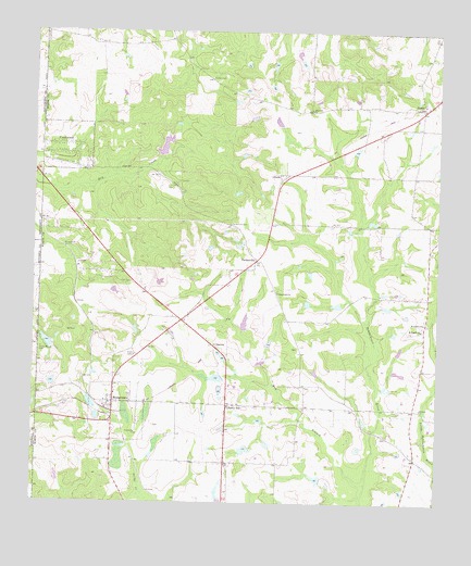
Bridgeboro, GA USGS Topographic Map
Click on map above to begin viewing in our Map Viewer.

This topographic map contains these locations and features:
Feature Name Type Latitude Longitude GNIS ID View Map
AlfordsPopulated PlaceN31.4624°W83.9238°331019View Map
Bay BranchStreamN31.3802°W83.8966°310876View Map
Bethany ChurchChurchN31.4005°W83.8796°311131View Map
BridgeboroPopulated PlaceN31.4016°W83.9749°331233View Map
Bridgeboro DivisionCivilN31.3857°W83.8912°1936130View Map
Bridgeboro Missionary Baptist ChurchChurchN31.4038°W83.9746°343260View Map
Bridgeboro Volunteer Fire Department Station 3BuildingN31.4083°W83.9745°2604754View Map
Chapel Hill CemeteryCemeteryN31.4316°W83.9243°349382View Map
Chapel Hill ChurchChurchN31.4307°W83.9241°312562View Map
CrestwoodPopulated PlaceN31.4677°W83.9874°331477View Map
Dry Creek SubdivisionPopulated PlaceN31.4530°W83.9957°343277View Map
Evergreen CemeteryCemeteryN31.4218°W83.8796°334753View Map
Evergreen ChurchChurchN31.4232°W83.8788°355740View Map
Evergreen School (historical)SchoolN31.4227°W83.8793°343279View Map
Fellowship ChurchChurchN31.4466°W83.9855°343280View Map
Friendship ChurchChurchN31.3932°W83.9674°314394View Map
Friendship School (historical)SchoolN31.3932°W83.9677°334754View Map
Gantts (historical)LocaleN31.4380°W83.9871°334755View Map
Gintown (historical)Populated PlaceN31.4635°W83.9824°343290View Map
GordyPopulated PlaceN31.4805°W83.8799°356060View Map
Gordy Volunteer Fire Department Station 4BuildingN31.4813°W83.8802°2604101View Map
Groveland EstatesPopulated PlaceN31.4488°W83.9955°343294View Map
Hopewell ChurchChurchN31.4793°W83.9138°315643View Map
Indian Cove (historical)Populated PlaceN31.4480°W83.9610°343298View Map
Jenkins LakeReservoirN31.4083°W83.9431°341888View Map
Jenkins Lake DamDamN31.4085°W83.9416°341887View Map
Liberty HillPopulated PlaceN31.4010°W83.9396°326369View Map
LivingstonPopulated PlaceN31.4163°W83.9432°326371View Map
Morris Hill School (historical)SchoolN31.4796°W83.9143°334758View Map
Mount Pisgah ChurchChurchN31.4213°W83.8796°318809View Map
New Bethel ChurchChurchN31.4810°W83.8796°343313View Map
Parker CemeteryCemeteryN31.4879°W83.9446°320213View Map
ParkervillePopulated PlaceN31.4396°W83.9307°326452View Map
Parkerville CemeteryCemeteryN31.4493°W83.9385°320236View Map
Parkerville School (historical)SchoolN31.4310°W83.9246°334762View Map
Pritchard LakeReservoirN31.4202°W83.9966°341882View Map
Pritchard Lake DamDamN31.4202°W83.9966°341881View Map
Rocky Mount CemeteryCemeteryN31.4160°W83.9977°321850View Map
Sears LakeReservoirN31.4700°W83.9596°340915View Map
Sears Lake DamDamN31.4668°W83.9616°340914View Map
Varnadoe LakeReservoirN31.3818°W83.9116°341884View Map
Varnadoe Lake DamDamN31.3818°W83.9116°341883View Map
Varnadoe North LakeReservoirN31.3894°W83.9342°341886View Map
Varnadoe North Lake DamDamN31.3902°W83.9332°341885View Map

Note: Coordinates in the location and feature list above are referenced to NAD83 datum.


Copyright (C) 2008-2025 Ryan Niemi / Sunset Dynamics ... All Rights Reserved