TopoQuest Logo
Do you find TopoQuest useful?
Help keep TopoQuest running and adding new maps/features by donating!
Bitcoin:  19c7KJd3qBynnjoSw5npx9KScwjBe4ifkT
Litecoin:  LXs6TkuXGGXo1vDsWCkWVdjQX94eUKd6ui
Home View Maps Find Maps Find Places Resources & Links


Brooks East, Maine Topographic Map

USGS Map Title: Brooks East, ME
USGS Map MRC: 44069E1
DRG (GeoTIFF) Download: o44069e1.tif


Neighboring USGS Topographic Map Quads:


  Dixmont, ME  
44069F2
 

  East Dixmont, ME  
44069F1
 

  Snow Mountain, ME  
44068F8
 

  Brooks West, ME  
44069E2
 

  Brooks East, ME  
44069E1
 

  Mount Waldo, ME  
44068E8
 

  Morrill, ME  
44069D2
 

  Belfast, ME  
44069D1
 

  Searsport, ME  
44068D8


Map MRC Location:

N45°
W70°
N45°
W69°
H8 H7 H6 H5 H4 H3 H2 H1
G8 G7 G6 G5 G4 G3 G2 G1
F8 F7 F6 F5 F4 F3 F2 F1
E8 E7 E6 E5 E4 E3 E2 E1
D8 D7 D6 D5 D4 D3 D2 D1
C8 C7 C6 C5 C4 C3 C2 C1
B8 B7 B6 B5 B4 B3 B2 B1
A8 A7 A6 A5 A4 A3 A2 A1
N44°
W70°
N44°
W69°

Brooks East, ME USGS 1:24K Topographic Map Preview:
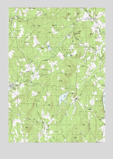
Brooks East, ME USGS Topographic Map
Click on map above to begin viewing in our Map Viewer.

This topographic map contains these locations and features:
Feature Name Type Latitude Longitude GNIS ID View Map
Arthur Jewell Community Health Center Ambulance ServiceBuildingN44.5482°W69.1229°2666819View Map
Basin PondLakeN44.5889°W69.0726°561693View Map
Bear HillSummitN44.5634°W69.0487°561836View Map
BrooksPopulated PlaceN44.5504°W69.1209°563012View Map
Brooks Post OfficePost OfficeN44.5525°W69.1243°2768918View Map
Brooks Volunteer Fire DepartmentBuildingN44.5531°W69.1245°2552939View Map
Camp Fair HavenLocaleN44.5126°W69.1231°563397View Map
Clark SchoolSchoolN44.5915°W69.0084°564051View Map
Clement HillSummitN44.5707°W69.0435°564085View Map
Coon HillSummitN44.5163°W69.0257°564338View Map
Dead BrookStreamN44.5045°W69.0698°564849View Map
Dead BrookStreamN44.5776°W69.0070°564850View Map
Dolloff HillSummitN44.6179°W69.0376°565196View Map
Dow SchoolSchoolN44.5606°W69.0053°565255View Map
Faith ChurchChurchN44.5926°W69.0431°571510View Map
Great Farm BrookStreamN44.6162°W69.1225°567144View Map
Greely SchoolSchoolN44.5079°W69.0025°567200View Map
Greenlawn CemeteryCemeteryN44.5212°W69.0039°567292View Map
Harding CemeteryCemeteryN44.5006°W69.0903°567603View Map
Haskell HillSummitN44.6081°W69.0867°567733View Map
Houstus HillSummitN44.5565°W69.0544°568371View Map
Hussey BrookStreamN44.5165°W69.0814°568515View Map
Irish HillSummitN44.5810°W69.0345°568670View Map
JacksonPopulated PlaceN44.6148°W69.1209°568728View Map
Jones BogSwampN44.5867°W69.0606°568944View Map
Kermit Nickerson SchoolSchoolN44.5212°W69.0021°2737922View Map
Land of Rest CemeteryCemeteryN44.5320°W69.0179°2737057View Map
Marden HillSummitN44.5395°W69.0055°570764View Map
Mason HillSummitN44.5958°W69.0978°570874View Map
McDonald HillSummitN44.6006°W69.0203°570970View Map
MonroePopulated PlaceN44.6151°W69.0181°571508View Map
Monroe CenterPopulated PlaceN44.6001°W69.0386°579528View Map
Monroe Community LibraryBuildingN44.6145°W69.0177°2738436View Map
Monroe Elementary SchoolSchoolN44.6142°W69.0214°2737955View Map
Monroe Post OfficePost OfficeN44.6150°W69.0240°2768940View Map
Monroe Volunteer Fire StationBuildingN44.6145°W69.0177°2553123View Map
Mount Rest CemeteryCemeteryN44.5810°W69.0517°571785View Map
Mount Solitude CemeteryCemeteryN44.5758°W69.0229°571788View Map
Nickerson MillsPopulated PlaceN44.5395°W69.0384°579555View Map
North MonroePopulated PlaceN44.6245°W69.0962°579569View Map
Norton HillSummitN44.5342°W69.0699°572491View Map
Oak HillSummitN44.5138°W69.0992°572585View Map
Parker HillSummitN44.6024°W69.0352°572980View Map
Pattee CornerPopulated PlaceN44.5870°W69.0823°579603View Map
Plummer HillSummitN44.6086°W69.0699°573531View Map
Quarry HillSummitN44.5042°W69.0362°573932View Map
Reynolds CemeteryCemeteryN44.5206°W69.0909°574149View Map
Roberts HillSummitN44.5685°W69.0793°574300View Map
Robertson CemeteryCemeteryN44.5712°W69.0311°574307View Map
Robertson HillSummitN44.5443°W69.0411°574310View Map
Robertson MountainSummitN44.6176°W69.0491°574311View Map
Thistle PondLakeN44.5806°W69.0468°576977View Map
Toddy PondLakeN44.5413°W69.0543°577150View Map
Town House CornersLocaleN44.5317°W69.0173°577231View Map
Town of BrooksCivilN44.5316°W69.1214°582371View Map
Town of MonroeCivilN44.6072°W69.0458°582602View Map
Town of SwanvilleCivilN44.5212°W69.0118°582758View Map
WaldoPopulated PlaceN44.5126°W69.0761°579792View Map
Webber HillSummitN44.5985°W69.0439°577935View Map
Webster CemeteryCemeteryN44.5088°W69.0300°577954View Map
White BrookStreamN44.5045°W69.0703°578339View Map
Wilde HillSummitN44.6005°W69.0712°578471View Map

Note: Coordinates in the location and feature list above are referenced to NAD83 datum.


Copyright (C) 2008-2024 Ryan Niemi / Sunset Dynamics ... All Rights Reserved