TopoQuest Logo
Do you find TopoQuest useful?
Help keep TopoQuest running and adding new maps/features by donating!
Bitcoin:  19c7KJd3qBynnjoSw5npx9KScwjBe4ifkT
Litecoin:  LXs6TkuXGGXo1vDsWCkWVdjQX94eUKd6ui
Home View Maps Find Maps Find Places Resources & Links


Byington, Ohio Topographic Map

USGS Map Title: Byington, OH
USGS Map MRC: 39083A3
DRG (GeoTIFF) Download: o39083a3.tif


Neighboring USGS Topographic Map Quads:


  Rainsboro, OH  
39083B4
 

  Bainbridge, OH  
39083B3
 

  Morgantown, OH  
39083B2
 

  Sinking Spring, OH  
39083A4
 

  Byington, OH  
39083A3
 

  Latham, OH  
39083A2
 

  Peebles, OH  
38083H4
 

  Jaybird, OH  
38083H3
 

  Rarden, OH  
38083H2


Map MRC Location:

N40°
W84°
N40°
W83°
H8 H7 H6 H5 H4 H3 H2 H1
G8 G7 G6 G5 G4 G3 G2 G1
F8 F7 F6 F5 F4 F3 F2 F1
E8 E7 E6 E5 E4 E3 E2 E1
D8 D7 D6 D5 D4 D3 D2 D1
C8 C7 C6 C5 C4 C3 C2 C1
B8 B7 B6 B5 B4 B3 B2 B1
A8 A7 A6 A5 A4 A3 A2 A1
N39°
W84°
N39°
W83°

Byington, OH USGS 1:24K Topographic Map Preview:
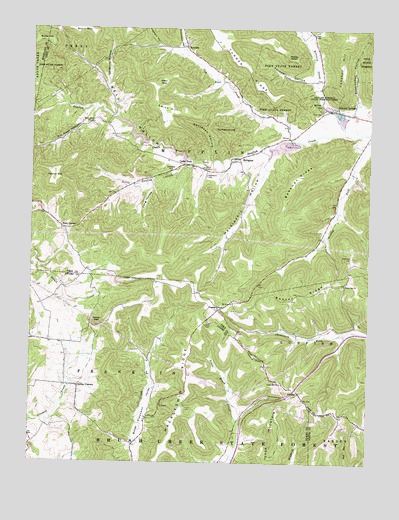
Byington, OH USGS Topographic Map
Click on map above to begin viewing in our Map Viewer.

This topographic map contains these locations and features:
Feature Name Type Latitude Longitude GNIS ID View Map
Beekman CemeteryCemeteryN39.0595°W83.2566°1037809View Map
Beekman RidgeRidgeN39.0826°W83.2763°1037810View Map
Bell HollowValleyN39.0865°W83.3132°1037821View Map
Butler HillSummitN39.1215°W83.3713°1038566View Map
ByingtonPopulated PlaceN39.0876°W83.2994°1062682View Map
Byington Post Office (historical)Post OfficeN39.0876°W83.2999°2042453View Map
Campbell HillSummitN39.1078°W83.2613°1048578View Map
Cave LakeReservoirN39.0917°W83.3199°1077956View Map
Cave Lake DamDamN39.0917°W83.3199°1077955View Map
Cedar ForkPopulated PlaceN39.0862°W83.3182°1062688View Map
Davidson HollowValleyN39.0876°W83.3074°1039596View Map
Dry Bone CreekStreamN39.0934°W83.2782°1066684View Map
Dry Bone School (historical)SchoolN39.1140°W83.3085°1055176View Map
East CemeteryCemeteryN39.1014°W83.2680°1039976View Map
Edendale School (historical)SchoolN39.0409°W83.3232°1053360View Map
Fields HollowValleyN39.0831°W83.2549°1055181View Map
Ford QuarryMineN39.0848°W83.3105°1040551View Map
Grassy Fork School (historical)SchoolN39.0645°W83.2677°1055185View Map
GroomsPopulated PlaceN39.0203°W83.2752°1062796View Map
Hackleshin HollowValleyN39.0870°W83.2874°1041228View Map
Hackleshin RidgeRidgeN39.0192°W83.3177°1041229View Map
Hackleshin School (historical)SchoolN39.0612°W83.3032°1055189View Map
Hilderbran School (historical)SchoolN39.0134°W83.2960°1053359View Map
Holmes School (historical)SchoolN39.0376°W83.2760°1055190View Map
Hopek HollowValleyN39.1090°W83.3077°1055192View Map
Humphrey HillSummitN39.0953°W83.3035°1041873View Map
Kincaid CemeteryCemeteryN39.1034°W83.2702°1963409View Map
Kincaid CreekStreamN39.0951°W83.2594°1066786View Map
Kincaid SpringsPopulated PlaceN39.1023°W83.2644°1064938View Map
Kincaid Springs State Fish HatcheryLocaleN39.1006°W83.2613°1080126View Map
Laughlin HollowValleyN39.1090°W83.3469°1042431View Map
Lawhorn HollowValleyN39.1203°W83.3277°1042445View Map
Little Sunfish CreekStreamN39.0862°W83.3152°1057810View Map
Longs Retreat DamDamN39.0884°W83.3166°1077957View Map
Longs Retreat LakeReservoirN39.0884°W83.3166°1077958View Map
Lowman School (historical)SchoolN39.0892°W83.3313°1055198View Map
Massies HeavenSummitN39.1176°W83.2807°1048951View Map
Mount Zion CemeteryCemeteryN39.0462°W83.2996°1963416View Map
Mount Zion ChurchChurchN39.0462°W83.2994°1043655View Map
Nace CornerPopulated PlaceN39.0673°W83.3624°1062912View Map
New Fain CemeteryCemeteryN39.1203°W83.3180°1963418View Map
New Fain Community ChurchChurchN39.1206°W83.3185°1963419View Map
NewfainPopulated PlaceN39.1198°W83.3174°1062918View Map
Newfain Post Office (historical)Post OfficeN39.1195°W83.3180°2044258View Map
Palmer MountainSummitN39.0815°W83.3666°1049055View Map
Perdue HollowValleyN39.1098°W83.2721°1044374View Map
Pin Hook HollowValleyN39.0970°W83.3569°1044450View Map
Pleasant Valley School (historical)SchoolN39.0051°W83.3369°1053361View Map
Poplar GrovePopulated PlaceN39.0440°W83.3049°1062951View Map
Poplargrove Post OfficePost OfficeN39.0445°W83.3055°2043432View Map
Potato KnobSummitN39.0398°W83.3499°1049102View Map
Shoemaker HollowValleyN39.1045°W83.2546°1046236View Map
Smith HillSummitN39.1031°W83.3296°1049183View Map
Smoky CornersPopulated PlaceN39.0217°W83.3569°1063024View Map
Smoky Corners School (historical)SchoolN39.0217°W83.3574°1053362View Map
Staley KnobSummitN39.1095°W83.3280°1049207View Map
Thompson HollowValleyN39.1203°W83.3188°1047037View Map
Tong HollowValleyN39.0812°W83.3299°1047093View Map
Township of MifflinCivilN39.0925°W83.2951°1086812View Map
Turner RidgeRidgeN39.1215°W83.3069°1047219View Map
Union Hill ChurchChurchN39.0234°W83.2841°1047329View Map
Washburn CemeteryCemeteryN39.0826°W83.3096°1047582View Map
West Wood ChurchChurchN39.0978°W83.3535°1047812View Map
Westwood CemeteryCemeteryN39.0967°W83.3516°1963431View Map
White Oak CemeteryCemeteryN39.0509°W83.2599°1963432View Map
White Oak ChurchChurchN39.0512°W83.2591°1047881View Map

Note: Coordinates in the location and feature list above are referenced to NAD83 datum.


Copyright (C) 2008-2024 Ryan Niemi / Sunset Dynamics ... All Rights Reserved