TopoQuest Logo
Do you find TopoQuest useful?
Help keep TopoQuest running and adding new maps/features by donating!
Bitcoin:  19c7KJd3qBynnjoSw5npx9KScwjBe4ifkT
Litecoin:  LXs6TkuXGGXo1vDsWCkWVdjQX94eUKd6ui
Home View Maps Find Maps Find Places Resources & Links


Rocky Branch, Louisiana Topographic Map

USGS Map Title: Rocky Branch, LA
USGS Map MRC: 32092F2
DRG (GeoTIFF) Download: o32092f2.tif


Neighboring USGS Topographic Map Quads:


  De Loutre, LA  
32092G3
 

  Haile, LA  
32092G2
 

  Harrell Lake, LA  
32092G1
 

  Point, LA  
32092F3
 

  Rocky Branch, LA  
32092F2
 

  Sterlington, LA  
32092F1
 

  Calhoun, LA  
32092E3
 

  West Monroe North, LA  
32092E2
 

  Monroe North, LA  
32092E1


Map MRC Location:

N33°
W93°
N33°
W92°
H8 H7 H6 H5 H4 H3 H2 H1
G8 G7 G6 G5 G4 G3 G2 G1
F8 F7 F6 F5 F4 F3 F2 F1
E8 E7 E6 E5 E4 E3 E2 E1
D8 D7 D6 D5 D4 D3 D2 D1
C8 C7 C6 C5 C4 C3 C2 C1
B8 B7 B6 B5 B4 B3 B2 B1
A8 A7 A6 A5 A4 A3 A2 A1
N32°
W93°
N32°
W92°

Rocky Branch, LA USGS 1:24K Topographic Map Preview:
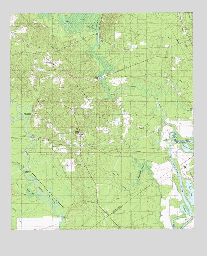
Rocky Branch, LA USGS Topographic Map
Click on map above to begin viewing in our Map Viewer.

This topographic map contains these locations and features:
Feature Name Type Latitude Longitude GNIS ID View Map
Bakers LandingLocaleN32.6732°W92.1401°548283View Map
Bayou D'Arbonne Recreation AreaParkN32.6924°W92.2346°540812View Map
Bayou de LoutreStreamN32.6762°W92.1396°559635View Map
Big IslandIslandN32.7499°W92.2112°545374View Map
Blasingame BrakeLakeN32.6617°W92.1588°540818View Map
Carter SloughStreamN32.6443°W92.2396°540813View Map
Colsons (historical)Populated PlaceN32.7274°W92.2424°548702View Map
Coulee CreekStreamN32.6251°W92.1462°554101View Map
Coulee CreekStreamN32.6871°W92.1462°534173View Map
CrossroadsPopulated PlaceN32.7215°W92.2210°540814View Map
Crossroads CemeteryCemeteryN32.7204°W92.2212°544052View Map
Crossroads ChurchChurchN32.7201°W92.2207°534289View Map
De Loutre BasinBasinN32.6799°W92.1407°534424View Map
Eagle LakeLakeN32.6467°W92.2364°540808View Map
Hamilton LakeLakeN32.6714°W92.1289°559683View Map
Hatley LakeLakeN32.7079°W92.1856°554678View Map
Hay BranchStreamN32.6504°W92.1660°540817View Map
Henderson LakeLakeN32.7024°W92.1782°554696View Map
Hollands BluffCliffN32.6321°W92.2121°540810View Map
Lake Drain LandingLocaleN32.6585°W92.2412°540809View Map
Lake Drain SloughStreamN32.6585°W92.2412°536444View Map
Loch LomondPopulated PlaceN32.6765°W92.1421°543404View Map
Long Point IslandIslandN32.7446°W92.1976°540815View Map
Long SloughGutN32.6518°W92.2182°540811View Map
Pace LakeLakeN32.6457°W92.1271°555581View Map
Parish Governing Authority District 8CivilN32.7001°W92.1797°1930252View Map
Parks CemeteryCemeteryN32.6943°W92.1253°537977View Map
Phillips FerryCrossingN32.7376°W92.1901°548725View Map
Phillips LakeSwampN32.7444°W92.2148°555636View Map
Port Union (historical)Populated PlaceN32.6646°W92.1412°1630804View Map
Port Union CemeteryCemeteryN32.6646°W92.1421°538346View Map
Rocky BranchPopulated PlaceN32.6788°W92.2032°538669View Map
Rocky Branch Crossroads Fire DepartmentBuildingN32.6824°W92.2034°2672780View Map
Rocky Branch Elementary School (historical)SchoolN32.6799°W92.2029°548727View Map
Rufus CreekStreamN32.6371°W92.2449°538761View Map
SpencerPopulated PlaceN32.7401°W92.1318°543690View Map
Spencer Post OfficePost OfficeN32.7496°W92.1343°1630803View Map
Tenmile IslandIslandN32.7432°W92.1935°540816View Map
The BasinBasinN32.6357°W92.1318°539840View Map
Wall LakeLakeN32.6260°W92.1336°556349View Map
Wall LakePopulated PlaceN32.6326°W92.1418°548635View Map
Ward EightCivilN32.7157°W92.1846°545236View Map

Note: Coordinates in the location and feature list above are referenced to NAD83 datum.


Copyright (C) 2008-2025 Ryan Niemi / Sunset Dynamics ... All Rights Reserved