TopoQuest Logo
Do you find TopoQuest useful?
Help keep TopoQuest running and adding new maps/features by donating!
Bitcoin:  19c7KJd3qBynnjoSw5npx9KScwjBe4ifkT
Litecoin:  LXs6TkuXGGXo1vDsWCkWVdjQX94eUKd6ui
Home View Maps Find Maps Find Places Resources & Links


Point, Louisiana Topographic Map

USGS Map Title: Point, LA
USGS Map MRC: 32092F3
DRG (GeoTIFF) Download: o32092f3.tif


Neighboring USGS Topographic Map Quads:


  Farmerville, LA  
32092G4
 

  De Loutre, LA  
32092G3
 

  Haile, LA  
32092G2
 

  Downsville North, LA  
32092F4
 

  Point, LA  
32092F3
 

  Rocky Branch, LA  
32092F2
 

  Downsville South, LA  
32092E4
 

  Calhoun, LA  
32092E3
 

  West Monroe North, LA  
32092E2


Map MRC Location:

N33°
W93°
N33°
W92°
H8 H7 H6 H5 H4 H3 H2 H1
G8 G7 G6 G5 G4 G3 G2 G1
F8 F7 F6 F5 F4 F3 F2 F1
E8 E7 E6 E5 E4 E3 E2 E1
D8 D7 D6 D5 D4 D3 D2 D1
C8 C7 C6 C5 C4 C3 C2 C1
B8 B7 B6 B5 B4 B3 B2 B1
A8 A7 A6 A5 A4 A3 A2 A1
N32°
W93°
N32°
W92°

Point, LA USGS 1:24K Topographic Map Preview:
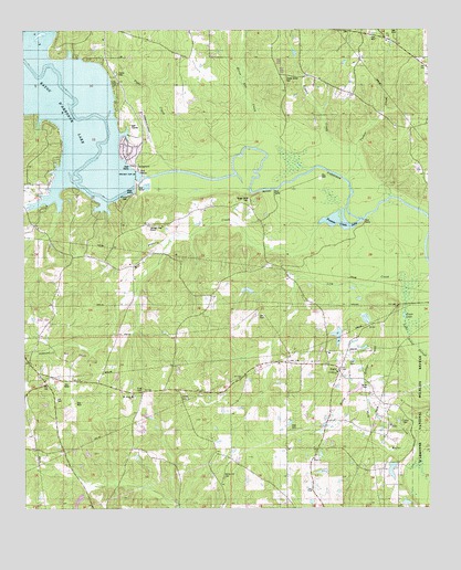
Point, LA USGS Topographic Map
Click on map above to begin viewing in our Map Viewer.

This topographic map contains these locations and features:
Feature Name Type Latitude Longitude GNIS ID View Map
Acree CemeteryCemeteryN32.6565°W92.2685°532075View Map
Antioch SchoolSchoolN32.7496°W92.2679°532196View Map
Bayles Pond DamDamN32.6701°W92.2868°556956View Map
Bayou Darbonne DamDamN32.7122°W92.3406°556710View Map
Briny Bridge CreekStreamN32.6846°W92.2660°533410View Map
Carter CemeteryCemeteryN32.6479°W92.2596°556374View Map
Downsville Gas FieldOilfieldN32.6660°W92.3643°540804View Map
Francis CreekStreamN32.7007°W92.2710°535079View Map
Francis Creek LakeReservoirN32.6991°W92.2758°540806View Map
Francis Creek Lake DamDamN32.7004°W92.2710°556955View Map
Horse Pen CreekStreamN32.7135°W92.2863°535806View Map
Jones LakeLakeN32.6755°W92.2577°554896View Map
King CemeteryCemeteryN32.6562°W92.3393°536199View Map
Lick CreekStreamN32.6768°W92.2576°540708View Map
Morse Hill CemeteryCemeteryN32.6329°W92.3132°537241View Map
Moselys BluffPopulated PlaceN32.7013°W92.3529°548722View Map
Mount Ararat ChurchChurchN32.6543°W92.3426°537285View Map
Parish Governing Authority District 5CivilN32.6645°W92.3608°1930105View Map
PointPopulated PlaceN32.6610°W92.2776°538281View Map
Point Assembly of God ChurchChurchN32.6379°W92.2860°556573View Map
Point Wilhite Fire DepartmentBuildingN32.6610°W92.2783°2672766View Map
Providence ChurchChurchN32.6607°W92.2787°540807View Map
Rogers CreekStreamN32.7174°W92.2807°538688View Map
Ruggs Bluff CemeteryCemeteryN32.7054°W92.3057°538762View Map
Shady Grove CemeteryCemeteryN32.7379°W92.2937°540805View Map
Shady Grove ChurchChurchN32.7382°W92.2946°539286View Map
TerrillsPopulated PlaceN32.6632°W92.3738°548732View Map
Tiger CreekStreamN32.7163°W92.3104°539926View Map
Tucker CreekStreamN32.7160°W92.2915°540017View Map
Union Parish AirportAirportN32.7223°W92.3372°1632702View Map
Ward FiveCivilN32.6615°W92.3693°545233View Map

Note: Coordinates in the location and feature list above are referenced to NAD83 datum.


Copyright (C) 2008-2024 Ryan Niemi / Sunset Dynamics ... All Rights Reserved