TopoQuest Logo
Do you find TopoQuest useful?
Help keep TopoQuest running and adding new maps/features by donating!
Bitcoin:  19c7KJd3qBynnjoSw5npx9KScwjBe4ifkT
Litecoin:  LXs6TkuXGGXo1vDsWCkWVdjQX94eUKd6ui
Home View Maps Find Maps Find Places Resources & Links


Cherry Lake North, California Topographic Map

USGS Map Title: Cherry Lake North, CA
USGS Map MRC: 38119A8
DRG (GeoTIFF) Download: o38119a8.tif


Neighboring USGS Topographic Map Quads:


  Strawberry, CA  
38120B1
 

  Pinecrest, CA  
38119B8
 

  Cooper Peak, CA  
38119B7
 

  Hull Creek, CA  
38120A1
 

  Cherry Lake North, CA  
38119A8
 

  Kibbie Lake, CA  
38119A7
 

  Duckwall Mountain, CA  
37120H1
 

  Cherry Lake South, CA  
37119H8
 

  Lake Eleanor, CA  
37119H7


Map MRC Location:

N39°
W120°
N39°
W119°
H8 H7 H6 H5 H4 H3 H2 H1
G8 G7 G6 G5 G4 G3 G2 G1
F8 F7 F6 F5 F4 F3 F2 F1
E8 E7 E6 E5 E4 E3 E2 E1
D8 D7 D6 D5 D4 D3 D2 D1
C8 C7 C6 C5 C4 C3 C2 C1
B8 B7 B6 B5 B4 B3 B2 B1
A8 A7 A6 A5 A4 A3 A2 A1
N38°
W120°
N38°
W119°

Cherry Lake North, CA USGS 1:24K Topographic Map Preview:
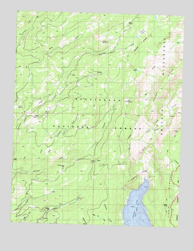
Cherry Lake North, CA USGS Topographic Map
Click on map above to begin viewing in our Map Viewer.

This topographic map contains these locations and features:
Feature Name Type Latitude Longitude GNIS ID View Map
Bear MeadowFlatN38.0919°W119.9099°256682View Map
Bourland MeadowFlatN38.1146°W119.9077°257393View Map
Bourland MountainSummitN38.1083°W119.9369°1682537View Map
Cherry Creek CanyonValleyN38.0267°W119.9011°258243View Map
Cherry LakeReservoirN38.0007°W119.9069°255077View Map
Clavey MeadowFlatN38.0680°W119.9988°258420View Map
Dead Horse GulchValleyN38.0138°W119.8978°2786653View Map
Hells MountainSummitN38.0734°W119.9168°261257View Map
Jawbone FallsFallsN38.0083°W119.9718°261904View Map
Jawbone PassGapN38.0366°W119.9410°261906View Map
Jawbone Pass PondLakeN38.0333°W119.9620°261907View Map
Little Reynolds CreekStreamN38.0299°W119.9877°262700View Map
Lookout PointSummitN38.0566°W119.8754°262907View Map
Lost CreekStreamN38.0308°W119.9966°262931View Map
Paddle CreekStreamN38.0638°W119.9921°264445View Map
Richards CreekStreamN38.0010°W119.9168°265405View Map
Shingle SpringSpringN38.0128°W119.8828°266124View Map
Snow CanyonValleyN38.0326°W119.8945°2786654View Map
Tuolumne CountyCivilN38.0276°W119.9548°277319View Map
Weed MeadowFlatN38.1199°W119.9185°268839View Map
West Fork Cherry CreekStreamN38.0530°W119.9032°268889View Map

Note: Coordinates in the location and feature list above are referenced to NAD83 datum.


Copyright (C) 2008-2024 Ryan Niemi / Sunset Dynamics ... All Rights Reserved