TopoQuest Logo
Do you find TopoQuest useful?
Help keep TopoQuest running and adding new maps/features by donating!
Bitcoin:  19c7KJd3qBynnjoSw5npx9KScwjBe4ifkT
Litecoin:  LXs6TkuXGGXo1vDsWCkWVdjQX94eUKd6ui
Home View Maps Find Maps Find Places Resources & Links


Caneyville, Kentucky Topographic Map

USGS Map Title: Caneyville, KY
USGS Map MRC: 37086D4
DRG (GeoTIFF) Download: o37086d4.tif


Neighboring USGS Topographic Map Quads:


  Falls of Rough, KY  
37086E5
 

  McDaniels, KY  
37086E4
 

  Madrid, KY  
37086E3
 

  Spring Lick, KY  
37086D5
 

  Caneyville, KY  
37086D4
 

  Leitchfield, KY  
37086D3
 

  Welchs Creek, KY  
37086C5
 

  Ready, KY  
37086C4
 

  Bee Spring, KY  
37086C3


Map MRC Location:

N38°
W87°
N38°
W86°
H8 H7 H6 H5 H4 H3 H2 H1
G8 G7 G6 G5 G4 G3 G2 G1
F8 F7 F6 F5 F4 F3 F2 F1
E8 E7 E6 E5 E4 E3 E2 E1
D8 D7 D6 D5 D4 D3 D2 D1
C8 C7 C6 C5 C4 C3 C2 C1
B8 B7 B6 B5 B4 B3 B2 B1
A8 A7 A6 A5 A4 A3 A2 A1
N37°
W87°
N37°
W86°

Caneyville, KY USGS 1:24K Topographic Map Preview:
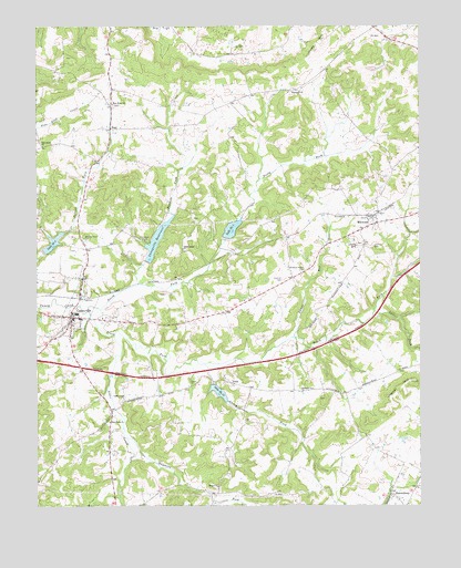
Caneyville, KY USGS Topographic Map
Click on map above to begin viewing in our Map Viewer.

This topographic map contains these locations and features:
Feature Name Type Latitude Longitude GNIS ID View Map
Alder CreekStreamN37.4195°W86.4744°485816View Map
Bennett ForkStreamN37.4328°W86.4666°486859View Map
Caney Creek ChurchChurchN37.4028°W86.4711°488848View Map
Caney ForkStreamN37.4120°W86.4455°488851View Map
CaneyvillePopulated PlaceN37.4242°W86.4883°488876View Map
Caneyville DivisionCivilN37.4007°W86.4581°1936915View Map
Caneyville ReservoirReservoirN37.4443°W86.4607°488877View Map
Caneyville Volunteer Fire DepartmentBuildingN37.4243°W86.4865°2636411View Map
City of CaneyvilleCivilN37.4242°W86.4906°2403985View Map
Dunns RunStreamN37.4189°W86.4169°491338View Map
First Apostolic ChurchChurchN37.4365°W86.4130°2647180View Map
Hoover HillSummitN37.4073°W86.3772°494513View Map
Hopewell ChurchChurchN37.4831°W86.4164°494530View Map
Jones HillSummitN37.4948°W86.4083°495502View Map
Lake Number 1ReservoirN37.4467°W86.4369°517200View Map
Lake Number 13ReservoirN37.4046°W86.4407°517201View Map
Lake Number 6ReservoirN37.4435°W86.4946°517202View Map
Laurel ForkStreamN37.4253°W86.3897°496043View Map
Layman CemeteryCemeteryN37.4342°W86.4191°496100View Map
Layman CemeteryCemeteryN37.4425°W86.3903°496101View Map
Macedonia ChurchChurchN37.3970°W86.4761°497415View Map
MillwoodPopulated PlaceN37.4503°W86.3905°498392View Map
New Hope ChurchChurchN37.4798°W86.4750°499357View Map
North Caney Creek ForkStreamN37.4259°W86.4830°499539View Map
PethPopulated PlaceN37.4070°W86.4366°508808View Map
Pine Knob Primitive Baptist ChurchChurchN37.4689°W86.4978°500706View Map
Pleasant Valley ChurchChurchN37.4364°W86.4130°500931View Map
Pleasant View ChurchChurchN37.4045°W86.4136°500949View Map
PostPopulated PlaceN37.4731°W86.4755°508862View Map
Raymers ForkStreamN37.4195°W86.4744°501624View Map
ShrewsburyPopulated PlaceN37.3789°W86.3847°503466View Map
South Fork Caney CreekStreamN37.4259°W86.4833°503910View Map
Union Home ChurchChurchN37.4420°W86.4522°505807View Map
Wilson ChurchChurchN37.3801°W86.4414°506896View Map

Note: Coordinates in the location and feature list above are referenced to NAD83 datum.


Copyright (C) 2008-2024 Ryan Niemi / Sunset Dynamics ... All Rights Reserved