TopoQuest Logo
Do you find TopoQuest useful?
Help keep TopoQuest running and adding new maps/features by donating!
Bitcoin:  19c7KJd3qBynnjoSw5npx9KScwjBe4ifkT
Litecoin:  LXs6TkuXGGXo1vDsWCkWVdjQX94eUKd6ui
Home View Maps Find Maps Find Places Resources & Links


McDaniels, Kentucky Topographic Map

USGS Map Title: McDaniels, KY
USGS Map MRC: 37086E4
DRG (GeoTIFF) Download: o37086e4.tif


Neighboring USGS Topographic Map Quads:


  Glen Dean, KY  
37086F5
 

  Kingswood, KY  
37086F4
 

  Custer, KY  
37086F3
 

  Falls of Rough, KY  
37086E5
 

  McDaniels, KY  
37086E4
 

  Madrid, KY  
37086E3
 

  Spring Lick, KY  
37086D5
 

  Caneyville, KY  
37086D4
 

  Leitchfield, KY  
37086D3


Map MRC Location:

N38°
W87°
N38°
W86°
H8 H7 H6 H5 H4 H3 H2 H1
G8 G7 G6 G5 G4 G3 G2 G1
F8 F7 F6 F5 F4 F3 F2 F1
E8 E7 E6 E5 E4 E3 E2 E1
D8 D7 D6 D5 D4 D3 D2 D1
C8 C7 C6 C5 C4 C3 C2 C1
B8 B7 B6 B5 B4 B3 B2 B1
A8 A7 A6 A5 A4 A3 A2 A1
N37°
W87°
N37°
W86°

McDaniels, KY USGS 1:24K Topographic Map Preview:
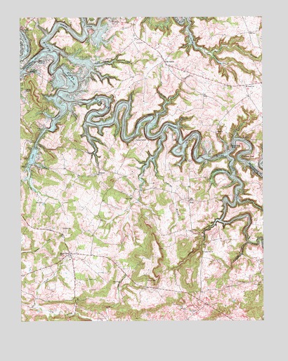
McDaniels, KY USGS Topographic Map
Click on map above to begin viewing in our Map Viewer.

This topographic map contains these locations and features:
Feature Name Type Latitude Longitude GNIS ID View Map
Ashcraft BranchStreamN37.5651°W86.4303°486082View Map
Ben Johnson Elementary SchoolSchoolN37.5963°W86.3830°495425View Map
Calvert ChurchChurchN37.5776°W86.3983°488647View Map
Cannons PointPopulated PlaceN37.5839°W86.4614°507646View Map
Cave CreekStreamN37.5870°W86.4775°489116View Map
Cobblers KnobPopulated PlaceN37.5681°W86.3855°507721View Map
ConcordPopulated PlaceN37.5609°W86.4597°507740View Map
Copper Slick HollowValleyN37.5900°W86.4245°490081View Map
Deweese CemeteryCemeteryN37.5387°W86.4786°490847View Map
Dry CreekStreamN37.5056°W86.4923°491174View Map
DuffPopulated PlaceN37.5498°W86.4130°507881View Map
Falling BranchPopulated PlaceN37.5948°W86.4972°507974View Map
Fentrees LookoutLocaleN37.6078°W86.4861°492025View Map
Fentress McMahanPopulated PlaceN37.6045°W86.4922°507988View Map
George BranchStreamN37.6248°W86.4128°492779View Map
Hinton HillsPopulated PlaceN37.6234°W86.4611°494304View Map
Horn Back MillPopulated PlaceN37.5717°W86.3916°508280View Map
Indian ValleyPopulated PlaceN37.5748°W86.4403°508311View Map
Lahue CemeteryCemeteryN37.5495°W86.4878°495907View Map
Little Clifty CreekStreamN37.5676°W86.3919°496677View Map
Long Hollow BranchStreamN37.5495°W86.3869°497121View Map
Long Lick CreekStreamN37.6212°W86.4664°497125View Map
McCoyPopulated PlaceN37.6187°W86.3816°508576View Map
McDanielsPopulated PlaceN37.6067°W86.4250°497837View Map
McDaniels Fire / RescueBuildingN37.6078°W86.4254°2636721View Map
North Fork Rough RiverStreamN37.6106°W86.4803°499564View Map
Panther CreekStreamN37.5814°W86.4661°500153View Map
Picnic Area Site 4LocaleN37.6245°W86.4505°500564View Map
Pilgrim ChurchChurchN37.5512°W86.4425°500627View Map
Pleasant Hill BranchStreamN37.5828°W86.4300°500839View Map
Poole CemeteryCemeteryN37.5745°W86.3816°501070View Map
Prewitt CemeteryCemeteryN37.5039°W86.4125°501311View Map
Rocky BranchStreamN37.6112°W86.4005°502235View Map
Rough River LakeReservoirN37.5751°W86.4459°502393View Map
Rough River ReservoirReservoirN37.5322°W86.3823°507317View Map
Shain CemeteryCemeteryN37.5175°W86.4647°503227View Map
Short CreekPopulated PlaceN37.5278°W86.4744°509050View Map
Short Creek ChurchChurchN37.5164°W86.4486°503446View Map
Stones HollowValleyN37.5412°W86.3977°504484View Map
Stones View ChurchChurchN37.5287°W86.4055°504485View Map
Taylor CemeteryCemeteryN37.5156°W86.3761°505004View Map
Thomason CemeteryCemeteryN37.5662°W86.4116°505176View Map
Walter CreekStreamN37.5770°W86.4264°506193View Map
Wildcat HollowValleyN37.5322°W86.3827°506736View Map

Note: Coordinates in the location and feature list above are referenced to NAD83 datum.


Copyright (C) 2008-2025 Ryan Niemi / Sunset Dynamics ... All Rights Reserved