TopoQuest Logo
Do you find TopoQuest useful?
Help keep TopoQuest running and adding new maps/features by donating!
Bitcoin:  19c7KJd3qBynnjoSw5npx9KScwjBe4ifkT
Litecoin:  LXs6TkuXGGXo1vDsWCkWVdjQX94eUKd6ui
Home View Maps Find Maps Find Places Resources & Links


Longtown, Mississippi Topographic Map

USGS Map Title: Longtown, MS
USGS Map MRC: 34090E1
DRG (GeoTIFF) Download: o34090e1.tif


Neighboring USGS Topographic Map Quads:


  Arkabutla West, MS  
34090F2
 

  Arkabutla East, MS  
34090F1
 

  Coldwater, MS  
34089F8
 

  Crenshaw North, MS  
34090E2
 

  Longtown, MS  
34090E1
 

  Senatobia, MS  
34089E8
 

  Crenshaw South, MS  
34090D2
 

  Pleasant Grove, MS  
34090D1
 

  Sardis, MS  
34089D8


Map MRC Location:

N35°
W91°
N35°
W90°
H8 H7 H6 H5 H4 H3 H2 H1
G8 G7 G6 G5 G4 G3 G2 G1
F8 F7 F6 F5 F4 F3 F2 F1
E8 E7 E6 E5 E4 E3 E2 E1
D8 D7 D6 D5 D4 D3 D2 D1
C8 C7 C6 C5 C4 C3 C2 C1
B8 B7 B6 B5 B4 B3 B2 B1
A8 A7 A6 A5 A4 A3 A2 A1
N34°
W91°
N34°
W90°

Longtown, MS USGS 1:24K Topographic Map Preview:
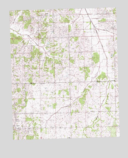
Longtown, MS USGS Topographic Map
Click on map above to begin viewing in our Map Viewer.

This topographic map contains these locations and features:
Feature Name Type Latitude Longitude GNIS ID View Map
Askew Grove CemeteryCemeteryN34.5187°W90.1215°1805824View Map
Askew Grove ChurchChurchN34.5179°W90.1223°666406View Map
Bill Gullege Pond DamDamN34.6051°W90.0784°682733View Map
Butterbowl CreekStreamN34.5829°W90.0168°667865View Map
Caruthers SchoolSchoolN34.5115°W90.0618°668125View Map
Church of Christ (historical)ChurchN34.5673°W90.0562°1805835View Map
CrockettPopulated PlaceN34.6195°W90.0834°683412View Map
Crockett ChurchChurchN34.6187°W90.0801°668950View Map
Crockett School (historical)SchoolN34.6193°W90.0831°1805836View Map
Cypress CornerPopulated PlaceN34.5543°W90.0931°669045View Map
District One Volunteer Fire Department Station 1BuildingN34.6155°W90.1089°2665914View Map
East Branch Strayhorn CreekStreamN34.5795°W90.0781°683416View Map
Fetterson School (historical)SchoolN34.6190°W90.0651°1805839View Map
Hammond Hill ChurchChurchN34.5540°W90.0045°670868View Map
Herbert E Gowdy Pond DamDamN34.5301°W90.0801°682692View Map
Hopewell ChurchChurchN34.5195°W90.1229°671441View Map
J R Johnson Pond DamDamN34.5918°W90.0818°682728View Map
LinwoodPopulated PlaceN34.5973°W90.0890°683439View Map
LongtownPopulated PlaceN34.5109°W90.1243°672855View Map
Longtown CemeteryCemeteryN34.5118°W90.1181°707421View Map
Longtown School (historical)SchoolN34.5251°W90.1226°1805831View Map
M P Moore Pond DamDamN34.5801°W90.0084°682720View Map
Matthews (historical)LocaleN34.6084°W90.0765°683447View Map
McGee ChapelChurchN34.5004°W90.0579°673349View Map
McGehees Chapel CemeteryCemeteryN34.5004°W90.0581°707422View Map
Miles Chapel (historical)ChurchN34.5468°W90.0915°1805832View Map
New Salem ChurchChurchN34.5829°W90.0454°674842View Map
Paradise ChurchChurchN34.6043°W90.0045°675439View Map
ParksplacePopulated PlaceN34.5104°W90.0570°685713View Map
Porter CreekStreamN34.6062°W90.0254°683460View Map
Ruffin (historical)LocaleN34.5679°W90.0848°683465View Map
Ruffin Grove ChurchChurchN34.5254°W90.0304°676947View Map
Salem CemeteryCemeteryN34.5740°W90.0659°683467View Map
Salem ChurchChurchN34.5740°W90.0654°677291View Map
Sanders School (historical)SchoolN34.5815°W90.1020°1805845View Map
Supervisor District 1CivilN34.5981°W90.0876°712090View Map

Note: Coordinates in the location and feature list above are referenced to NAD83 datum.


Copyright (C) 2008-2024 Ryan Niemi / Sunset Dynamics ... All Rights Reserved