TopoQuest Logo
Do you find TopoQuest useful?
Help keep TopoQuest running and adding new maps/features by donating!
Bitcoin:  19c7KJd3qBynnjoSw5npx9KScwjBe4ifkT
Litecoin:  LXs6TkuXGGXo1vDsWCkWVdjQX94eUKd6ui
Home View Maps Find Maps Find Places Resources & Links


Earl Park, Indiana Topographic Map

USGS Map Title: Earl Park, IN
USGS Map MRC: 40087F4
DRG (GeoTIFF) Download: o40087f4.tif


Neighboring USGS Topographic Map Quads:


  Sheldon, IL  
40087G5
 

  Kentland, IN  
40087G4
 

  Goodland, IN  
40087G3
 

  Darrow, IL  
40087F5
 

  Earl Park, IN  
40087F4
 

  Wadena, IN  
40087F3
 

  Stockland, IL  
40087E5
 

  Boswell, IN  
40087E4
 

  Fowler, IN  
40087E3


Map MRC Location:

N41°
W88°
N41°
W87°
H8 H7 H6 H5 H4 H3 H2 H1
G8 G7 G6 G5 G4 G3 G2 G1
F8 F7 F6 F5 F4 F3 F2 F1
E8 E7 E6 E5 E4 E3 E2 E1
D8 D7 D6 D5 D4 D3 D2 D1
C8 C7 C6 C5 C4 C3 C2 C1
B8 B7 B6 B5 B4 B3 B2 B1
A8 A7 A6 A5 A4 A3 A2 A1
N40°
W88°
N40°
W87°

Earl Park, IN USGS 1:24K Topographic Map Preview:
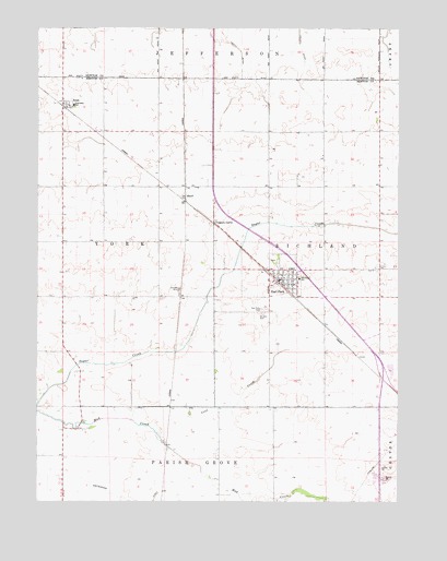
Earl Park, IN USGS Topographic Map
Click on map above to begin viewing in our Map Viewer.

This topographic map contains these locations and features:
Feature Name Type Latitude Longitude GNIS ID View Map
Coon CreekStreamN40.6464°W87.4675°432929View Map
Earl ParkPopulated PlaceN40.6828°W87.4117°449649View Map
Earl Park CemeteryCemeteryN40.6756°W87.4223°433860View Map
Gretencord DitchCanalN40.6256°W87.4592°435486View Map
RaubPopulated PlaceN40.7300°W87.4917°441790View Map
Rheude AirportAirportN40.6641°W87.4390°2770297View Map
Rheude AirportAirportN40.6609°W87.4397°2677029View Map
Richland Township Fire DepartmentBuildingN40.6836°W87.4152°2626272View Map
Saint John the Baptist CemeteryCemeteryN40.6748°W87.4222°442559View Map
SheffPopulated PlaceN40.7056°W87.4492°443340View Map
Talley DitchCanalN40.7492°W87.4097°444552View Map
Town of Earl ParkCivilN40.6856°W87.4199°2396916View Map
Township of RichlandCivilN40.6933°W87.3817°453789View Map
Township of YorkCivilN40.6933°W87.4826°454066View Map
Yeagers CurvePopulated PlaceN40.6986°W87.4392°446373View Map

Note: Coordinates in the location and feature list above are referenced to NAD83 datum.


Copyright (C) 2008-2025 Ryan Niemi / Sunset Dynamics ... All Rights Reserved