TopoQuest Logo
Do you find TopoQuest useful?
Help keep TopoQuest running and adding new maps/features by donating!
Bitcoin:  19c7KJd3qBynnjoSw5npx9KScwjBe4ifkT
Litecoin:  LXs6TkuXGGXo1vDsWCkWVdjQX94eUKd6ui
Home View Maps Find Maps Find Places Resources & Links


Columbus, Arkansas Topographic Map

USGS Map Title: Columbus, AR
USGS Map MRC: 33093G7
DRG (GeoTIFF) Download: o33093g7.tif


Neighboring USGS Topographic Map Quads:


  Mineral Springs North, AR  
33093H8
 

  Nashville, AR  
33093H7
 

  McCaskill, AR  
33093H6
 

  Mineral Springs South, AR  
33093G8
 

  Columbus, AR  
33093G7
 

  Washington, AR  
33093G6
 

  Red Bluff, AR  
33093F8
 

  McNab, AR  
33093F7
 

  Sheppard, AR  
33093F6


Map MRC Location:

N34°
W94°
N34°
W93°
H8 H7 H6 H5 H4 H3 H2 H1
G8 G7 G6 G5 G4 G3 G2 G1
F8 F7 F6 F5 F4 F3 F2 F1
E8 E7 E6 E5 E4 E3 E2 E1
D8 D7 D6 D5 D4 D3 D2 D1
C8 C7 C6 C5 C4 C3 C2 C1
B8 B7 B6 B5 B4 B3 B2 B1
A8 A7 A6 A5 A4 A3 A2 A1
N33°
W94°
N33°
W93°

Columbus, AR USGS 1:24K Topographic Map Preview:
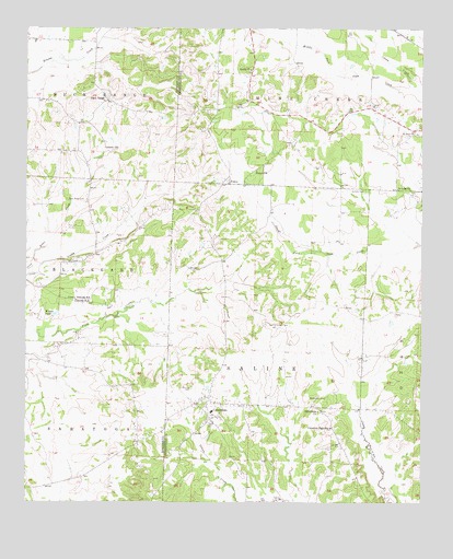
Columbus, AR USGS Topographic Map
Click on map above to begin viewing in our Map Viewer.

This topographic map contains these locations and features:
Feature Name Type Latitude Longitude GNIS ID View Map
Buck RangePopulated PlaceN33.8568°W93.8491°76450View Map
Buck Range CemeteryCemeteryN33.8301°W93.8616°47135View Map
Camp Spring Church (historical)ChurchN33.7529°W93.8344°62548View Map
Camp Spring Church (historical)ChurchN33.7554°W93.8313°61551View Map
Caney CreekStreamN33.8587°W93.7513°47419View Map
ColumbusPopulated PlaceN33.7760°W93.8171°47941View Map
Columbus Fire DepartmentBuildingN33.7754°W93.7962°2116292View Map
Columbus High SchoolSchoolN33.7696°W93.7788°47942View Map
Columbus Post OfficePost OfficeN33.7757°W93.8217°2781892View Map
Corinth ChurchChurchN33.8029°W93.8555°48047View Map
Fountain Church (historical)ChurchN33.8265°W93.8349°62586View Map
Gamble CemeteryCemeteryN33.8329°W93.7682°49316View Map
Grahm CreekStreamN33.8118°W93.8727°49540View Map
Liberty ChurchChurchN33.8437°W93.8502°51101View Map
Little Brushy CreekStreamN33.8665°W93.8596°62611View Map
Macedonia CemeteryCemeteryN33.7779°W93.7799°51542View Map
Macedonia ChurchChurchN33.7740°W93.7821°51566View Map
Mounds CemeteryCemeteryN33.7801°W93.8227°52256View Map
Saint Luke ChurchChurchN33.8326°W93.7577°54383View Map
Saint Paul ChurchChurchN33.8473°W93.7518°54442View Map
Sardis ChurchChurchN33.8640°W93.8035°54592View Map
SchooleyPopulated PlaceN33.8154°W93.8530°62676View Map
Section Sixteen CemeteryCemeteryN33.7971°W93.7991°54665View Map
Temple ChurchChurchN33.8379°W93.8018°55487View Map
Township of Buck RangeCivilN33.8612°W93.8655°66675View Map
Walker School (historical)SchoolN33.8204°W93.8424°62708View Map
Wilson PondLakeN33.7995°W93.8660°75229View Map
YancyPopulated PlaceN33.8343°W93.8099°58923View Map
Yancy Volunteer Fire DepartmentBuildingN33.8518°W93.8164°2117341View Map

Note: Coordinates in the location and feature list above are referenced to NAD83 datum.


Copyright (C) 2008-2025 Ryan Niemi / Sunset Dynamics ... All Rights Reserved