TopoQuest Logo
Do you find TopoQuest useful?
Help keep TopoQuest running and adding new maps/features by donating!
Bitcoin:  19c7KJd3qBynnjoSw5npx9KScwjBe4ifkT
Litecoin:  LXs6TkuXGGXo1vDsWCkWVdjQX94eUKd6ui
Home View Maps Find Maps Find Places Resources & Links


Carlton, Georgia Topographic Map

USGS Map Title: Carlton, GA
USGS Map MRC: 34083A1
DRG (GeoTIFF) Download: o34083a1.tif


Neighboring USGS Topographic Map Quads:


  Danielsville North, GA  
34083B2
 

  Bowman, GA  
34083B1
 

  Dewy Rose, GA  
34082B8
 

  Danielsville South, GA  
34083A2
 

  Carlton, GA  
34083A1
 

  Elberton West, GA  
34082A8
 

  Crawford, GA  
33083H2
 

  Sandy Cross, GA  
33083H1
 

  Vesta, GA  
33082H8


Map MRC Location:

N35°
W84°
N35°
W83°
H8 H7 H6 H5 H4 H3 H2 H1
G8 G7 G6 G5 G4 G3 G2 G1
F8 F7 F6 F5 F4 F3 F2 F1
E8 E7 E6 E5 E4 E3 E2 E1
D8 D7 D6 D5 D4 D3 D2 D1
C8 C7 C6 C5 C4 C3 C2 C1
B8 B7 B6 B5 B4 B3 B2 B1
A8 A7 A6 A5 A4 A3 A2 A1
N34°
W84°
N34°
W83°

Carlton, GA USGS 1:24K Topographic Map Preview:
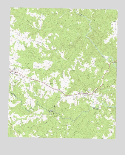
Carlton, GA USGS Topographic Map
Click on map above to begin viewing in our Map Viewer.

This topographic map contains these locations and features:
Feature Name Type Latitude Longitude GNIS ID View Map
Andrews Mill (historical)LocaleN34.0312°W83.0088°335720View Map
Antioch ChurchChurchN34.1109°W83.0068°310584View Map
Beaver CreekStreamN34.0259°W83.0354°310984View Map
Burroughs CemeteryCemeteryN34.0882°W83.0940°335460View Map
CarltonPopulated PlaceN34.0432°W83.0338°354994View Map
Carlton Volunteer Fire DepartmentBuildingN34.0426°W83.0338°2604882View Map
City of CarltonCivilN34.0427°W83.0385°2403996View Map
Clouds CreekStreamN34.0240°W83.0660°312760View Map
Comer DivisionCivilN34.0823°W83.0886°1936195View Map
Comer Mill (historical)LocaleN34.0418°W83.1199°335474View Map
Comer Volunteer Fire DepartmentBuildingN34.0667°W83.1247°2604528View Map
Cooper CemeteryCemeteryN34.0457°W83.0990°335476View Map
Cooper CemeteryCemeteryN34.0290°W83.0990°334692View Map
Cunningham ShoalsRapidsN34.0346°W83.0154°335743View Map
David CemeteryCemeteryN34.0926°W83.0929°335482View Map
Davids Mill (historical)LocaleN34.0901°W83.0504°335483View Map
Deadmans Ferry (historical)CrossingN34.0743°W83.0040°335484View Map
Deep CreekStreamN34.1143°W83.0307°313414View Map
Eberhart School (historical)SchoolN34.1071°W83.0715°335491View Map
Fork Missionary Baptist Church (historical)ChurchN34.0384°W83.0624°335496View Map
Glenn LakeReservoirN34.0360°W83.0262°339185View Map
Glenn Lake DamDamN34.0318°W83.0265°339184View Map
Grove CreekStreamN34.0184°W83.0593°356117View Map
Harpers Ferry (historical)CrossingN34.0918°W83.0276°335500View Map
Holly CreekStreamN34.0990°W83.0363°315553View Map
Holly Creek ChurchChurchN34.1026°W83.1224°315554View Map
Madison County Emergency Medical Services Station 2BuildingN34.0667°W83.1247°2625440View Map
Moon Ferry (historical)CrossingN34.1062°W83.0304°335522View Map
Mule BranchStreamN34.0293°W83.0238°319139View Map
New Hope ChurchChurchN34.0904°W83.0918°319432View Map
NewtownPopulated PlaceN34.0748°W83.0449°335529View Map
Newtown ChurchChurchN34.0773°W83.0432°319590View Map
NickvillePopulated PlaceN34.1134°W83.0015°332504View Map
Old Fork CemeteryCemeteryN34.0390°W83.0624°319982View Map
Otter Run LakeReservoirN34.0324°W83.0260°335534View Map
PaoliPopulated PlaceN34.0923°W83.0915°332601View Map
Piney Grove ChurchChurchN34.0012°W83.0876°320723View Map
Powers CemeteryCemeteryN34.0709°W83.0490°335540View Map
Rockspring ChurchChurchN34.1037°W83.0004°334666View Map
Rocky Shoals CreekStreamN34.0657°W83.0846°321861View Map
RossPopulated PlaceN34.0459°W83.0665°332926View Map
Seymours LakeReservoirN34.0522°W83.0778°322732View Map
Smiths StorePopulated PlaceN34.0584°W83.0151°335552View Map
South Fork Broad River Number 64 DamDamN34.0984°W83.1232°336495View Map
Steel BridgeBridgeN34.0743°W83.0040°347910View Map
Strickland BranchStreamN34.0654°W83.0843°323678View Map
Thankful Grove ChurchChurchN34.0115°W83.0024°324027View Map
Vineyard CreekPopulated PlaceN34.1176°W83.0868°335562View Map
Vineyard Creek ChurchChurchN34.1184°W83.0868°324718View Map
Watson Mill State ParkParkN34.0279°W83.0729°324919View Map
Watson ShoalsRapidsN34.0265°W83.0740°335803View Map
Whitehead DamDamN34.0401°W83.0932°339186View Map
Whitehead LakeReservoirN34.0410°W83.0939°339187View Map
Witcher ShoalsRapidsN34.0329°W83.0193°335806View Map

Note: Coordinates in the location and feature list above are referenced to NAD83 datum.


Copyright (C) 2008-2025 Ryan Niemi / Sunset Dynamics ... All Rights Reserved