TopoQuest Logo
Do you find TopoQuest useful?
Help keep TopoQuest running and adding new maps/features by donating!
Bitcoin:  19c7KJd3qBynnjoSw5npx9KScwjBe4ifkT
Litecoin:  LXs6TkuXGGXo1vDsWCkWVdjQX94eUKd6ui
Home View Maps Find Maps Find Places Resources & Links


Carrolltown, Pennsylvania Topographic Map

USGS Map Title: Carrolltown, PA
USGS Map MRC: 40078E6
DRG (GeoTIFF) Download: o40078e6.tif


Neighboring USGS Topographic Map Quads:


  Barnesboro, PA  
40078F7
 

  Hastings, PA  
40078F6
 

  Coalport, PA  
40078F5
 

  Colver, PA  
40078E7
 

  Carrolltown, PA  
40078E6
 

  Ashville, PA  
40078E5
 

  Nanty Glo, PA  
40078D7
 

  Ebensburg, PA  
40078D6
 

  Cresson, PA  
40078D5


Map MRC Location:

N41°
W79°
N41°
W78°
H8 H7 H6 H5 H4 H3 H2 H1
G8 G7 G6 G5 G4 G3 G2 G1
F8 F7 F6 F5 F4 F3 F2 F1
E8 E7 E6 E5 E4 E3 E2 E1
D8 D7 D6 D5 D4 D3 D2 D1
C8 C7 C6 C5 C4 C3 C2 C1
B8 B7 B6 B5 B4 B3 B2 B1
A8 A7 A6 A5 A4 A3 A2 A1
N40°
W79°
N40°
W78°

Carrolltown, PA USGS 1:24K Topographic Map Preview:
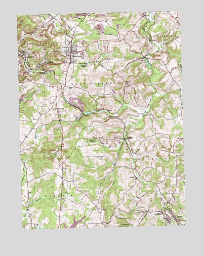
Carrolltown, PA USGS Topographic Map
Click on map above to begin viewing in our Map Viewer.

This topographic map contains these locations and features:
Feature Name Type Latitude Longitude GNIS ID View Map
Bakers CrossroadPopulated PlaceN40.6242°W78.6950°1168613View Map
BakertonPopulated PlaceN40.6028°W78.7447°1192090View Map
Bakerton Elementary SchoolSchoolN40.6042°W78.7492°1207321View Map
Bakerton ReservoirReservoirN40.5910°W78.7287°1168618View Map
Borough of CarrolltownCivilN40.6048°W78.7072°1215011View Map
Borough of LorettoCivilN40.5086°W78.6349°1215028View Map
Bradley JunctionPopulated PlaceN40.5517°W78.6670°1203137View Map
Cambria County Fire SchoolBuildingN40.6150°W78.6732°2645713View Map
CarrolltownPopulated PlaceN40.6028°W78.7086°1171264View Map
Carrolltown 6th Ward Elementary SchoolSchoolN40.6026°W78.7081°1207320View Map
Carrolltown Airport (historical)AirportN40.5987°W78.6789°1194037View Map
Carrolltown Fire Engine Company Station 51BuildingN40.6005°W78.7091°2645106View Map
Carrolltown Police DepartmentBuildingN40.6033°W78.7071°2780231View Map
Carrolltown Post OfficePost OfficeN40.6040°W78.7093°2780008View Map
Carrolltown ReservoirReservoirN40.5954°W78.6979°1171265View Map
Carrolltown RoadPopulated PlaceN40.5976°W78.7278°1171266View Map
City ReservoirReservoirN40.5015°W78.7113°1171887View Map
Dividing RidgeRidgeN40.5845°W78.7120°1201366View Map
DriscollPopulated PlaceN40.5295°W78.6622°1203447View Map
Duclos RunStreamN40.6040°W78.6409°1173574View Map
Eckenrode MillPopulated PlaceN40.5984°W78.6525°1173969View Map
ElmoraPopulated PlaceN40.6017°W78.7464°1198318View Map
ElmoraLocaleN40.5926°W78.7406°1201184View Map
Elmora Post OfficePost OfficeN40.6016°W78.7448°2779892View Map
FoxburgPopulated PlaceN40.6242°W78.7247°1212797View Map
John Carroll Area Ambulance Station 64BuildingN40.6080°W78.7081°2719453View Map
Jones PortalMineN40.5109°W78.6884°1178152View Map
Lauer SchoolSchoolN40.5815°W78.7103°1178915View Map
Laurel Lick RunStreamN40.5648°W78.6542°1178955View Map
Lonely AcresPopulated PlaceN40.5509°W78.6928°1179841View Map
LorettoPopulated PlaceN40.5031°W78.6303°1179952View Map
Loretto Fire Department Station 73BuildingN40.5065°W78.6342°2645482View Map
Loretto Post OfficePost OfficeN40.5046°W78.6326°2772802View Map
Loretto Post Office (historical)Post OfficeN40.5031°W78.6303°1214340View Map
Loretto RoadPopulated PlaceN40.5090°W78.6550°1179954View Map
Morchesky Airport (historical)AirportN40.5917°W78.7150°1194035View Map
Mount Assisi MonasteryChurchN40.5101°W78.6395°1181641View Map
Saint Benedict Roman Catholic ChurchChurchN40.6023°W78.7083°2648386View Map
Saint Benedicts SchoolSchoolN40.6023°W78.7072°1185827View Map
Saint Francis CollegeSchoolN40.5042°W78.6375°1185944View Map
Saint Michaels SchoolSchoolN40.5026°W78.6289°1186501View Map
Saint Therese of Lisieux MonasteryChurchN40.5076°W78.6453°1186744View Map
Strittmatter AirportAirportN40.5463°W78.6943°1194020View Map
Township of East CarrollCivilN40.5822°W78.6922°1216081View Map
Township of West CarrollCivilN40.6090°W78.7364°1216099View Map
Tunnel SidingLocaleN40.5831°W78.7164°1201185View Map
WAMQ-AM (Loretto)TowerN40.5034°W78.6359°1200422View Map
Weber SchoolSchoolN40.5837°W78.6670°1190755View Map
West Carrol Township Water Sewer Authority DamDamN40.5884°W78.7214°1194925View Map
WintersetPopulated PlaceN40.5023°W78.6884°1204976View Map

Note: Coordinates in the location and feature list above are referenced to NAD83 datum.


Copyright (C) 2008-2025 Ryan Niemi / Sunset Dynamics ... All Rights Reserved